 New York Know
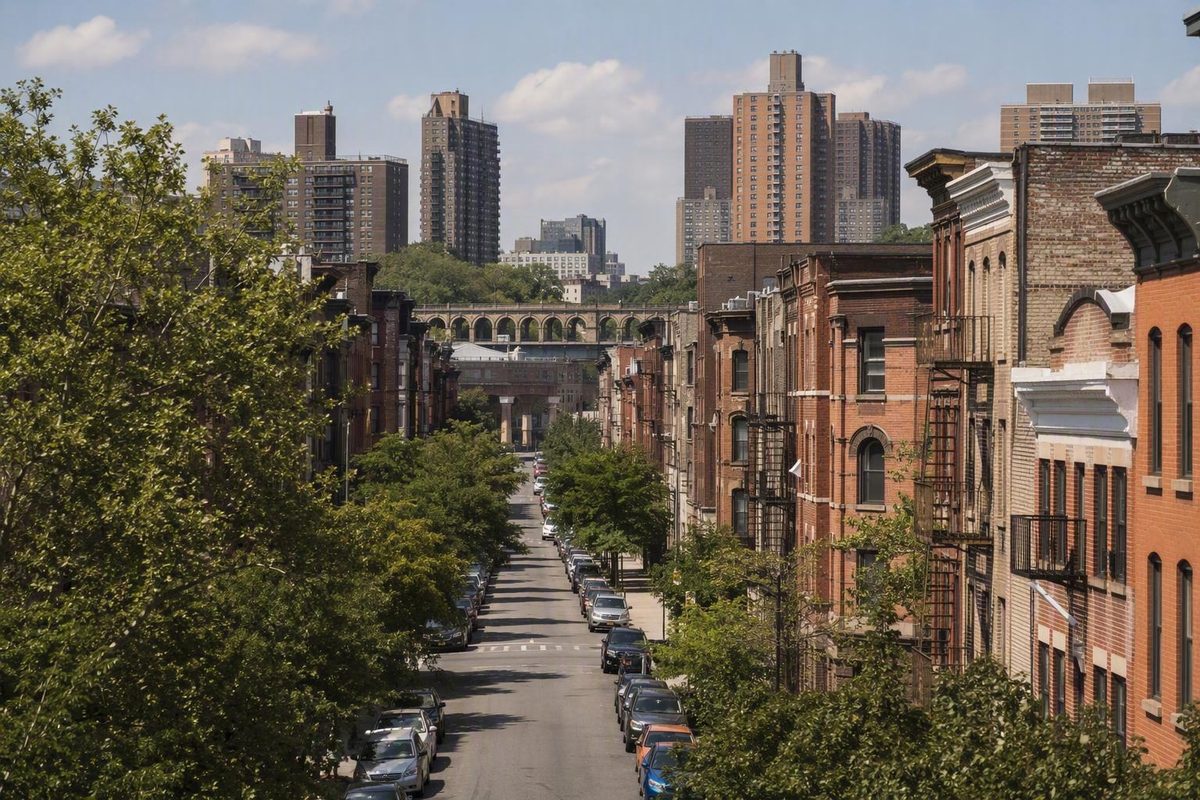
The South Bronx is one of New York City’s most historically significant regions, but it is often described too loosely. It is not one neighborhood, it has no universally accepted border, and it cannot be understood through a single image—whether that image is Yankee Stadium, the emergence of hip-hop, the fires of the 1970s, or later redevelopment.
A more useful approach separates three questions:
- Which part of the South Bronx do you mean?
- What history or cultural theme are you trying to understand?
- Which destinations belong in one coherent visit?
That framework matters because Mott Haven, Concourse, Port Morris, Melrose, Hunts Point, and other places sometimes included under the South Bronx label have different street patterns, land uses, histories, transit options, and visitor experiences.
For a first visit, do not try to “cover the South Bronx.” Choose one neighborhood or theme, identify an anchor destination, and build a compact plan around it. You will spend less time backtracking and gain a clearer understanding of the place you are actually visiting.
This article provides historical context and a planning framework rather than a live itinerary. Transit service, entrances, accessibility, construction, opening hours, and public access can change, so operational details still need to be checked with the relevant operator or institution before departure.
What and Where Is the South Bronx?
The South Bronx is an informally defined region in the southern part of the Bronx, a borough of New York City. It is best understood as a collection of neighborhoods rather than an official district or one homogeneous neighborhood.
There is no universally accepted boundary. Maps, institutions, tourism guides, and local usage do not always include the same places. One common formulation covers areas west of the Bronx River and south of the Cross Bronx Expressway, while broader definitions extend farther north, sometimes toward Fordham Road. The uncertainty is part of the term itself, as reflected in this overview of the South Bronx and its disputed geography.
For basic orientation, the Bronx lies north of Manhattan across the Harlem River. That makes the southern Bronx geographically close to Upper Manhattan, but proximity alone does not place every neighborhood near the borough’s southern edge inside one fixed South Bronx district.
The label also changes according to who is using it:
- A historian may use a broad regional definition when discussing housing, infrastructure, migration, or public policy.
- A resident may identify a specific neighborhood rather than use the regional label.
- A visitor guide may group several attractions under “South Bronx” for convenience.
- A mapping or real-estate service may draw a boundary that does not match local usage.
- A traveler choosing transit needs an exact address, not a broad regional label.
The simplest terminology rule is:
Use “the South Bronx” for the broad region, disputed geography, and shared historical themes. Use specific neighborhood names for destinations, routes, businesses, street conditions, and local experiences.
That distinction prevents two common mistakes. The first is imagining that the South Bronx has one entrance, center, or main street. The second is taking something true of one neighborhood and applying it to every place included under the label.
A walk examining industrial land use and waterfront access in Hunts Point is a different journey. Mott Haven and Port Morris offer another geography again. All may be called South Bronx visits, but they are not interchangeable.
Which Neighborhoods Count as the South Bronx?
Mott Haven, Melrose, and Port Morris are the neighborhoods most consistently included in common definitions of the South Bronx. Beyond those three, the list changes according to who is drawing the boundary and for what purpose.
The following table is a drafting and orientation tool, not an official map:
| Consistently included | Often included | Definition-dependent |
|---|---|---|
| Mott Haven | Concourse | Highbridge |
| Melrose | Longwood | Crotona Park East |
| Port Morris | Morrisania | Hunts Point |
| Other areas near broader northern or eastern boundaries |
Placement in the second or third column does not mean that one definition is correct and another is wrong. It indicates that usage varies. Digital maps and visitor-oriented descriptions commonly name places such as Concourse, Mott Haven, Melrose, and Port Morris without establishing a definitive perimeter; the Apple Maps area description is one example of that approach.
Concourse
Concourse is one of the easiest areas for a first-time visitor to organize around recognizable anchors. Yankee Stadium provides a major sports focus, while the Bronx Museum of the Arts and the architecture of the Grand Concourse support an art-and-design theme.
Even here, “nearby” should not be treated as a guarantee that every attraction fits into an effortless walk. A stadium event can change crowd movement and station use, while museum hours, entrances, and admission procedures may change. Build the visit around the exact institution or event that matters most, then add secondary stops only after checking their current status.
Mott Haven and Melrose
Mott Haven and Melrose are frequently treated as central South Bronx neighborhoods. Mott Haven can be approached through neighborhood history, architecture, commercial corridors, and the relationship between older residential fabric and later development.
Melrose matters both as a neighborhood and as a transit reference point. It should not be treated merely as territory between better-known attractions. If a plan includes a destination in or near Melrose, use its precise address instead of assuming that a general Mott Haven or Concourse route will naturally include it.
Port Morris
Port Morris is often paired with Mott Haven in discussions of industrial history, converted uses, redevelopment, and changing land use. That pairing can make geographic and thematic sense, but Port Morris retains a distinct industrial character.
A past Municipal Art Society tour used industrial history, housing, local businesses, green space, and change along Bruckner Boulevard as interpretive themes. That Mott Haven and Port Morris tour description offers a useful way to think about the area, but it is not evidence that any named business, venue, tour, or public space is operating now.
Hunts Point
Hunts Point should be treated as a separate destination, not as an extension of Mott Haven or Concourse. Its industrial and waterfront landscape includes food-distribution activity as well as parks and public-space projects. Together, those elements can support a compelling land-use theme, but they also create a different walking environment.
Historical descriptions can suggest themes and places to investigate, but current public access and the final walking approach must be checked independently.
Longwood, Morrisania, Highbridge, and Crotona Park East
These neighborhoods appear in broader South Bronx definitions, but not consistently enough to present them as parts of one universally bounded district. Their inclusion may depend on whether a speaker uses the Cross Bronx Expressway, the Bronx River, Fordham Road, historical development patterns, or another reference point.
That variation is a reason to name the neighborhood whenever possible. “A destination in Longwood” gives a visitor more useful information than “somewhere in the South Bronx.” It provides a better basis for choosing a station, evaluating a route, and understanding local context.
Most importantly, do not use borough-wide statistics—or the conditions of one neighborhood—to characterize the entire South Bronx. The Bronx contains substantial variation, and the South Bronx label itself covers places with different housing forms, commercial activity, public spaces, and transportation patterns.
From Morrisania to the Urban Crisis: A Concise Timeline
The early history of the region is often summarized through Morrisania and the Morris family, followed by accounts of German and Irish immigration. These brief summaries provide context, but the supplied map and encyclopedia material is compressed and partly derivative. It should not be treated as a complete history of Indigenous land, ownership, settlement, annexation, immigration, or neighborhood formation.
The central point is that the area changed repeatedly. It was never socially or economically static. In the decades around and after World War II, major population movements transformed South Bronx communities, with Black and Puerto Rican New Yorkers becoming increasingly prominent.
Demographic change is not, by itself, an adequate explanation for the later crisis. Placing population change immediately before housing abandonment can wrongly imply that incoming residents caused the decline. The stronger interpretation is structural: residents were moving through a housing and employment system already shaped by infrastructure decisions, unequal lending, landlord behavior, public policy, employment loss, and uneven investment.
From the 1960s through the 1970s and into the 1980s, parts of the South Bronx experienced severe population loss, housing abandonment, fires, declining employment, and deteriorating quality of life. These conditions did not result from one conclusively proven cause. Commonly identified forces include:
- infrastructure construction and neighborhood disruption;
- discriminatory lending and restricted access to credit;
- declining industrial and other employment;
- landlord abandonment;
- reduced city and federal investment;
- demographic and economic change;
- damaging housing policies or incentives;
- and broader decisions about where public and private capital would flow.
The Cross Bronx Expressway is a major part of this history, but it should not be presented as the sole cause. The Museum of the City of New York reports that the expressway was completed in 1963 and displaced thousands of residents. Its account places that disruption alongside declining employment, discriminatory bank lending, abandonment, population movement, and reduced government investment. The museum also reports 33,465 fires across the Bronx in 1976—a borough-wide annual figure, not a count for one South Bronx neighborhood—and says some landlords were accused of burning buildings as revenues fell. President Jimmy Carter’s 1977 visit to Charlotte Street then brought national political attention to a crisis already well known to residents and organizers. These dates, figures, and qualifications appear in the museum’s South Bronx exhibition overview.
The chronology is therefore not a simple fall-and-rescue story. Infrastructure disruption, disinvestment, housing deterioration, and employment loss accumulated over time.
Carter’s Charlotte Street visit matters because it shows how thoroughly the crisis had entered national politics and media. It does not mark the beginning of local recovery. Treating it that way would erase the people who had been organizing before the cameras arrived.
The familiar story often moves too quickly from fire and abandonment to a political visit and then to “comeback.” That compressed arc turns the South Bronx into a symbol rather than a set of communities.
How Residents and Community Groups Rebuilt the South Bronx
Any serious account of rebuilding should begin with residents—especially Puerto Rican and African-American organizers—and the community institutions they created or sustained.
Local activists did not wait for one comprehensive rescue plan. They formed nonprofit community development corporations, organized tenants and parents, cleared vacant lots, rehabilitated abandoned housing, and pursued public and private funding. Their work joined physical reconstruction with education, family services, advocacy, and neighborhood stewardship.
Documented organizations included:
- United Bronx Parents;
- the South East Bronx Community Organization, commonly known as SEBCO;
- Mid-Bronx Desperadoes;
- Banana Kelly;
- and the People’s Development Corporation.
These organizations did not have identical missions, constituencies, or methods. Grouping them together should not erase their separate histories. What connects them is their participation in community-based responses to abandonment and disinvestment.
United Bronx Parents and education organizing
Evelina Lopez Antonetty founded United Bronx Parents in 1965. The organization began by mobilizing Puerto Rican parents and children around education reform and later expanded its services. Its history demonstrates that neighborhood rebuilding was never confined to bricks and buildings. Schools, family support, leadership development, and residents’ power to influence institutions were also part of recovery.
Housing work during the emergency
Community organizing and physical reconstruction were already underway during the height of the crisis. In 1976, activists organized the renovation of 360 housing units on East 163rd Street. SEBCO, Mid-Bronx Desperadoes, Banana Kelly, and the People’s Development Corporation participated in housing rehabilitation and community development. Activists formed nonprofit development organizations, worked on vacant sites, and assembled funding from public and private sources. The redevelopment of Charlotte Street later became especially symbolic: work on Charlotte Gardens began in 1982, and its first single-family homes were sold in 1985. The Museum of the City of New York documents these organizations, dates, and resident-led efforts in its account of South Bronx rebuilding.
The significance of the East 163rd Street project is not merely numerical. It demonstrates that organizing and reconstruction were taking place during the emergency, not only after it. The language of total collapse is therefore inadequate: it describes real destruction but can hide simultaneous acts of preservation, resistance, and rebuilding.
Charlotte Street as symbol—and complication
Charlotte Street became one of the most nationally recognizable images of South Bronx devastation after Carter’s visit. Its later redevelopment created a powerful before-and-after story, but that story should not be mistaken for a complete account of the region.
The physical transformation was real, and Charlotte Gardens became a national symbol of rebuilding. Yet one development cannot summarize every neighborhood’s experience or answer every question about housing access, affordability, and who benefited from later investment.
The phrase “the South Bronx came back” therefore requires scrutiny:
- Who preserved communities during the worst years?
- Who received new or rehabilitated housing?
- Which projects created stable, affordable homes?
- Which residents benefited from new investment?
- Who encountered new pressure as development interest changed?
- Which institutions remained accountable to local communities?
New housing and improved public space can bring substantial benefits. They can also coexist with concerns about affordability, cultural displacement, and whether long-term residents will share in those benefits. The museum attributes fears of being priced out to activists whose communities helped restore these neighborhoods; it does not provide a current measured displacement rate.
A more accurate formulation is that residents and community organizations rebuilt housing and institutions under difficult conditions; later public and private investment created additional possibilities; and the distribution of redevelopment’s benefits remains a legitimate subject of debate.
Why the South Bronx Is Central to Hip-Hop and Graffiti History
The South Bronx is foundational to the emergence of hip-hop culture and the development of graffiti in New York during the 1970s. That importance is not merely a tourism slogan, but it requires more nuance than a single date, address, or inventor narrative can provide.
August 11, 1973 is widely used as a symbolic milestone because of the event associated with DJ Kool Herc. It offers a recognizable focal point for discussing an important party, place, and innovator. It does not establish that an entire culture appeared fully formed at one isolated moment; NYC Tourism’s South Bronx cultural overview presents the date within the area’s broader hip-hop legacy.
That longer view avoids two distortions. The first is the “single inventor” story, which can obscure the many artists, audiences, and communities involved. The second is the suggestion that poverty automatically produced hip-hop. Economic hardship, disinvestment, and contested public space formed part of the historical setting, but deprivation does not mechanically create cultural innovation. People make culture through imagination, skill, organization, and social connection.
Graffiti belongs to this history as well. It became prominent in the Bronx in the early 1970s and circulated through the subway system, allowing names and visual styles to travel beyond their immediate neighborhoods.
Their broader cultural connections matter, but so do the differences between them.
How to visit cultural sites responsibly
A visitor interested in hip-hop or public art should look for context rather than just a photograph. Ask:
- Who made the work?
- Is the artist publicly identified?
- Does an institution or cultural organization interpret the site?
- Is the work on public property?
- Are you entering residential, institutional, or private space?
- What person, event, or community does the work commemorate?
- Is the mural or installation still present?
- Has a current first-party source confirmed public access?
Murals change, buildings are altered, and tour routes are revised. A listing that was accurate several years ago cannot establish that a work remains visible or accessible now.
Credit artists by name when reliable information is available. Do not pose residents as scenery or photograph people closely without permission. Avoid narratives that sell the South Bronx primarily through crime, danger, or ruin. Commercial labels are marketing choices, not historical analysis and not evidence about present-day conditions.
The strongest cultural visit recognizes that the South Bronx was not simply a distressed environment in which art somehow appeared. It was a place where artists, young people, families, venue operators, organizers, and audiences created networks and new forms of expression.
Choose a Focused South Bronx Visit Instead of a Checklist
The South Bronx is too varied for an indiscriminate “top ten” itinerary. A better visit starts with one subarea or theme and adds only destinations that reinforce it.
For a half-day, choose one anchor and perhaps one or two nearby secondary stops. For a full day, build a deeper neighborhood visit or combine two genuinely adjacent themes. Avoid jumping among Concourse, Hunts Point, and Port Morris merely because all three can appear under the same regional label.
The following blocks are planning frameworks, not verified turn-by-turn itineraries.
Culture, art, and architecture
Use the Grand Concourse and the Bronx Museum of the Arts as the core of an art-and-architecture visit. The Grand Concourse supplies the built-environment theme, while the museum provides an institutional anchor. A separately verified hip-hop-history or public-art stop can add cultural context without turning the day into a scattered mural hunt.
A sensible structure is:
- Begin at the principal museum or architecture stop.
- Spend time observing the surrounding streetscape.
- Add one cultural site whose location and public access have been confirmed.
- Finish near a transit station selected before departure.
Do not assume that a mural promoted in an old article is still present. If the museum is essential to the day, check its current hours, admission arrangements, entrance procedures, and accessibility information directly before traveling.
Baseball and Concourse
For a baseball-focused visit, make Yankee Stadium the anchor. The current stadium was built in 2009 across from the former stadium site, according to the official city tourism guide’s South Bronx profile.
The rest of the visit can remain focused on baseball and Concourse rather than attempting to represent the entire South Bronx. A compact visit is not incomplete simply because it does not cross several neighborhoods.
On event days, crowd patterns, security procedures, and station use may differ from ordinary conditions. Confirm ticket rules, entry gates, bag policies, event times, and any expected stadium access through the event operator. If there is no game, do not assume that a tour or interior experience is available.
Mott Haven and Port Morris
Pair Mott Haven and Port Morris if your interests include neighborhood history, architecture, industrial change, commercial corridors, redevelopment, or the relationship between older urban fabric and newer construction.
This theme benefits from slow observation:
- How do residential and industrial blocks meet?
- Where do major roads change the walking environment?
- Which buildings reveal earlier uses?
- Where has newer construction altered the streetscape?
- How do public spaces connect—or fail to connect—to surrounding blocks?
Use current first-party information to select any business, gallery, venue, or green space. Historical tour descriptions can suggest what to look for, but they cannot confirm what is open or publicly accessible now.
Hunts Point and the industrial waterfront
Hunts Point deserves its own plan. Food-distribution infrastructure, industrial land use, and waterfront public spaces create a distinctive urban theme, but this is not a casual add-on to a museum or stadium day.
A personal walking account described Port Morris and Hunts Point through industrial landscapes, food markets, street art, and waterfront spaces. It was published on April 20, 2016, and therefore cannot establish current entrances, facilities, greenway connections, construction conditions, or public access. The 2016 South Bronx walking account is best treated as historical route inspiration, not live navigation.
Before attempting a Hunts Point walk, identify the exact public destination and examine the final approach. Do not assume that a waterfront space visible on a map has a convenient public entrance from every direction.
Pre-visit verification
Before leaving, confirm:
- current opening hours and closure notices;
- admission charges or timed-entry requirements;
- reservations or event tickets;
- the correct public entrance;
- restroom availability;
- step-free access and other accessibility needs;
- construction and street closures;
- whether a park, waterfront, market, or cultural site is open to the public;
- and the route back to your accommodation.
A theme-based block gives shape to the day. It is not a promise that every sidewalk, venue, or entrance has been inspected.
Plan Transit and Walking by Destination
There is no universal South Bronx gateway. Choose transit for the exact neighborhood, address, entrance, and anchor destination.
The 2 and 5 subway lines connect Midtown with several destinations in the broad South Bronx area. That does not make either line automatically best for every journey, and the available source does not verify live service or current station accessibility. Check the transit operator’s current service information on the day of travel; the supplied visitor-safety guide supports the general 2-and-5 connection but should not be used as a substitute for live MTA information.
Stations listed within the broad area include:
- Longwood Avenue;
- Prospect Avenue;
- East 149 Street;
- Jackson Avenue;
- and Intervale Avenue.
Melrose and Yankees–East 153rd Street are also listed as commuter-rail stations serving parts of the broader area. These names come from a commercial South Bronx neighborhood and transit guide, not a live transit source. They are orientation examples only and do not establish current schedules, service changes, accessibility, or the best station for a particular destination.
A station’s presence on a neighborhood list does not prove that it provides the shortest, easiest, most accessible, or most comfortable approach. The final blocks can matter as much as the train ride.
A walking-first structure that reduces backtracking
Use this sequence:
- Choose one anchor. Start with the museum, stadium, historic area, park, tour meeting point, or other destination that matters most.
- Identify its neighborhood. Do not stop at “South Bronx.”
- Choose transit for the exact address. Consider the intended entrance and the final blocks, not only the station name.
- Add nearby stops in the same subarea. Keep them secondary so the day still works if one is unavailable.
- Use transit for a major transition. If you add a second, more distant area, take one deliberate ride instead of repeatedly crossing back and forth.
- Preselect the return route. Know which station or service you expect to use at the end.
Commercial neighborhood guides may assign high walkability or transit scores to a large South Bronx area, but those scores depend on proprietary boundaries and methods. They may suggest broad connectivity; they cannot prove that a specific route is comfortable, step-free, open, well lit, or practical for a particular traveler.
Walking distance is only one variable. A short route can still be inconvenient because of a highway crossing, construction, an inaccessible station, stadium crowds, industrial traffic, weather exposure, or an entrance on the opposite side of a large site.
Day-of-travel transit check
- Review live subway or commuter-rail service.
- Confirm the station and exit closest to the intended entrance.
- Check accessibility for your particular needs.
- Look for construction, street closures, and event-related changes.
- Account for weather and limited shelter on exposed routes.
- Anticipate stadium or event crowds where relevant.
- Save the return route and one reasonable alternative.
Avoid building a tightly timed schedule around an unverified journey estimate. The useful question is not “How long does Midtown to the South Bronx take?” It is “What is the current route from my starting point to this exact entrance?”
Visit Thoughtfully: Safety, Tours, and Respectful Planning
The South Bronx should not be described categorically as either safe or dangerous. Conditions can vary by neighborhood, block, route, and time, as they can elsewhere in New York City. A regional label cannot tell you what a particular station exit, industrial approach, event-night street, or late return journey will be like.
Plan around a specific destination and a defined route. Favor clear connections to transit, especially on a first visit, and avoid unplanned late-night wandering in unfamiliar areas. A broad assurance about an entire neighborhood should never replace ordinary city judgment.
For route-specific context, the available tourism guidance recommends consulting current transit information and the NYPD’s CompStat 2.0 incident map. Use such a map as one planning input, not as a verdict on a neighborhood or a guarantee about a route.
General city precautions include:
- Stay aware of your surroundings.
- Keep phones, wallets, cameras, and bags secure.
- Know where you are going before leaving a station.
- Avoid blocking sidewalks while checking directions.
- Keep the return route available offline or written down.
- Revise the plan if a street, station, crowd, or connection feels unsuitable.
- Contact the appropriate authorities in an emergency.
These precautions are not evidence that South Bronx residents or streets are inherently threatening. They are practical habits for moving through a large city.
How to compare South Bronx tours
Commercial marketplaces list tours involving hip-hop, street art, baseball, neighborhood history, and several boroughs. A category label does not establish that a tour spends substantial time in the South Bronx. Some products combine the Bronx with Harlem, Queens, and Brooklyn, so visitors should examine the actual itinerary rather than infer depth from a title.
Compare tours using:
- actual time spent in the Bronx and South Bronx;
- named stops;
- whether stops are drive-bys, photo stops, or extended visits;
- the guide’s credentials and relationship to the subject;
- the depth of community and historical context;
- walking distance, pace, stairs, and standing time;
- language;
- group size;
- accessibility;
- cancellation terms;
- and review count as well as average rating.
Prices, schedules, routes, ratings, access conditions, and availability are dynamic. Check the booking page for the date under consideration and confirm essential arrangements with the operator. Commercial rankings may incorporate popularity, availability, performance, and supplier commissions, so they are not independent proof of quality; the marketplace’s South Bronx tour category explicitly describes commercial factors in its ranking process.
Be skeptical of products built around words such as “dangerous,” “notorious,” or “ghetto.” Such labels can turn living neighborhoods into spectacle and encourage shallow interpretation. A stronger tour names people, organizations, artworks, and policy decisions; distinguishes historical conditions from the present; and gives residents agency in the story.
Respectful visitor habits
Use neighborhood names when you know them. Support local institutions and businesses where appropriate, but verify that they are operating before building a trip around them. Credit artists instead of treating murals as anonymous scenery. Ask permission before photographing identifiable people, workers, private homes, or activity on residential property.
Do not enter industrial sites, markets, courtyards, or building grounds merely because a map appears to show a path. Public visibility is not the same as public access.
Most of all, resist the urge to look only for evidence of a prewritten story. If you arrive expecting either devastation or uncomplicated revival, you will miss the ordinary complexity of the place.
Which visit style fits?
| Visit style | Best for | Main tradeoff | What to verify |
|---|---|---|---|
| Self-guided visit | Independent travelers with one clear anchor | Requires more route and context research | Access, hours, transit, entrances, final walking approach |
| South Bronx-focused walking tour | Visitors seeking neighborhood depth and interpretation | Quality and perspective depend heavily on the guide | Named stops, credentials, walking demands, accessibility |
| Multi-borough coach tour | Travelers wanting a broad city overview with limited walking | Bronx coverage may be brief or mainly photographic | Actual Bronx time, route, stop format, mobility requirements |
None is universally best. Choose according to whether you value independence, neighborhood depth, or broad geographic coverage.
The clearest way to plan a New York South Bronx visit is to decide first which version of the South Bronx your trip is about. It might be a Concourse art-and-architecture visit, a baseball day, a Mott Haven and Port Morris history walk, a hip-hop-focused experience, or an industrial-waterfront exploration in Hunts Point.
Then select one neighborhood or cultural theme and build the visit around a small number of related destinations. Understanding the region’s disputed geography, cultural creation, resident-led rebuilding, and present-day variation produces a more useful and respectful visit than either a checklist or a stereotype.
Before departure, verify current transit, public access, opening hours, accessibility, construction, and route conditions. Regional history provides the context; the exact neighborhood and destination determine the practical day.
Frequently Asked Questions
Where does the South Bronx begin and end?
There is no universally accepted boundary. A common formulation places it west of the Bronx River and south of the Cross Bronx Expressway, while broader definitions extend farther north, sometimes toward Fordham Road. Different maps and institutions include different neighborhoods, so the most useful approach is to treat the South Bronx as an informal region and name the specific neighborhood when planning a route.
Which neighborhoods are definitely considered part of the South Bronx?
Mott Haven, Melrose, and Port Morris are the most consistently included. Concourse, Crotona Park East, Highbridge, Hunts Point, Longwood, and Morrisania appear in some broader definitions but not all. These categories are explanatory rather than official.
Why is the South Bronx known as the birthplace of hip-hop?
August 11, 1973, associated with DJ Kool Herc, is widely used as a symbolic milestone. It is better understood as a focal date in a longer cultural development than as the instant an entire culture appeared.
What can visitors see in the South Bronx besides Yankee Stadium?
Established anchors include the Bronx Museum of the Arts and the architecture of the Grand Concourse. Visitors can also develop themed plans around Mott Haven and Port Morris history, hip-hop and public art, or Hunts Point’s industrial and waterfront landscape. Verify the current hours, access, and status of every specific institution, mural, park, or tour before traveling.
Is the South Bronx safe for visitors?
No single label can answer that for such a varied region. Conditions differ by neighborhood, block, route, and time. Plan a specific destination, use a clear transit connection, avoid unplanned late-night wandering in unfamiliar areas, and consult current official transit information and route-specific reported-incident data. Maps and statistics can inform planning, but they cannot guarantee personal safety.