 New York Know
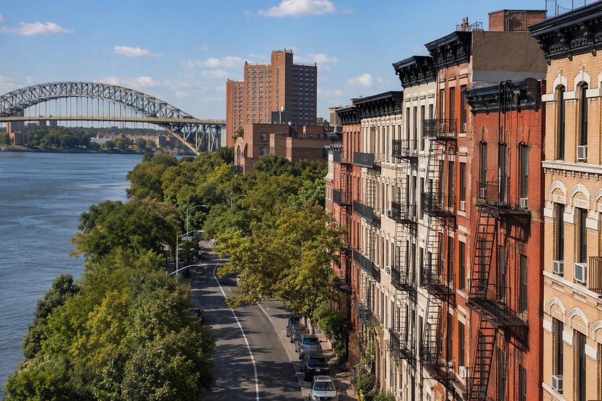
The Bronx makes more sense when you stop looking for one perfect neighborhood map.
Unlike a compact visitor district, the borough is a collection of residential neighborhoods, commercial corridors, parks, waterfront communities, cultural regions, and destination clusters. Some names describe only a few blocks; others cover broad areas with disputed edges.
For basic orientation, use compass regions. For a visit, plan around nearby landmarks, entrances, and transit connections. These systems overlap, but they answer different questions—and none turns informal neighborhood names into fixed legal boundaries.
How to read a Bronx neighborhood map
Neighborhood names in New York City are customary rather than legally definitive. They reflect history, local identity, major roads, commercial corridors, institutions, and everyday usage. Two maps can therefore place the same block in different neighborhoods without either map being entirely unreasonable.
It helps to distinguish three kinds of geography:
- Informal neighborhoods, such as Belmont, Riverdale, Soundview, or Morris Park.
- Broad regional labels, such as the South Bronx, West Bronx, or Northeast Bronx.
- Official community districts, the 12 administrative districts used for local planning and community-board representation.
The first two categories are flexible. Community-district boundaries are official, but the neighborhood names associated with each district remain approximate and nonexclusive. Lehman College’s Bronx research guide cautions that neighborhood boundaries are not officially designated and that neighborhoods can span district lines. Its associations place Melrose in Districts 1 and 3, while Fordham and University Heights appear in Districts 5 and 7. The guide also links to the underlying city profiles and lookup tools.
Maps also reflect the publisher’s purpose. A resident may identify a place by its nearest commercial road or subway stop. A tourism guide may group several attractions under a widely recognized destination name. A real-estate directory may favor a label familiar to prospective renters or buyers. A historical map may preserve an older name that is less common in present-day conversation.
Several recurring issues explain why Bronx neighborhood maps disagree:
- Boundaries depend on convention. One map may use a park, railway, avenue, or highway as an edge, while another extends the neighborhood beyond it.
- Names can be nested. A small enclave may sit within a larger neighborhood, which may itself be part of a broad region.
- Institutions influence local identity. A zoo, university, cemetery, park, or shopping corridor may become the simplest way to describe the surrounding area.
- Regional labels expand and contract. “South Bronx,” in particular, can refer to different collections of southern and southwestern neighborhoods depending on the period and context.
- Commercial naming affects usage. Tourism and property marketing can popularize a label without making it official.
Published lists may also mix unlike geographic units. Residential neighborhoods sometimes appear beside parks, islands, historical enclaves, waterfront developments, or broad regional labels. City Island, for example, is both an inhabited island and a community. Bronx Park is a major landscape and destination area, not the same kind of unit as Bedford Park or Mott Haven. The South Bronx is a broad region rather than one residential neighborhood.
The editorial rule here is straightforward: commonly recognized residential areas are listed as neighborhoods; broad regional labels are identified separately; parks, islands, and enclaves are explained when they affect orientation; and every neighborhood boundary should be treated as approximate. This is a practical map guide, not an exhaustive inventory or legal boundary map.
The Bronx at a glance: east, west, north, and south
The Bronx is New York City’s northernmost borough. It lies directly north of Manhattan, with the Harlem River separating much of the two boroughs, and it is the only New York City borough located primarily on the mainland. The Hudson River forms its western edge, while Long Island Sound and connected waterways shape much of the east.
The most useful natural reference within the borough is the Bronx River. In broad geographic terms, it separates the hillier West Bronx from the generally flatter East Bronx. This is an orientation tool, not an official neighborhood-boundary system: local identities, streets, and district lines do not all stop neatly at the river. Jerome Avenue, meanwhile, is the reference for east and west street designations; it is not the boundary between the East Bronx and West Bronx. A general Bronx overview explains both geographic conventions.
One commonly published four-part system groups Bronx New York neighborhoods as follows:
- Northwest Bronx: north of Fordham Road and west of the Bronx River.
- Southwest Bronx: south of Fordham Road and west of the Bronx River.
- Northeast Bronx: north of Pelham Parkway and east of the Bronx River.
- Southeast Bronx: south of Pelham Parkway and east of the Bronx River.
This is a third-party orientation convention rather than an official city classification. Fordham Road, Pelham Parkway, and the Bronx River are useful reference lines, but they do not resolve every disputed neighborhood edge. The published neighborhood grouping also notes that names and regional systems vary in use.
The four-part model is most useful for understanding scale. Riverdale and City Island are both in the northern Bronx, for example, but they are on opposite sides of the borough and should not be treated as neighboring destinations. Belmont and Morris Park are closer to each other than either is to Riverdale, even though maps may classify their larger regional settings differently.
The North Bronx and South Bronx are broader kinds of labels. They are geographically and culturally meaningful, but their limits are not consistently defined. “North Bronx” may be used loosely for several northern areas. “South Bronx” can encompass multiple neighborhoods in the south and southwest, with its perceived extent changing according to the speaker, subject, and historical period.
The simplest mental model is layered:
- Use the Bronx River to think broadly about east and west.
- Use Fordham Road and Pelham Parkway for the four-region convention.
- Use North Bronx and South Bronx as contextual regional labels.
- Use Jerome Avenue to understand east-west street naming.
- Use an exact address when the precise location matters.
Bronx neighborhoods by compass region
The following directory is a useful working convention, not an official or exhaustive inventory. Smaller enclaves may sit within the listed areas, and some neighborhood identities extend across the proposed dividing lines.
Northwest Bronx
Commonly recognized Northwest Bronx neighborhoods include:
- Bedford Park
- Belmont
- Fordham
- Kingsbridge
- Norwood
- Riverdale
- Spuyten Duyvil
- University Heights
- Woodlawn Heights
This part of the borough includes several distinct landscapes. Riverdale and Spuyten Duyvil occupy the Hudson-side northwest. Kingsbridge sits farther inland around major road and transit corridors. Bedford Park and Norwood are closer to the central-northern Bronx, while Belmont and Fordham connect visitors with the Arthur Avenue and Bronx Park destination areas.
Including Belmont or Fordham in a northwest list does not mean every map will place every associated attraction there. Tourism guides frequently use Fordham, Belmont, and Bronx Park as convenient destination labels rather than attempting to resolve the exact placement of large institutions, entrances, and surrounding blocks.
“Woodlawn Heights” is often shortened to Woodlawn in ordinary usage. The neighborhood and Woodlawn Cemetery are related geographic references, but they are not equivalent units.
Southwest Bronx
Commonly recognized Southwest Bronx neighborhoods include:
- Claremont
- Concourse
- East Tremont
- Highbridge
- Hunts Point
- Longwood
- Melrose
- Morris Heights
- Morrisania
- Mott Haven
- Port Morris
- Tremont
- West Farms
This grouping covers a large and varied part of the borough, including waterfront and industrial areas, residential districts, Grand Concourse communities, and places central to early hip-hop history.
The Southwest Bronx and the South Bronx are sometimes treated as equivalent in broad directories, but that shortcut should be used cautiously. The South Bronx is not one neighborhood. Mott Haven, Melrose, Port Morris, Hunts Point, Longwood, and Morrisania are commonly associated with the broader label, but its complete extent is not universally settled.
East Tremont, Tremont, and West Farms illustrate another difficulty: nearby names can overlap in conversation without having universally accepted edges. When deciding where a particular building or attraction belongs, its address is more useful than a regional list.
Northeast Bronx
Commonly recognized Northeast Bronx neighborhoods include:
- Allerton
- Baychester
- City Island
- Co-op City
- Eastchester
- Edenwald
- Pelham Gardens
- Pelham Parkway
- Wakefield
- Williamsbridge
The Northeast Bronx reaches from inland residential neighborhoods to waterfront and island communities. Co-op City and Baychester occupy the northeastern side near major roads and open spaces. Wakefield, Williamsbridge, Edenwald, and Eastchester are in the northern mainland Bronx, while Pelham Gardens and Pelham Parkway sit closer to central-eastern institutions and parkways.
City Island is the main geographic exception. It is an inhabited island community associated with the Northeast Bronx and connected to the mainland by a bridge. It has a neighborhood identity of its own rather than functioning like a typical mainland district. A Bronx neighborhood mapping project describes that bridge connection and island setting.
Southeast Bronx
Commonly recognized Southeast Bronx neighborhoods include:
- Castle Hill
- Clason Point
- Country Club
- Morris Park
- Parkchester
- Pelham Bay
- Soundview
- Schuylerville
- Throggs Neck
- Van Nest
- Westchester Square
The Southeast Bronx includes inland apartment districts, lower-density eastern areas, waterfront communities, and historic commercial centers. Parkchester and Soundview are major reference points for large surrounding areas. Morris Park and Van Nest sit farther inland, while Country Club, Schuylerville, Throggs Neck, and Clason Point are associated with the borough’s eastern and southeastern edges.
Pelham Bay is both a neighborhood name and a reference used for the nearby park and subway terminus. Context matters: “Pelham Bay Park” may refer to the park itself, a subway station, an entrance, or the broader destination area.
Throggs Neck and Throgs Neck are alternate spellings of the same neighborhood. The double-g spelling is common for the neighborhood, while the single-g form appears in the official name of the Throgs Neck Bridge and in some directories.
Across all four regions, resist reading this directory as a ranking. It does not identify the safest, cheapest, wealthiest, quietest, or “best” neighborhoods. Those judgments require defined criteria and current, geographically consistent evidence. This list answers a narrower question: which names are commonly used, and where can a first-time visitor place them approximately?
The 12 Bronx community districts and their neighborhood associations
The Bronx has 12 community districts, each associated with a community board. The district boundaries are official, while the neighborhood labels used to describe them remain informal and nonexclusive. A district can include several neighborhoods, and a neighborhood can be associated with more than one district. Lehman College’s district guide compiles the associations and links to NYC Planning profiles.
The guide lists the following associations:
- Bronx Community District 1: Melrose, Mott Haven, Port Morris.
- Bronx Community District 2: Hunts Point, Longwood.
- Bronx Community District 3: Claremont, Crotona Park East, Melrose, Morrisania.
- Bronx Community District 4: Concourse, Concourse Village, East Concourse, Highbridge, Mount Eden.
- Bronx Community District 5: Fordham, Morris Heights, Mount Hope, University Heights.
- Bronx Community District 6: Bathgate, Belmont, Bronx Park South, East Tremont, West Farms.
- Bronx Community District 7: Bedford Park, Fordham, Kingsbridge Heights, Norwood, University Heights.
- Bronx Community District 8: Fieldston, Kingsbridge, North Riverdale, Riverdale, Spuyten Duyvil, plus Marble Hill marked “MN” for Manhattan.
- Bronx Community District 9: Bronx River, Castle Hill, Clason Point, Harding Park, Parkchester, Soundview, Soundview-Bruckner, Unionport.
- Bronx Community District 10: City Island, Co-op City, Country Club, Edgewater Park, Pelham Bay, Schuylerville, Throggs Neck, Westchester Square.
- Bronx Community District 11: Allerton, Bronxdale, Indian Village, Morris Park, Pelham Gardens, Pelham Parkway, Van Nest.
- Bronx Community District 12: Baychester, Eastchester, Edenwald, Olinville, Wakefield, Williamsbridge, Woodlawn.
These associations are useful for research, but they should not be reverse-engineered into rigid neighborhood boundaries.
Consider Melrose. It appears with Districts 1 and 3, so its name alone does not identify one board. Fordham and University Heights each appear with Districts 5 and 7.
The district list also includes labels absent from the shorter compass directory. Bathgate, Mount Eden, Mount Hope, Kingsbridge Heights, Fieldston, North Riverdale, Harding Park, Unionport, Edgewater Park, Bronxdale, Indian Village, and Olinville are examples. Their presence does not make the compass directory incorrect; it demonstrates that a short visitor-oriented list and a civic district reference serve different purposes.
Begin with the question you need to answer:
- “What general part of the Bronx is this?” Use the compass regions.
- “What neighborhood name is commonly used?” Compare maps and local sources.
- “Which board handles this address?” Use New York City’s address-based community-board lookup.
- “What demographic profile covers the area?” Use the relevant NYC Planning district profile or NYC Population FactFinder, then confirm which geography the data represent.
- “Does this issue affect the entire named neighborhood?” Do not assume so; check the relevant blocks and administrative boundary.
Inferring a community board from “Fordham,” “Melrose,” or “University Heights” can produce the wrong result.
Neighborhoods visitors are most likely to explore
Most visitors encounter the Bronx through a handful of destination areas rather than by trying to cover the borough from end to end. These places are not necessarily more important than other neighborhoods; they simply contain landmarks, institutions, food traditions, or historical sites that make them common starting points.
Belmont and Arthur Avenue
Belmont is closely associated with Arthur Avenue, an Italian-American food district with bakeries, butchers, restaurants, specialty shops, and the Arthur Avenue Retail Market. The area is frequently promoted as the Bronx’s Little Italy, but visitors do not need to accept claims that it is the city’s only or most “authentic” Italian district to appreciate its commercial identity and food traditions. NYC Tourism highlights Belmont and the historic Arthur Avenue Retail Market.
The surrounding commercial blocks can be explored on foot, while the Bronx Zoo and New York Botanical Garden are close enough to consider within the same broader day. They are not all on one small block, however, so visitors still need to plan entrances and transfers.
Concourse
Concourse is associated with Yankee Stadium and the apartment buildings lining the Grand Concourse, including prominent examples of Art Deco architecture. The boulevard provides a clear north-south organizing feature, although nearby labels include Concourse, Concourse Village, East Concourse, Highbridge, and Mount Eden.
A visitor can treat the stadium and 161st Street corridor as one anchor and the architecture of the Grand Concourse as another.
Sources in the evidence disagree about whether the current stadium occupies the former stadium’s exact site or was built across the street. That dispute is unnecessary for planning. Use the present stadium address and current event instructions rather than relying on a historical-site description.
Fordham and the Bronx Park area
Visitor guides also use Fordham and Bronx Park as access labels for the Bronx Zoo and New York Botanical Garden. That is convenient for trip planning, but it can simplify the precise placement of entrances, grounds, and nearby neighborhood lines.
Plan by the entrance you intend to use. Large institutions can have multiple gates, and the entrance nearest one station or bus stop may not be the best one for reaching your next destination.
Mott Haven
Mott Haven is a neighborhood in the southern Bronx and part of the broader South Bronx. The two names are not synonyms. Saying that a destination is in Mott Haven is more geographically specific; saying that it is in the South Bronx places it within a larger regional and cultural context.
Mott Haven can anchor a focused visit centered on architecture, culture, or neighborhood history. It should not be used as shorthand for every neighborhood in the southern Bronx.
Morris Heights
Morris Heights is significant in accounts of early hip-hop history because of 1520 Sedgwick Avenue. DJ Kool Herc held a party there on August 11, 1973, an event widely associated with hip-hop’s formative history. The site is in the West Bronx, illustrating why the geography of hip-hop cannot always be reduced to a single, fixed definition of the South Bronx. A Bronx visitor guide documents the address, date, and DJ Kool Herc connection.
This is best approached as historical context rather than as a conventional entertainment attraction. It is a residential location, so visitors should respect residents and avoid assuming unrestricted access.
Riverdale
Riverdale occupies the northwest Bronx near the Hudson side of the borough. Its principal visitor destination is Wave Hill, a public garden and cultural site overlooking the Hudson River and the New Jersey Palisades.
Riverdale’s distance from eastern Bronx destinations is easy to underestimate on a borough map. It pairs more naturally with northwest or nearby northern places than with City Island or Soundview. Even destinations that appear close in a straight line may require an indirect route.
City Island
City Island has a maritime identity shaped by its waterfront setting, seafood restaurants, boating traditions, and relationship with Long Island Sound. It is connected to the mainland by bridge and is approached as an island destination rather than as another stop directly along a subway line.
The journey therefore forms part of the visit.
Woodlawn
Woodlawn is associated with Woodlawn Cemetery, a major landscape and historical destination. People buried there include jazz musicians Miles Davis and Duke Ellington and author Herman Melville. Those documented associations make the cemetery relevant to music, literary, architectural, and New York history. The Bronx neighborhood guide identifies all three burial sites.
The surrounding neighborhood has its own identity. As elsewhere in the borough, the landmark should not be treated as interchangeable with the entire neighborhood.
Pelham Bay
The park contains varied landscapes and covers a much larger area than a compact neighborhood square, so the intended entrance matters.
Pelham Bay also functions as a transit gateway for City Island. That makes the two places practical partners for an eastern Bronx day, although a park visit and an island meal may still require more time than their apparent proximity suggests.
How to group Bronx neighborhoods into practical days
The Bronx’s major destinations are dispersed. Walking works well within Arthur Avenue, along selected sections of the Grand Concourse, or around a chosen park, garden, or commercial corridor. It is less practical as the primary way to travel among every major attraction.
A good day starts with one anchor and adds only places that fit geographically and logistically.
Belmont and Bronx Park
Build this day around some combination of:
- Arthur Avenue and Belmont
- The Bronx Zoo
- The New York Botanical Garden
Arthur Avenue can provide the neighborhood portion of the day, while either the zoo or botanical garden becomes the major institutional visit. Attempting both large institutions plus a leisurely Belmont meal may produce an overly crowded schedule, depending on your interests and available time.
Before going, verify opening hours, admission policies, timed-entry requirements, entrance locations, accessibility, and the route between your chosen stops with the attractions and transit operator. A general neighborhood guide cannot preserve changing operational details reliably.
Concourse and the southern Bronx
A Concourse-centered day can combine:
- Yankee Stadium and the 161st Street area
- A selected stretch of the Grand Concourse
- Nearby architecture or cultural stops
- Carefully chosen hip-hop-history context
Do not treat the South Bronx as one compact walking district. If a particular historical address is important, map it separately and decide whether the additional travel fits the day.
If you are attending a game or event, let that fixed time control the schedule. On a non-event day, the neighborhood and architectural context can take priority.
Northwest Bronx
A northwest day can center on:
- Riverdale
- Wave Hill
- Nearby Hudson-side streets
- Another northern destination selected by exact address
This cluster requires address-level planning. “Northwest Bronx” covers a large area, and hills, rail lines, parkland, and indirect streets can make two nearby-looking points awkward to combine. Check the specific entrance, station, or bus stop rather than assuming that all of Riverdale is equally close to Wave Hill.
If you add Woodlawn, Van Cortlandt Park, Kingsbridge, or another northern destination, calculate the transfer from the actual addresses. Sharing a broad northern label does not guarantee an easy walk.
City Island and Pelham Bay
A practical outline is:
- Travel to the Pelham Bay Park subway area.
- Continue toward City Island using the current bus connection.
- Explore the island’s main commercial and waterfront areas.
- Add Pelham Bay Park or Orchard Beach only if the route, season, daylight, and operating conditions make sense.
Because City Island is not reached directly by subway, it should be treated as a deliberate destination. Allowing time for the connecting trip is more realistic than trying to place the island between unrelated stops.
Why fewer areas usually produce a better day
The same applies to pairing a long Bronx Park visit with a distant waterfront meal and an evening event in the southwest without enough transfer time.
Choose one or two neighboring areas, then decide what to omit. That approach follows New York Know’s stated planning method: group sights by area, make walking useful within each cluster, and reduce repeated trips across the city.
A simple planning sequence is:
- Pick one fixed-time anchor.
- Add one nearby neighborhood experience.
- Identify the exact entrance for every large venue or park.
- Use transit for the major transition.
- Leave enough time to walk locally without rushing.
- Remove stops that require crossing most of the borough for a brief visit.
Transit, edge cases, and what to verify before going
Different parts of the Bronx are served by subway, Metro-North, and buses, but convenience varies substantially by address. A neighborhood described as transit-accessible may have strong service along one edge and require a significant bus connection or walk elsewhere.
For initial orientation, a third-party visitor guide reports that the B and D serve several Grand Concourse stops, the 1 reaches the northwest Bronx, and Metro-North’s Harlem Line serves Fordham and the Botanical Garden station. It also identifies the Bx29 as the connection between the Pelham Bay Park subway area and City Island. These are planning leads, not a substitute for current agency information. Confirm routes, stops, schedules, accessibility, and service changes directly with the relevant transit operator before traveling. See the visitor guide’s transit overview.
Several edge cases deserve particular care.
Throggs Neck and Throgs Neck are the same neighborhood. Search results, signs, bridge references, and local organizations may use different spellings. The variation does not indicate separate districts.
Marble Hill is legally part of Manhattan. The Bronx-oriented district resource includes Marble Hill in its District 8 list but marks it “MN,” meaning Manhattan. For borough-specific services or official forms, use the exact address and city lookup rather than relying on visual geography.
A park name may not identify a residential neighborhood. Bronx Park, Pelham Bay Park, Van Cortlandt Park, and Crotona Park are meaningful geographic references, but park boundaries and neighborhood boundaries answer different questions.
A destination label may simplify placement. Tourism material may place the zoo or botanical garden under Fordham because that is useful for visitors. A local source, planning document, or entrance map may use Bronx Park, Belmont, Bedford Park, or another adjacent name. Use the attraction’s street address when navigating.
A community district is not a ZIP code or police precinct. Community districts, ZIP codes, precincts, school districts, council districts, and census geographies can overlap in different ways. Select the geography that matches the question being asked.
Before leaving, verify:
- Present-day subway, bus, and Metro-North routes
- Planned and unplanned service changes
- Station and vehicle accessibility
- Weekend and late-night service patterns
- Venue hours and ticket requirements
- The correct park or institutional entrance
- Walking conditions between the station and destination
- Event-related street or transit changes
For civic geography and demographic research, use NYC Planning district profiles, the address-based community-board lookup, and Population FactFinder. Confirm whether the data cover a community district, census area, borough, ZIP code, or another geography before drawing conclusions.
Do not infer current safety, school quality, rents, home prices, or commute performance from a tourism description or promotional real-estate profile. Each topic requires recent, comparable, neighborhood-level evidence. A meaningful housing comparison, for example, should define the date, property or unit type, asking or closed price, sample size, and geographic boundary. Borough-wide statistics cannot establish conditions on one neighborhood block.
Frequently asked questions
How many neighborhoods are in the Bronx?
There is no universally accepted total. Counts change depending on whether a publisher includes smaller enclaves, alternate names, islands, parks, historical areas, or broad regional labels. Some directories divide a larger neighborhood into several smaller areas, while others combine them.
The most accurate answer is that the Bronx contains dozens of commonly recognized neighborhoods, but no official neighborhood-boundary system produces one definitive count. The borough’s 12 community districts should not be mistaken for 12 neighborhoods: each district has several neighborhood associations, and some names cross district lines.
What is considered the South Bronx?
The South Bronx is a broad geographic and cultural label, not one neighborhood with settled borders. It commonly includes southern and southwestern neighborhoods such as Mott Haven, Melrose, Port Morris, Hunts Point, Longwood, and Morrisania. Its full extent varies by context, speaker, and historical period.
For navigation, use a specific neighborhood or address. For history and culture, “South Bronx” remains useful because it connects multiple communities through shared narratives, including hip-hop history. Tourism material, for example, identifies Mott Haven as part of the South Bronx while presenting the South Bronx itself as a broader region.
Is Marble Hill part of the Bronx or Manhattan?
Marble Hill is legally part of Manhattan. A Bronx-oriented district resource lists it with District 8 but expressly marks it “MN,” indicating Manhattan.
For an official question involving an address, borough, community board, or service, use the relevant city lookup rather than inferring the answer from a map.
Are Throggs Neck and Throgs Neck the same neighborhood?
Yes. They are alternate spellings of the same southeastern Bronx neighborhood. “Throggs Neck” is a common neighborhood spelling, while “Throgs Neck” appears in the bridge name and in some directories.
When researching an address, local organization, or route, try both spellings. The variation does not indicate two separate neighborhoods.
Which Bronx neighborhoods make sense for a first visit?
Choose according to your main interest:
- Belmont and Bronx Park for Arthur Avenue, the Bronx Zoo, or the New York Botanical Garden.
- Concourse for Yankee Stadium and Grand Concourse architecture.
- Mott Haven or another selected southern Bronx area for neighborhood and cultural context.
- Morris Heights for carefully planned early hip-hop-history research.
- Riverdale for Wave Hill and the Hudson-side northwest Bronx.
- City Island and Pelham Bay for a maritime and park-oriented eastern outing.
- Woodlawn for Woodlawn Cemetery and its historical associations.
For a first visit, choose one cluster rather than trying to sample every corner of the borough. Verify current routes and venue details, make only the major transit moves the day can comfortably support, and spend enough time walking locally to understand where you are.
There is no single definitive map of Bronx neighborhoods. Use compass regions for broad orientation, community districts for civic questions, and compact landmark-based clusters for visiting. Choose one part of the borough at a time, confirm current transit and venue details, and let the neighborhood—not a borough-wide checklist—shape the day.