 New York Know
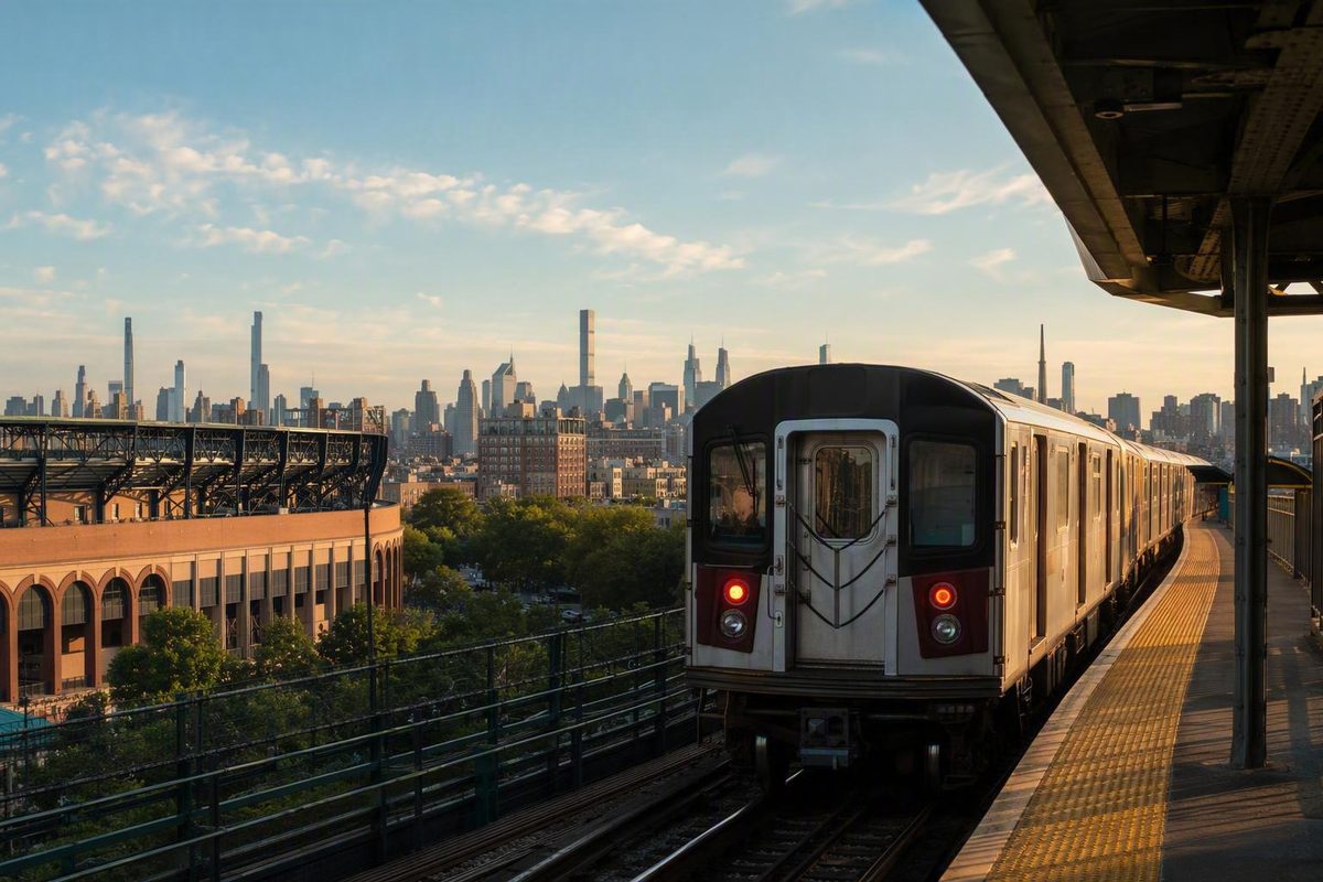
The 7 train provides a direct subway connection between Flushing and Midtown Manhattan, with stops serving Citi Field, Jackson Heights, Woodside, Long Island City, Grand Central, Times Square, and Hudson Yards. It runs through Queens and Manhattan—not Brooklyn.
Three facts make the route easier to use: the complete local route has 22 stations, the circle 7 and diamond <7> represent different stopping patterns, and day-of-travel conditions can override the normal map. This guide covers the stable route structure. Confirm arrivals, planned work, express operation, skipped stops, platform changes, and elevator availability through current MTA information before leaving.
Route reference: the official MTA weekday line map used for this guide was updated December 7, 2025. Temporary construction alerts are intentionally excluded because they can expire.1
The 7 Train at a Glance
The 7 runs between Flushing–Main St in Queens and 34 St–Hudson Yards in Manhattan. It does not enter Brooklyn.
The MTA weekday map lists 22 stations: 18 in Queens and four in Manhattan.1 The route is particularly useful for trips involving:
- Downtown Flushing
- Mets–Willets Point
- Jackson Heights and Woodside
- Long Island City
- Grand Central
- Fifth Avenue
- Times Square
- Hudson Yards
Two route symbols may appear:
- A 7 inside a circle generally identifies local service.
- A 7 inside a diamond, represented in text as <7>, identifies express service.
Under normal service, the local stops at every station. The express skips selected Queens stations when it operates. Do not assume that every train using the purple 7 designation has the same stopping pattern.
It also helps to distinguish permanent route information from operational information:
Relatively stable information
- The two terminals
- The 22-station local route
- Station order
- Borough locations
- The stations shown as transfer or accessible stations on the weekday map
Information that can change
- Arrival times and waiting intervals
- Express hours and direction
- Skipped stops
- Platform assignments
- Planned suspensions
- Elevator and escalator availability
- Special-event service
Use the route below to understand where the train normally goes. For an actual trip, compare that route with current MTA notices immediately before departure.
All 22 Line 7 NYC Subway Stations
The complete local route runs from Flushing–Main St in eastern Queens to 34 St–Hudson Yards on Manhattan’s west side. For travel in the opposite direction, read the table from bottom to top.
The service, transfer, accessibility, and airport-bus columns reflect the MTA’s weekday line map.1 “Transfer listed” means that the map identifies a subway connection at that station; individual connecting services may have weekday, late-night, or weekend restrictions. An accessibility designation is also not a guarantee that every elevator will be operating when you arrive.
| Borough | Station | Weekday map designation | Subway transfer | ADA accessible designation | Listed airport-bus connection |
|---|---|---|---|---|---|
| Queens | Flushing–Main St | Local and express; terminal | — | Yes | Q48 |
| Queens | Mets–Willets Point | Local and express | — | — | Q48 |
| Queens | 111 St | Local | — | — | Q48 |
| Queens | 103 St–Corona Plaza | Local | — | — | — |
| Queens | Junction Blvd | Local and express | — | Yes | Q72 |
| Queens | 90 St–Elmhurst Av | Local | — | — | — |
| Queens | 82 St–Jackson Hts | Local | — | — | — |
| Queens | 74 St–Broadway | Local | Transfer listed | Yes | Q70 SBS and Q47 |
| Queens | 69 St | Local | — | — | — |
| Queens | 61 St–Woodside | Local and express | — | Yes | Q70 SBS |
| Queens | 52 St | Local | — | — | — |
| Queens | 46 St–Bliss St | Local | — | — | — |
| Queens | 40 St–Lowery St | Local | — | — | — |
| Queens | 33 St–Rawson St | Local | — | — | — |
| Queens | Queensboro Plaza | Local and express | Transfer listed | Yes | — |
| Queens | Court Sq | Local and express | Transfer listed | Yes | — |
| Queens | Hunters Point Av | Local and express | — | — | — |
| Queens | Vernon Blvd–Jackson Av | Local and express | — | — | — |
| Manhattan | Grand Central–42 St | Local and express | Transfer listed | Yes | — |
| Manhattan | 5 Av | Local and express | Transfer listed | — | — |
| Manhattan | Times Sq–42 St | Local and express | Transfer listed | Yes | — |
| Manhattan | 34 St–Hudson Yards | Local and express; terminal | — | Yes | — |
Why some 7 train lists show only 20 stops
A third-party itinerary labeled as the Flushing Local displays only 20 stops because it omits 69 St and 52 St.2 Both belong in the normal 22-station local route.
Other third-party lists include all 22 stations but may use different names or incorrect borough groupings. One such page calls the western terminal “34 St–11 Av” and incorrectly places numerous Queens stations under Brooklyn.3 Its inclusion of 69 St and 52 St helps explain the difference in station counts, but its borough labels should not be followed.
The official western-terminal name is 34 St–Hudson Yards. “34 St–11 Av” refers to its location near 11th Avenue, not the station name used on the MTA line map.
The route in simpler geographic groups
Visitors generally do not need to memorize all 22 stations. It is often easier to divide the route into four segments:
- Manhattan: Grand Central–42 St through 34 St–Hudson Yards
For travel from Manhattan toward Queens, confirm that the train is heading toward Flushing–Main St. For travel from Queens toward Midtown or Hudson Yards, confirm that it is heading toward 34 St–Hudson Yards. Read the destination shown on the arriving train rather than relying only on the platform or track.
7 Local vs. <7> Express: How to Tell Which Train You Are Taking
The most visible distinction is the shape surrounding the route number:
- Circle 7: local
- Diamond <7>: express
Local service normally stops at every station. Express service skips selected stops in Queens when operating. If your destination appears only in the local-station list and you are uncertain about the arriving train, the circle 7 is the safer choice.
Express service is generally time- and direction-dependent. The supplied route material describes a typical peak-direction pattern: toward Manhattan during the morning peak and toward Flushing later in the day. This guide does not publish exact express hours or a definitive direction-specific stop pattern because those details require a current official schedule and can be affected by service changes.
Do not plan around a promised time saving. Even when an express train is operating, waiting for it may offset its faster stopping pattern. A local train already at the platform may be the more practical option.
Which stations are labeled local and express?
The MTA weekday line map labels the following stations for both local and express service:1
- Flushing–Main St
- Mets–Willets Point
- Junction Blvd
- 61 St–Woodside
- Queensboro Plaza
- Court Sq
- Hunters Point Av
- Vernon Blvd–Jackson Av
- Grand Central–42 St
- 5 Av
- Times Sq–42 St
- 34 St–Hudson Yards
The other ten stations are labeled local:
- 111 St
- 103 St–Corona Plaza
- 90 St–Elmhurst Av
- 82 St–Jackson Hts
- 74 St–Broadway
- 69 St
- 52 St
- 46 St–Bliss St
- 40 St–Lowery St
- 33 St–Rawson St
These designations explain the normal weekday route structure. They do not promise that every express train will follow an unchanging pattern. Construction, operational changes, special events, and direction can affect where a train stops.
A reliable boarding check
Before stepping onto a train:
- Confirm the destination. Look for Flushing–Main St or 34 St–Hudson Yards.
- Check the route symbol. A circle 7 generally means local; a diamond <7> means express.
- Read the platform signs. Make sure the track serves your intended direction.
- Read the train display. Do not identify a train solely by the track on which it arrives.
- Listen to announcements. A train may be changed from express to local or instructed to skip stops.
- Review current notices. Planned work can override the normal weekday map.
If your destination is one of the ten local-only stations, board the circle 7 unless a current MTA notice provides different instructions.
Key Transfers Along the 7 Train
The MTA weekday map lists subway transfers at six 7 stations: 74 St–Broadway, Queensboro Plaza, Court Sq, Grand Central–42 St, 5 Av, and Times Sq–42 St.1
These are weekday-map designations. Connecting services and transfer availability can differ late at night or on weekends.
74 St–Broadway
At 74 St–Broadway, the weekday map lists connections to:
- E, F, and M until 11 p.m.
- R except late nights
- Q70 SBS and Q47 airport-bound bus services
This is a major interchange for riders changing between the 7 and other Queens subway services. The 7 station is also marked accessible on the weekday map.
Observe the time qualifications attached to the connecting subway services. A transfer shown during a weekday afternoon may not operate in the same way late at night. Airport-bound buses are separate services requiring riders to leave the train and find the appropriate bus stop.
Queensboro Plaza
Queensboro Plaza is an important western Queens interchange. The weekday map labels it for local and express 7 service, identifies subway transfers, and marks the station accessible.
Use the current trip plan for your specific onward connection rather than treating Queensboro Plaza and Court Sq as interchangeable. Planned work can also change the appropriate platform or transfer path.
Court Sq
Court Sq is another major western Queens interchange. It is labeled for local and express service, has subway transfers, and is marked accessible on the weekday map.
Although Court Sq and Queensboro Plaza are close together on the 7, they provide different onward connections. Follow the station named in your current trip plan.
Grand Central–42 St
Grand Central–42 St is the first Manhattan stop when arriving from Queens. It is one of the route’s principal transfer hubs and is served by both local and express trains on the weekday map.
Because it is a large station complex, allow time to follow signs between services. The station is marked accessible, but travelers who require a step-free route should still check current elevator conditions before departure.
5 Av
The 5 Av station is a weekday transfer point between Grand Central–42 St and Times Sq–42 St. It is served by both local and express 7 trains.
The station is not among the nine 7 stations marked ADA accessible on the weekday map. Travelers requiring a step-free route should not assume that a transfer designation means the complete transfer path is accessible.
Times Sq–42 St
Times Sq–42 St is the other principal Manhattan transfer hub on the route. It is served by both local and express trains and is marked accessible.
There is an important qualification: the transfer from Times Sq–42 St to 42 St–Port Authority Bus Terminal is identified as not accessible on the MTA weekday map.1 Accessibility can therefore vary within a station complex. Follow signs for the exact service you need rather than treating every corridor marked “transfer” as equivalent.
Useful 7 Train Stops for Visitors
The 7 is most useful when it handles one substantial movement between areas. Rather than building a day around repeated trips across the city, choose the station that brings you into the area where you intend to spend the next part of your visit.
For Flushing: Flushing–Main St
Flushing–Main St is the eastern terminal. A rider boarding at Times Sq–42 St can remain on the 7 to Flushing without changing trains.
One third-party trip planner estimates the subway journey from Times Square to Flushing at roughly 35 minutes, but that figure is not a guaranteed runtime.4 Waiting time, local or express operation, congestion, and service changes can all affect the trip.
Because Flushing–Main St is the terminal, an unfamiliar rider does not need to identify an intermediate stop: remain aboard until the end of the route. For the return journey, confirm that the train is heading toward 34 St–Hudson Yards.
For Citi Field: Mets–Willets Point
The MTA line map’s entrance information for Mets–Willets Point references the Citi Field Jackie Robinson Rotunda.1 The station is labeled for local and express service on the weekday map.
Event travel requires more flexibility than an ordinary trip. Check current service before leaving for the event and again before the return trip.
Do not assume that an event guarantees express service. The route symbol, train display, announcements, and current MTA notices determine how the arriving train is operating.
For Midtown’s east side: Grand Central–42 St
Grand Central–42 St is the first Manhattan stop from Queens. It works both as a destination and as a transfer hub for onward travel.
If your next destination is nearby, continuing on foot may be simpler than making another short subway trip through a large station complex. If you are transferring, allow time to follow the signs for the correct service and platform.
For central Midtown: 5 Av and Times Sq–42 St
The 5 Av and Times Sq–42 St stations provide access to different points along 42nd Street. Choose between them according to your destination or required transfer rather than assuming one is always better.
Times Sq–42 St is the larger transfer hub and the starting point for a direct 7 ride to Flushing. If 5 Av is already closer to your origin, boarding there can avoid unnecessary backtracking.
For the far west side: 34 St–Hudson Yards
Stay aboard after Times Square to reach it.
Before boarding a train at Hudson Yards, check its display and listen for announcements rather than assuming that every train at the platform is ready to depart.
Use the 7 for the major move, then walk
A walking-first itinerary uses transit to bridge the long distance between areas and keeps the next part of the day concentrated around the arrival neighborhood. New York Know’s editorial approach similarly emphasizes grouping activities by area instead of repeatedly crossing the city.5
Applied to the 7, that could mean:
- Riding to Flushing and keeping the next part of the day there
- Traveling directly to Mets–Willets Point for an event
- Arriving at Grand Central or Times Square and exploring a compact part of Midtown
- Using 34 St–Hudson Yards as the beginning or end of a west-side segment
The objective is not to visit every important 7 station in one day. It is to use the line for a necessary Manhattan–Queens transition and minimize backtracking after arrival.
Accessible Stations and Step-Free Trip Planning
The MTA weekday line map marks nine 7 stations as ADA accessible:1
- Flushing–Main St
- Junction Blvd
- 74 St–Broadway
- 61 St–Woodside
- Queensboro Plaza
- Court Sq
- Grand Central–42 St
- Times Sq–42 St
- 34 St–Hudson Yards
This is a static route-map designation, not a real-time guarantee.
A station may also contain some accessible features without providing the complete step-free route required for a particular trip. Do not describe a station absent from the official accessible list as fully accessible based solely on the presence of an elevator or ramp.
The Times Square transfer limitation
Times Sq–42 St is marked as an accessible 7 station, but the transfer to 42 St–Port Authority Bus Terminal is identified as not accessible.1
This distinction matters when a trip continues beyond the 7. Reaching an accessible station does not establish that every internal passage or onward transfer is step-free.
How to plan a step-free 7 trip
Use this process:
- Choose an accessible origin and destination. Begin with the nine stations identified above.
- Check every transfer independently. A generally accessible complex may contain an inaccessible connection.
- Check current elevator and escalator conditions. Do this shortly before departure.
- Review planned service changes. A train skipping an accessible station may require a different route.
-
Verify replacement transportation. A substitute subway route or shuttle may not provide the same accessibility.
-
Recheck conditions before returning. Elevator and service conditions can change during the day.
Because no live elevator-status record is embedded in this stable route guide, consult the current MTA website or app before beginning a journey that depends on a working elevator.
Airport-Bus Connections from the 7
The 7 does not provide direct rail service to LaGuardia Airport or another airport. The MTA weekday line map lists airport-bound bus connections at six Queens stations:1
| 7 station | Airport-bus connection listed on the weekday map |
|---|---|
| Flushing–Main St | Q48 |
| Mets–Willets Point | Q48 |
| 111 St | Q48 |
| Junction Blvd | Q72 |
| 74 St–Broadway | Q70 SBS and Q47 |
| 61 St–Woodside | Q70 SBS |
These entries describe connections shown on the cited weekday map, not independently verified live bus operations. Bus routes, boarding locations, and service conditions can change separately from the subway.
A listed connection also does not create a one-seat subway ride to the airport. Riders must leave the train, locate the correct bus stop, and board the appropriate bus.
Before relying on one of these connections, verify:
- Whether the bus serves the required airport terminal
- The current boarding location
- The direction of travel
- Subway and bus service status
- Planned changes affecting either service
- Accessibility of the subway station and bus connection
- Sufficient transfer and airport check-in time
No connection is universally fastest. The practical choice depends on where you board the 7, train and bus waiting times, traffic, luggage, terminal destination, accessibility requirements, and disruptions. Compare the complete trip rather than choosing solely by proximity on the subway map.
How to Check Service Before You Ride
This article is a stable route guide, not a live service feed. The MTA line map describes weekday service and warns that routes and transfers may differ on weekends and late nights.1
Immediately before departure, use current MTA information to check:
- Train arrivals
- Service status
- Planned work
- Subway schedules
- Directional skipped stops
- Express-to-local changes
- Partial suspensions
- Platform or boarding changes
- Elevator and escalator outages
The approved route map is the official source for the normal station structure, but it does not replace current operational information. Use the MTA website or app to locate the current status, schedule, planned-work, and accessibility tools. Check once during planning and again shortly before leaving.
Why a general service label is not enough
A broad line-status label may not reveal a station-level problem. In one time-stamped third-party snapshot, the 7 received an overall “Good Service” rating while the same page displayed directional skipped stops and unusual boarding arrangements.6
That snapshot should not be treated as current service information. It illustrates a general point: a line may be operating across most of its route while still skipping the station a particular rider needs.
Read the details below any general status label. Look specifically for your direction, station, transfer, and required accessibility path.
Treat headways and journey times as estimates
A statement that trains arrive every three or five minutes may represent a schedule, a particular period, or a time-stamped model output. It does not establish the maximum wait throughout the day.
The same limitation applies to the roughly 35-minute third-party estimate between Times Square and Flushing. It can provide a planning baseline, but it does not include every possible wait, delay, service change, or altered stopping pattern. Add flexibility to time-sensitive journeys.
Keep temporary alerts out of the permanent route
Any temporary alert published in a guide should include a visible last checked date and time. It should be removed or revised when it expires rather than being incorporated into the permanent station table.
A station temporarily bypassed during construction remains part of the normal route. Mixing a temporary skip into the permanent list can make readers think that a short-term service pattern is permanent.
A final decision sequence
Before using the 7:
- Confirm your direction: Flushing–Main St or 34 St–Hudson Yards.
- Use the complete local route: do not rely on a list that omits 69 St or 52 St.
- Identify the train: circle 7 for local or diamond <7> for express.
- Confirm the stop: check the display, platform signs, announcements, and current notices.
- Choose transfers deliberately: weekday connections may differ at night or on weekends.
- Plan accessibility for the complete journey: include transfer paths, replacement services, and current elevator conditions.
- Check current MTA information immediately before leaving: normal route facts do not guarantee day-of-travel operation.
Use the 7 for the major move between Manhattan and Queens, then keep the next part of the day compact and walkable around the neighborhood where you arrive.
Frequently Asked Questions
Does the 7 train go through Brooklyn?
No. The 7 serves Queens and Manhattan. It runs from Flushing–Main St through Queens to Grand Central, Times Square, and 34 St–Hudson Yards in Manhattan.1
Some third-party route pages contain incorrect borough groupings. Stations such as Junction Blvd, 74 St–Broadway, 61 St–Woodside, Queensboro Plaza, Court Sq, and Vernon Blvd–Jackson Av are in Queens, not Brooklyn.
How many stops does the local 7 train have?
The complete local route has 22 stations: 18 in Queens and four in Manhattan.1
A third-party itinerary displays only 20 because it omits 69 St and 52 St. Both are local stations on the complete route.
How can I tell the 7 local from the <7> express?
A 7 inside a circle generally identifies local service. A 7 inside a diamond, represented as <7>, identifies express service.
Also check the train’s destination display, platform signs, announcements, and current service notices. Express operation is time- and direction-dependent, and a service change can alter the normal stopping pattern.
Can I take the 7 directly from Times Square to Flushing?
Yes. Board a Queens-bound 7 at Times Sq–42 St and remain aboard to Flushing–Main St. No transfer is required.4
A third-party planner estimates the subway portion at roughly 35 minutes, but actual travel time depends on waiting time, the train’s stopping pattern, congestion, and service conditions.
Does the 7 train run differently on weekends or late at night?
It can. The MTA’s 7 line map represents weekday service and states that routes and transfers may differ on weekends and late nights.1
Do not assume that the usual peak-direction express pattern, transfer availability, or platform arrangement applies to every service period. Check current MTA schedules, service notices, planned work, and elevator status before traveling.