 New York Know
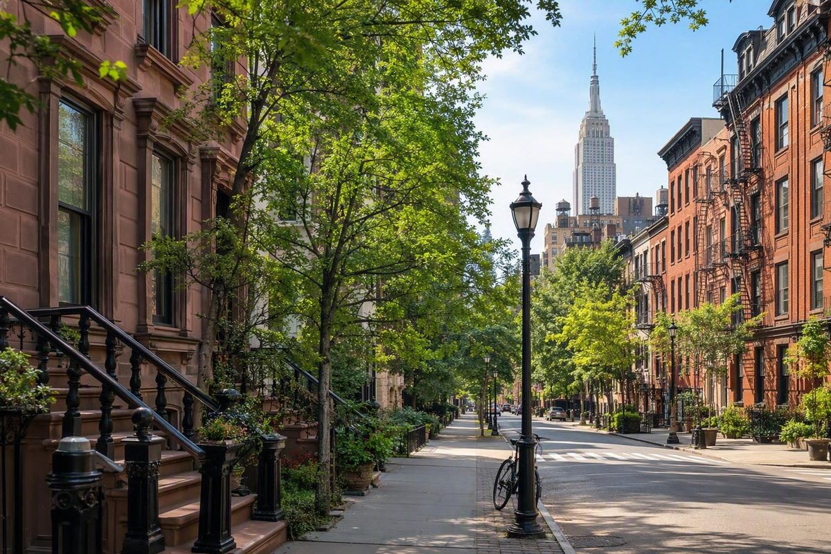
Understand Manhattan one area at a time.
Manhattan becomes easier to navigate once you stop looking for one definitive neighborhood map. Its boundaries are approximate, smaller districts often overlap, and familiar terms such as Downtown and Uptown can describe either a region or a direction.
For visitors, that ambiguity is a planning fact rather than a problem to solve. Learn the borough from north to south, use the rivers, Central Park, Fifth Avenue, and numbered streets as anchors, and choose a base according to the places you intend to visit. That approach is more useful than any universal ranking of the “best” Manhattan neighborhoods.
How to read a map of Manhattan’s neighborhoods
Manhattan is one of New York City’s five boroughs. It is not interchangeable with New York City, nor is it itself a neighborhood. Within the borough are broad regions, principal neighborhoods, smaller subareas, commercial districts, historic districts, landmark zones, and developments.
Neighborhood names and boundaries are generally informal rather than officially fixed. A map might present Greenwich Village and the West Village as separate entries, while another treats the West Village as part of a broader Village. Times Square may appear as a destination, a district, or an area overlapping Midtown and the Theater District. Hudson Yards may be classified as a development, district, or neighborhood. A widely used geographic compilation explicitly describes Manhattan neighborhood limits as approximate and subject to change in its explanation of neighborhood boundaries.
That variability also explains why Manhattan has no authoritative neighborhood total. Publishers count different types of places. Homes.com, for example, labels its own collection as covering 57 Manhattan neighborhoods, but that figure reflects the directory’s taxonomy rather than an official city count on its Manhattan neighborhood page. Other directories use different names and classifications.
A practical visitor map needs a simple hierarchy:
- Borough: Manhattan.
- Broad region: Downtown, Midtown, Uptown, or Upper Manhattan.
- Principal neighborhood: Chelsea, Harlem, SoHo, the Upper West Side, or another widely recognized area.
- District, subarea, or development: Times Square, Alphabet City, Carnegie Hill, NoMad, Hudson Yards, and similar smaller or overlapping labels.
This hierarchy remains flexible. Some places function as principal neighborhoods in everyday speech even when another map classifies them as districts or subareas. The purpose is not to police local vocabulary. It is to prevent the assumption that every name on a map represents the same kind of geographic unit.
Several physical features provide more dependable orientation:
- The Hudson River borders Manhattan on the west.
- The East River lies along its eastern side.
- The Harlem River helps define its northern geography.
- Central Park creates the clearest divide between the Upper West and Upper East Sides.
- Fifth Avenue is commonly used as the reference separating east from west.
- Numbered cross streets help visitors estimate north-south position through much of the borough.
New York City’s five boroughs are Manhattan, Brooklyn, Queens, the Bronx, and Staten Island, while the Hudson, East, and Harlem Rivers frame Manhattan’s basic geography in this overview of the borough.
An address can therefore be more informative than a neighborhood label. “West 44th Street near Eighth Avenue” places you in the Midtown and Theater District orbit with useful precision. “Midtown” alone covers too much territory to describe the immediate setting.
Throughout this guide, street limits are orientation aids rather than definitive borders. Use them to understand adjacency: what lies north, south, east, or west; which areas can be explored together; and when a deliberate subway trip makes more sense than continuing on foot.
The broad regions: Downtown, Midtown, Uptown, and Upper Manhattan
A north-to-south framework is the fastest way to build a mental map of Manhattan. The difficult part is that the dividing lines vary by source.
Lower Manhattan, often called Downtown, commonly means the area below 14th Street. In casual visitor language, however, “downtown” may be used more loosely for neighborhoods south of Midtown—or simply as the direction south.
Midtown has an especially disputed southern edge. One common convention places it between 34th and 59th Streets. Some visitor-oriented guides extend it south to 14th Street so Chelsea, Flatiron, NoMad, and related central districts fit into one sightseeing region.
Uptown is less exact. It can describe the Upper East and Upper West Sides around Central Park, everything north of Midtown, or simply the direction north. A subway announcement that a train is heading uptown is directional; it does not mean the train is entering a single neighborhood called Uptown.
Upper Manhattan generally means the northern part of the borough. Some frameworks begin it above 96th Street, but the transition is uneven: the Upper East Side is commonly described as ending around East 96th Street, while the Upper West Side may extend to West 110th Street. Visitor guides display these competing conventions, including one that defines Downtown from 14th Street south, uses either 14th or 34th Street as Midtown’s lower edge, and gives different eastern and western transition points for Upper Manhattan in its first-time visitor geography.
| Broad region | Useful approximate street band | Representative neighborhoods and areas | Boundary caveat |
|---|---|---|---|
| Lower Manhattan or Downtown | Southern tip to around 14th Street | Financial District, Battery Park City, Tribeca, Chinatown, SoHo, Lower East Side | “Downtown” is also directional and may be used more loosely |
| Central area south of core Midtown | Around 14th to 34th Streets | Chelsea, Flatiron, NoMad, Gramercy | Some visitor guides absorb this band into Midtown |
| Midtown | Commonly around 34th to 59th Streets | Hell’s Kitchen, Midtown East, Murray Hill, Garment District, Times Square | Some practical travel maps begin Midtown at 14th Street |
| Uptown and the Upper Sides | Around 59th Street north along Central Park | Upper East Side, Upper West Side, Carnegie Hill, Lincoln Square | “Uptown” may mean a region, direction, or everything north of Midtown |
| Upper Manhattan | Often above 96th Street, with west-side variation | Harlem, East Harlem, Morningside Heights, Washington Heights, Inwood | East- and west-side transitions do not occur at precisely the same street |
| Northern exception | Beyond Manhattan Island | Marble Hill | Politically in Manhattan but physically connected to the Bronx mainland |
Treat these bands as layers rather than hard-edged boxes. If a hotel is advertised as “Downtown,” look for the address or nearest intersection. A property near 14th Street creates a different walking map from one near the Battery, even if both receive the same regional label.
The same principle applies to Midtown. A theater-focused visitor may prefer the west 40s, while someone concentrating on Grand Central and the East Side may choose Midtown East. Both locations are in Midtown, but their immediate surroundings and most convenient walking routes differ.
Upper Manhattan: Marble Hill, Inwood, Washington Heights, and Harlem
At Manhattan’s northern end, the geography becomes more varied than a simple extension of Midtown’s street grid. Moving roughly south, the principal labels include Marble Hill, Inwood, Washington Heights, Hamilton Heights, Morningside Heights, Harlem, and East Harlem. Smaller labels sit within or overlap these larger areas.
Marble Hill is Manhattan’s essential geographic exception. It belongs politically to Manhattan but lies across the Harlem River from Manhattan Island. It has been physically connected to the Bronx mainland since 1914. The same geographic compilation places Inwood above Dyckman Street and describes Washington Heights as extending approximately from West 155th Street to Dyckman Street in its north-to-south neighborhood list.
Within northern Washington Heights, Fort George is described as a smaller area running approximately from West 181st Street to Dyckman Street and from Broadway toward the Harlem River in this Manhattan neighborhood mapping project. As with all such ranges, these limits are best used for orientation rather than as a test of whether one block “belongs.”
Washington Heights and northern Manhattan matter especially to visitors planning to see The Met Cloisters. Its northern location makes it more natural to combine with Washington Heights and nearby green space than with an unrelated sequence of Downtown attractions. It can serve as the anchor of a northern-Manhattan day rather than a hurried detour.
Its classification varies, but visitors mainly need to understand that it belongs to northern Manhattan rather than the Upper West Side or Midtown.
Morningside Heights is associated with Columbia University and the Cathedral of St. John the Divine.
Harlem is a large and internally varied area, not one uniform district. Central Harlem, West Harlem, and East Harlem have distinct geographic and historical associations, and smaller labels may be nested within them. Harlem occupies a prominent place in African American cultural history and is strongly associated with jazz, gospel, and the Apollo Theater. Washington Heights is associated with The Met Cloisters, while Morningside Heights contains Columbia University and the Cathedral of St. John the Divine in this overview of northern Manhattan destinations.
East Harlem is a principal neighborhood label in its own right, not simply another name for central Harlem. For route planning, its eastern position matters because it changes which park entrances, avenues, and stations are most practical.
A northern-Manhattan day can be organized in several ways:
- Use The Met Cloisters as the main anchor, then spend time in Washington Heights.
- Combine Morningside Heights with West Harlem.
- Build a Harlem-focused day around cultural history, performance, architecture, and food.
- Pair the northern edge of Central Park with Harlem or East Harlem instead of returning immediately to Midtown.
Avoid reducing all of Upper Manhattan to one atmosphere or making neighborhood-wide assumptions about affordability, nightlife, or safety. Large neighborhoods contain different land uses and block-level conditions. Exact destinations, walking demands, and transportation access matter more than a broad label.
The two sides of Central Park
Central Park is Manhattan’s clearest neighborhood divider. The Upper West Side lies between the park and the Hudson River. The Upper East Side lies between Fifth Avenue and the East River.
The Upper East Side is commonly placed from approximately East 59th to East 96th Streets. Within or overlapping that larger neighborhood are smaller areas such as Carnegie Hill, which one mapping project places roughly between East 86th and East 96th Streets and Third and Fifth Avenues in its Manhattan neighborhood profiles.
The Upper West Side is often placed from approximately West 59th to West 110th Streets between Central Park and the Hudson River. Definitions differ, however. One visitor guide begins the Upper West Side at West 72nd Street, effectively treating Lincoln Square and the lower west 60s separately in its Upper West Side description.
The two sides are more useful when compared through location and attractions than through stereotypes. The Upper East Side is associated with Museum Mile along Fifth Avenue and access to Central Park’s eastern edge. The Upper West Side is associated with the American Museum of Natural History, Riverside Park, the Hudson River side, and western park entrances.
| Consideration | Upper West Side | Upper East Side |
|---|---|---|
| Approximate location | West of Central Park, commonly extending toward West 110th Street | East of Central Park, commonly extending toward East 96th Street |
| Central Park access | Western entrances | Eastern entrances |
| Major museum association | American Museum of Natural History | Museum Mile institutions along Fifth Avenue |
| Waterfront orientation | Hudson River and Riverside Park | East River |
| Smaller-area example | Lincoln Square or the lower Upper West Side, depending on taxonomy | Carnegie Hill in the northern portion |
| Best planning question | Are most of your park and museum stops west of the park? | Are most of your museums and park stops along Fifth Avenue or farther east? |
Central Park separates the neighborhoods, but crossing it is a meaningful part of a route rather than a negligible step. If Museum Mile and the American Museum of Natural History are both priorities, place them on separate, geographically coherent park days instead of repeatedly moving from one side to the other.
Neither side is uniform. The Upper East Side should not be reduced to luxury, formality, or designer shopping, and the Upper West Side should not be described as quiet or family-oriented on every block. Both contain commercial avenues, residential side streets, institutions, restaurants, schools, and varying levels of activity.
Midtown and its overlapping districts
Midtown is a broad region containing neighborhoods, business districts, entertainment zones, landmark areas, and destination clusters. It is not one uniform neighborhood.
Common Midtown labels include:
- Hell’s Kitchen
- Midtown East
- Murray Hill
- the Garment District
- Koreatown
- Times Square
- the Theater District
- Rockefeller Center
- the Diamond District
Other maps may add Turtle Bay, Sutton Place, Midtown West, Bryant Park, or parts of Hudson Yards. These names do not represent equivalent geographic units. Midtown East is a broad positional label; Rockefeller Center is a landmark complex and destination area; the Diamond District is a concentrated commercial district; and Times Square overlaps Midtown and the Theater District.
The Theater District is commonly placed at approximately West 41st to West 54th Streets between Sixth and Eighth Avenues. Times Square sits within and overlaps that zone, so presenting it as a completely separate, officially bounded neighborhood creates a false distinction.
West of the Theater District, Hell’s Kitchen is often described as extending from approximately West 34th to West 59th Streets between Eighth Avenue and the Hudson River. Its edges vary where it meets the Theater District, Columbus Circle, and Hudson Yards. These approximate Theater District and Hell’s Kitchen ranges appear together in a visitor-oriented Manhattan guide covering Midtown’s west side.
On the east side, The Diamond District is associated with part of West 47th Street.
For visitors, Midtown’s importance comes from its concentration of recognizable destinations:
- Broadway theaters
- Times Square
- Rockefeller Center
- the Empire State Building
- Bryant Park
- Grand Central
- the Museum of Modern Art
- Fifth Avenue
That concentration can make Midtown practical when most of an itinerary is nearby. It also presents multiple transit options, although the usefulness of any hotel depends on its exact location and the routes serving its nearest station.
The trade-offs are contextual. Blocks around Times Square may feel crowded and noisy to a traveler who wants slower evenings. A side street farther from the largest attractions can produce a different experience while remaining in Midtown. Accommodation costs also vary by date, property, and room type, making neighborhood-wide price claims unreliable.
A coherent Midtown day might proceed as follows:
- Begin around Grand Central and Bryant Park.
- Walk toward Fifth Avenue and Rockefeller Center.
- Add the Museum of Modern Art if it suits your interests.
- Continue toward Times Square and the Theater District for an evening performance.
An Empire State Building and Koreatown variation can be built farther south, while a Hell’s Kitchen route can emphasize the west side. Trying to cover every Midtown district in one walk, however, can turn a sensible geographic plan into another checklist.
Between Midtown and Downtown: Chelsea, Flatiron, NoMad, and Gramercy
The band from approximately 14th to 34th Streets forms a transition between conventional Midtown and Downtown. It contains adjacent neighborhoods and newer district labels whose edges frequently overlap.
Chelsea is commonly placed between West 14th and West 34th Streets, extending from Sixth Avenue toward the Hudson River. To the east, its transition toward Flatiron is not marked by one universally accepted line.
Chelsea is associated with galleries, the High Line, the Hudson River, and access toward Hudson Yards. Those features make it useful for a west-side walking day, but they do not mean every Chelsea block has the same character. The riverfront, gallery district, and eastern edge near Sixth Avenue create different immediate settings.
The Flatiron District is approximately described as running from 16th to 27th Streets between Park Avenue South and Sixth Avenue. Gramercy Park is commonly placed from approximately East 14th to East 23rd Streets and from First Avenue to Park Avenue South. The same geographic compilation that provides these ranges also stresses that Manhattan neighborhood limits are approximate rather than official in its neighborhood list.
It should not be treated as having a universally settled boundary with Flatiron. In practical visitor language, “Flatiron/NoMad” often communicates the general area more effectively than insisting on a precise dividing line.
| Area | Relative location | Notable features | Neighboring or overlapping labels |
|---|---|---|---|
| Chelsea | West side between Downtown and core Midtown | Galleries, High Line access, Hudson River proximity | Meatpacking District, Hudson Yards, Flatiron |
| Flatiron District | Central area around Madison Square | Architecture, Madison Square, central avenues | NoMad, Chelsea, Gramercy, Union Square |
| NoMad | North of Madison Square | Central location and architecture | Flatiron, Koreatown, Midtown South |
| Gramercy | East of Flatiron and north of the East Village | Gramercy Park area and residential streets | Union Square, Flatiron, East Village, Kips Bay |
These areas can act as bridges between Midtown and Downtown itineraries. Staying here does not put every major attraction within walking distance, but it can make northbound and southbound days easier to organize. Their central position is more useful than claims that one is inherently calmer, better, or more authentic.
A coherent walking day could begin near Madison Square, move through Flatiron and NoMad, and continue west into Chelsea. Another could pair Gramercy with Union Square and the northern East Village. Choose according to which side of Manhattan you want to emphasize.
The Villages and nearby downtown neighborhoods
Greenwich Village is the broad historic area associated with Washington Square Park and New York University. Its street pattern differs from Midtown’s more predictable grid, and it is broadly associated with historic streets, restaurants, cafés, jazz, and nightlife. Those descriptions are useful context, not promises about every block.
The West Village is generally treated as a western subarea of the broader Village rather than an unrelated neighborhood. Maps differ over where Greenwich Village ends and the West Village begins, so the names overlap in everyday use.
The East Village lies east of Greenwich Village. Some publishers list Alphabet City separately, while others keep it within the East Village.
South of the Village, SoHo is associated with cast-iron architecture, shopping, loft buildings, and some cobblestone streets. Its position makes it easy to combine with NoLita, Chinatown, or the western side of the Lower East Side.
Its edges blend into its neighbors. Little Italy remains a recognized cultural and visitor district, though maps differ over the territory assigned to it.
The Bowery is best understood as a positional corridor rather than a rigid box. A Manhattan mapping project describes it through its relationship to the Lower East Side, Chinatown, NoLita, and the East Village rather than giving it one uncontested boundary.
East of the Bowery, the Lower East Side is a broad historic neighborhood associated with restaurants, nightlife, cultural institutions, and dense urban streets. The boundary is especially fluid around Houston Street and the southern East Village.
The Meatpacking District, west of Greenwich Village and south of Chelsea, is another smaller district that may be counted separately or treated as part of adjacent neighborhoods. Its location near the High Line and Hudson River makes it a natural connection between the West Village and Chelsea.
Useful walking clusters include:
- West-side Village route: Washington Square Park, Greenwich Village, the West Village, and the Meatpacking District.
- East-side route: the East Village, the Bowery, the Lower East Side, and Chinatown.
- Southern Village route: Greenwich Village, SoHo, NoLita, and Chinatown.
Choose two or three adjacent areas rather than trying to sample the West Village, Harlem, and the Financial District in one continuous sightseeing day. Walking between neighboring districts makes the transitions part of the experience: street patterns change, commercial activity shifts, and one label gradually gives way to another.
This approach does not require pretending that boundaries are invisible. It treats them as porous. A restaurant listed in NoLita may appear as SoHo on another map; the practical question is whether it fits your route.
Lower Manhattan: Tribeca, Chinatown, the Financial District, and the waterfront
Lower Manhattan is a region containing multiple neighborhoods and districts. It is not a single neighborhood.
Principal southern labels include Tribeca, Chinatown, Little Italy, SoHo, NoLita, the Lower East Side, the Financial District, Battery Park City, and the Battery area. Depending on the map, the region may also include Civic Center, the Seaport, Two Bridges, and other smaller or overlapping areas.
Some of these places received their primary treatment in the previous section because they connect naturally with the Villages. Their appearance here reflects the flexible use of “Downtown” and “Lower Manhattan,” not a claim that they belong to two officially bounded regions.
Tribeca lies on the west side of Lower Manhattan. It is associated with converted industrial and warehouse buildings and access to Hudson River Park.
Chinatown is useful as either the finish of a northbound Lower Manhattan walk or the beginning of a route toward the Lower East Side. It also connects naturally with Civic Center, Little Italy, NoLita, and the Bowery.
At Manhattan’s southern end, the Financial District is associated with Wall Street, the 9/11 Memorial area, the Battery, the Seaport, and access to ferries serving Ellis Island and the Statue of Liberty. A visitor guide groups those destinations around the Financial District while also describing Lower Manhattan as a wider region containing several distinct neighborhoods in its area overview.
Several adjacent labels should not be treated as synonyms:
- The Financial District is the broad business and historic district around Wall Street and the southern street network.
- Battery Park City is the west-side area along the Hudson.
-
The Battery is the waterfront park area at Manhattan’s southern tip.
-
The 9/11 Memorial area is a major destination within wider Downtown geography, not a replacement name for the entire region.
These distinctions matter when choosing a hotel or planning a walk. “Near the Battery” and “near the Seaport” both mean Lower Manhattan, but they place you on different waterfront edges. “Financial District” can still cover enough territory that the nearest intersection or station determines the practical route.
A walking-first day can begin near the harbor and move through the Financial District’s older street pattern. From there, pass through Wall Street or nearby historic streets, continue toward civic or memorial spaces, and make a deliberate turn toward the Seaport. The day can finish in Chinatown or near the East River.
The route can also be reversed. Beginning in Chinatown lets you move through Civic Center and the memorial area before reaching the Battery later in the day. The better direction depends on opening hours, reservations, ferry plans, weather, and where you want to finish.
New York Know’s walking-first Lower Manhattan route recommends beginning near the harbor, passing through the Financial District and civic or memorial spaces, turning toward the Seaport, and finishing around Chinatown or the East River. That is an editorial planning approach, not a guarantee that every traveler will save time. Its value is in demonstrating a repeatable principle: use adjacency to create one continuous geographic story rather than zigzagging among disconnected attractions.
Choose a neighborhood by itinerary, not by superlative
There is no universally best Manhattan neighborhood for a first visit. The most practical choice is the area that fits your priorities, accommodation, mobility needs, budget, and tolerance for walking, noise, and crowds.
Use this repeatable process.
1. Map your priority sights. List the places you would be genuinely disappointed to miss. Put them on a map before assigning days. Leave optional attractions out of this first step so they do not distort the pattern.
2. Identify the densest cluster. If most pins sit around Broadway, Rockefeller Center, and Fifth Avenue, Midtown deserves consideration. If they gather around Central Park museums, compare the Upper East and Upper West Sides. If they concentrate around the harbor and Wall Street, look closely at Lower Manhattan.
3. Check the exact accommodation location. Do not stop at the neighborhood name. Find the cross streets, nearest station, walking distance to that station, and position within the neighborhood. A large area can contain several different visitor contexts.
4. Evaluate the station, not merely the distance to one. A nearby entrance is useful only if the routes serving it connect sensibly with your plans. Check current transportation information directly before traveling, particularly when accessibility or a time-sensitive reservation matters.
5. Build days from adjacent areas. Combine Chelsea with the Meatpacking District, SoHo with Chinatown, or the Upper West Side with the western side of Central Park. When you need to cross the borough, make that transit move deliberately instead of repeatedly bouncing north and south.
Interest-based matches can narrow the choice without turning the decision into a ranking:
- Broadway and major Midtown sights: Midtown, the Theater District, or nearby Hell’s Kitchen.
- Museums and Central Park: the Upper East or Upper West Side, depending on the museum cluster.
- High Line and galleries: Chelsea and the Meatpacking District.
- Architecture and shopping: SoHo and adjacent NoLita.
- African American cultural history: Harlem.
- Harbor history and waterfront sights: the Financial District, Battery area, Seaport, or Battery Park City.
- Village streets, cafés, jazz, and nightlife: Greenwich Village, the West Village, or the East Village, with conditions varying by block.
- A central position between Midtown and Downtown: Flatiron, NoMad, Chelsea, or Gramercy.
Visitor guides often frame this choice as a trade-off between convenience and neighborhood atmosphere. Midtown places many prominent attractions nearby and may simplify a short, sightseeing-heavy trip. The Villages, Chelsea, Flatiron, and the Upper West Side are often considered by travelers seeking a more residential context, but that comparison is subjective and depends heavily on the exact block.
Crowding, noise, distance, and inconvenience should not be confused with danger. A busy Times Square block may be a poor match for someone seeking an early, quiet evening, but that is a question of trip style. Similarly, a northern-Manhattan base may be inconvenient for an itinerary concentrated around the harbor without making the neighborhood itself undesirable.
Before booking, ask:
- Is the accommodation on a major commercial avenue or a side street?
- How far is the walk to the station you will actually use?
- Are your priority destinations mostly north, south, east, or west?
- Will you return late after performances or meals?
- Does the building meet your mobility and accessibility needs?
- Are you comfortable with the amount of walking required?
- Does the immediate land use match the kind of stay you want?
For a more focused version of this process, see New York Know’s guide to choosing a New York neighborhood for a first trip. It is first-party editorial advice rather than an independently proven rule, but its central method is repeatable: choose one geographic focus, explore adjoining areas on foot, and use transit purposefully.
Frequently asked questions
How many neighborhoods are in Manhattan?
There is no authoritative total. Counts vary because publishers classify broad regions, principal neighborhoods, sub-neighborhoods, commercial districts, historic districts, destination areas, and developments differently.
One real-estate directory presents its own list of 57 Manhattan neighborhoods, but that is the publisher’s taxonomy rather than an official city count. A useful guide should therefore explain what it counts instead of claiming Manhattan has one exact number of neighborhoods.
Are Manhattan neighborhood boundaries official?
Generally, neighborhood names and limits are informal, overlapping, and subject to change. Published maps should be treated as orientation tools rather than definitive statements of where every neighborhood begins and ends.
When location matters, use an exact address, intersection, or station. Those details are more dependable than assuming every publisher, resident, hotel, or business uses a neighborhood name in precisely the same way.
What is the difference between Downtown, Midtown, Uptown, and Upper Manhattan?
Downtown commonly means Lower Manhattan below 14th Street, but it can also mean the direction south. Midtown is often placed around 34th to 59th Streets, although visitor guides may extend it south to 14th Street. Uptown can refer to areas around and north of Central Park or simply the direction north. Upper Manhattan generally means the northern part of the borough, with transition points varying between the east and west sides.
These are broad regional terms, not precise neighborhood names. For practical planning, “Chelsea,” “Midtown East,” or “Washington Heights” communicates more than “Downtown” or “Uptown” alone.
Which Manhattan neighborhood is most practical for a first visit?
The answer depends on the itinerary. Midtown can be practical for visitors concentrating on Broadway, Times Square, Rockefeller Center, Bryant Park, Grand Central, Fifth Avenue, and other central sights. It may also involve more crowds and noise near the busiest destinations.
Flatiron or NoMad may suit travelers dividing their time between Midtown and Downtown. Lower Manhattan works well for harbor, memorial, Financial District, and Downtown plans. The Upper Sides make sense when Central Park and museums dominate the itinerary, while Chelsea, SoHo, and the Villages may appeal to visitors prioritizing galleries, architecture, restaurants, or walking through adjoining neighborhoods.
Map your fixed plans first, then compare exact accommodations and nearby stations. That process is more reliable than accepting a universal first-visit recommendation.
What is the main difference between the Upper East Side and Upper West Side?
Central Park is the clearest divider. The Upper East Side lies east of the park and is associated with Museum Mile along Fifth Avenue. The Upper West Side lies west of the park and is associated with the American Museum of Natural History, Riverside Park, and the Hudson River side.
Their approximate north-south limits also differ by source. The Upper East Side is commonly placed from around East 59th to East 96th Streets. The Upper West Side is often placed from around West 59th to West 110th Streets, although some descriptions begin it at West 72nd Street.
For visitors, the important question is not which side is better. It is which side contains more of the museums, park entrances, restaurants, and other places in the planned itinerary.
Return to the map rather than searching for one winning neighborhood. Find the part of Manhattan containing most of your priority sights, choose a practical nearby base or day cluster, and explore outward into adjoining areas. Boundaries will remain approximate; your exact block, useful stations, and daily route will matter more than the label attached to the neighborhood.