 New York Know
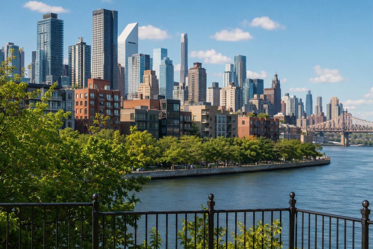
Queens is easier to plan as several distinct areas, not one interchangeable destination. Start with the part of the borough that best matches your destinations and preferred surroundings, then compare exact addresses and current transportation before booking. There is no evidence-based universal “best” Queens neighborhood: the right choice depends on where you need to go, the setting you want, and how much transit complexity you will accept.
Start here: choose the part of Queens, not a universal “best” neighborhood
Use your trip priorities to create a shortlist before comparing individual hotels or rentals.
| Visitor priority | Start with | Main planning consideration |
|---|---|---|
| Relative proximity to Manhattan and denser urban surroundings | Astoria, Long Island City, Sunnyside, Woodside | Distance from the exact address to useful transit |
| Central Queens neighborhood exploration | Jackson Heights, Elmhurst, Corona, Rego Park, Forest Hills, Kew Gardens | These are distinct neighborhoods, not variations of one experience |
| A major Queens commercial center | Flushing | The area is large, with substantial address-level variation |
| A major commercial and transit reference point | Jamaica | Confirm the station and service that fit your plans |
| Generally lower-density surroundings farther east | Bayside, Little Neck, Douglaston, Fresh Meadows | Buses, commuter rail, driving, and address-level access may matter more |
| Beaches and outdoor recreation | The Rockaways | Treat the peninsula as a separate destination day |
For visitors expecting to spend substantial time in Manhattan, northwestern Queens is the most logical first group to investigate. Astoria, Long Island City, Sunnyside, and Woodside occupy the borough’s western side and generally offer denser surroundings and more direct subway access than farther-east Queens. That broad pattern does not make every address equally useful: the decisive question is whether the nearest practical transit connection serves your actual destinations.
Central Queens requires a different mental map. Jackson Heights, Elmhurst, and Corona form one useful geographic group for research, while Rego Park, Forest Hills, and Kew Gardens form another. Their proximity does not erase differences in housing, commercial activity, street layout, parks, or transportation.
Flushing and Jamaica work well as orientation points because both are major commercial centers, while Jamaica is also a major transit hub. Neither name refers only to a single station area. Compare the full address with the places you intend to visit rather than relying on a neighborhood-wide commute claim.
These areas make the most sense when northeastern or eastern Queens is central to the trip or when a particular address suits a defined transportation plan.
The Rockaways call for another approach entirely. Their peninsula setting and beach access make them a destination for waterfront time and outdoor recreation, not an easy extra stop to attach to an unrelated central or northwestern Queens day.
Queens neighborhoods by region
Regional groupings are useful orientation tools, but they are not official or universally fixed divisions. Directories classify neighborhoods, enclaves, developments, cultural districts, and sub-neighborhoods differently. A broad directory of Queens place names, for example, combines primary neighborhood names with smaller areas and developments.
Here is a practical, non-exhaustive regional index:
| Region | Commonly listed neighborhoods |
|---|---|
| Northwestern Queens | Astoria, Long Island City, Sunnyside, Woodside |
| Central Queens | Briarwood, Corona, East Elmhurst, Elmhurst, Forest Hills, Jackson Heights, Kew Gardens, Maspeth, Rego Park, Ridgewood |
| Northeastern Queens | Bayside, College Point, Douglaston–Little Neck, Flushing, Fresh Meadows, Glen Oaks, Whitestone |
| Southeastern Queens | Cambria Heights, Hollis, Jamaica, Laurelton, Queens Village, Rosedale, Springfield Gardens |
| Southwestern Queens | Howard Beach, Ozone Park, Richmond Hill, Woodhaven |
| The Rockaways | Arverne, Belle Harbor, Breezy Point, Far Rockaway, Rockaway Beach, Rockaway Park |
Northwestern Queens also contains localized names that may appear in accommodation listings, maps, or conversations. Hunters Point and Dutch Kills are associated with Long Island City; Ditmars is associated with Astoria; and Sunnyside Gardens is a more specific name within Sunnyside. These labels can be useful, but they do not all describe the same type or scale of geography.
Central Queens covers a broad and varied part of the borough. It is more useful to think in smaller sets—Jackson Heights with nearby Elmhurst and Corona, or Forest Hills with Rego Park and Kew Gardens—than to assume “central Queens” describes one coherent visitor experience.
Flushing and Jamaica are major reference points, but neither represents every surrounding neighborhood. The same caution applies to southwestern Queens, where Howard Beach, Ozone Park, Richmond Hill, and Woodhaven occupy different positions and have different transportation patterns.
The Rockaway names describe communities distributed along a long peninsula. Far Rockaway, Arverne, Rockaway Beach, Rockaway Park, Belle Harbor, and Breezy Point should not be treated as interchangeable. Use a regional map for orientation, then research the precise place name and address.
The major areas visitors are most likely to compare
A useful comparison asks four questions: Where is the area within Queens? What is its broad urban form? What role or draw stands out? What trade-off follows from choosing it?
Astoria and Long Island City
Position: Both are in northwestern Queens, near the East River and Manhattan.
Urban form: Astoria is broadly associated with older, lower-rise housing and established commercial streets. Long Island City combines newer residential and office development with industrial buildings and infrastructure.
Role or draw: Astoria is known for concentrated dining, cafés, and nightlife. Long Island City adds waterfront parks, office districts, newer development, and visible industrial heritage. These broad distinctions are also reflected in a third-party comparison of Queens neighborhoods.
Planning trade-off: Astoria may better match a visitor seeking an established neighborhood streetscape, while some Long Island City addresses may be closer to waterfront space or major transit connections. Neither is automatically more convenient; compare the accommodation with your itinerary.
Sunnyside and Woodside
Position:
Urban form:
Role or draw: They can serve as practical bases or support a neighborhood-focused Queens day, particularly when the itinerary follows compatible transportation routes.
Planning trade-off: A short-looking distance on a map may still require a substantial walk to transit, a transfer, or a service pattern that does not fit your destination. Judge the address, not the broad “western Queens” label.
Jackson Heights, Elmhurst, and Corona
Position:
Urban form:
Role or draw: Their geographic relationship makes them useful to research together, especially for a central Queens day organized around neighborhood walking and commercial streets.
Planning trade-off: Choose one or two anchors rather than treating all three neighborhoods as a single walking district. A point that appears nearby on a borough map may not fit comfortably into the same route.
Forest Hills, Rego Park, and Kew Gardens
Position:
Urban form:
Role or draw: The broader area also offers a contrast with the denser commercial environments farther west and around Jackson Heights.
Planning trade-off: Park access and transit usefulness vary by address. Questions about schools, safety, or affordability require separate, current research and should not be inferred from the neighborhood name.
Flushing
Position: Flushing is in northeastern Queens.
Urban form:
Role or draw: Flushing is one of Queens’s major commercial reference points and can support a focused neighborhood day without adding distant parts of the borough.
Planning trade-off: “Flushing” may appear as a neighborhood, postal name, or element in a broader geographic description. Confirm where the address is and which transportation connection serves it.
Jamaica
Position: Jamaica is in southeastern Queens.
Urban form:
Role or draw: Jamaica is both a major commercial center and one of Queens’s principal transit hubs.
Planning trade-off: Being near “Jamaica” is not precise enough for planning.
Bayside and nearby northeastern communities
Position: Bayside, Little Neck, Douglaston, Whitestone, and nearby communities occupy farther-northeastern Queens.
Urban form:
Role or draw: They may suit trips centered on northeastern Queens, visits to nearby people or places, or travelers deliberately choosing a base outside the Manhattan-oriented core.
Planning trade-off: Their usefulness depends heavily on the address and transportation plan. Do not assume a fixed commute or conclude from the neighborhood name alone that a car is either required or unnecessary.
The Rockaways
Position: The Rockaways extend along a peninsula on Queens’s southern edge.
Urban form:
Role or draw: Beaches, waterfront time, and outdoor recreation distinguish the area from western and central Queens.
Planning trade-off: A Rockaways day is fundamentally different from a conventional city-neighborhood day. Weather, seasonal plans, the chosen beach area, and the long shape of the peninsula affect the route. Coastal conditions also warrant separate research when evaluating accommodation.
Build a Queens day without zigzagging across the borough
The most practical day does not try to collect neighborhood names. It chooses one geographic cluster, establishes one or two anchors, and leaves room to experience the streets between them.
Official community-district labels provide useful research pairings, even though they do not prove that every place within a district is walkable from every other place. NYC Health lists Long Island City and Astoria together under Queens 401, Woodside and Sunnyside under Queens 402, and other pairings including Elmhurst and Corona, Ridgewood and Maspeth, Rego Park and Forest Hills, and Flushing and Whitestone among its 14 Queens Community Health Profiles.
| Possible cluster | Shape of the day | Check first |
|---|---|---|
| Astoria and Long Island City | Northwestern streets and waterfront | Distance between the selected anchors |
| Woodside and Sunnyside | Compact western Queens study | Arrival and departure connections |
| Elmhurst and Corona | Central commercial and residential focus | Whether the route works comfortably on foot |
| Ridgewood and Maspeth | Western-central pairing | Transit required between specific points |
| Rego Park and Forest Hills | Central streets and park access | Park entrance and return route |
| Flushing and Whitestone | Northeastern research pair | Whether the connection requires a bus or another mode |
These are planning frameworks, not ready-made walking routes. Community districts are administrative units, and two names appearing in one profile label does not mean their centers are adjacent.
A sound one-day process is straightforward:
- Choose one cluster. Do not begin with venues scattered across the borough.
- Pick no more than two main anchors. These might be a commercial street, park, museum, waterfront area, or meal.
- Choose an arrival point near the first anchor.
- Choose a departure point near the final anchor. It does not need to be the same station.
- Map the walking spine. Prefer a route that moves in one general direction rather than repeatedly backtracking.
- Use transit for an awkward or disconnected middle section.
- Check current service before leaving. Planned work or disruptions may change the best route.
For a northwestern example, choose Astoria and Long Island City. Begin by identifying the Astoria commercial area or other anchor you actually want to explore, then select the practical arrival station for that point. Choose one Long Island City waterfront or neighborhood anchor for later in the day and identify a convenient departure station nearby.
Map the transition before committing to a continuous walk. If the route between the two anchors fits the amount of walking you want and follows streets you intend to explore, keep it on foot. If it creates a long, indirect, or infrastructure-heavy gap, use transit for that middle segment. The decision is based on the selected points and route—not on the assumption that two neighborhoods sharing a district label form one seamless walk.
This reflects New York Know’s area-based planning principle: choose a base thoughtfully, group sights geographically, and create days that work well on foot. The aim is not to avoid transit; it is to avoid spending the day repeatedly crossing the city.
Do not add the Rockaways or far-eastern Queens simply to increase the number of neighborhoods visited. Either can reward a dedicated day, but each weakens a northwestern or central Queens plan when treated as a last-minute extra.
Neighborhoods, community districts, and postal names are not the same thing
Queens geography becomes confusing because several valid naming systems overlap.
A neighborhood is a commonly recognized place whose edges may be informal or disputed. A sub-neighborhood or enclave is a more localized name within or across a larger area. A community district is an official administrative area represented by a community board. A postal name helps organize mail, while a ZIP Code is a postal geography. These systems are not interchangeable.
The NYC Health portal lists 14 Queens community-district profiles, using labels from Queens 401 through Queens 414. The codes and profile names below reproduce that official Community Health Profile crosswalk:
| Profile code | Profile label | Profile code | Profile label |
|---|---|---|---|
| 401 | Long Island City and Astoria | 408 | Hillcrest and Fresh Meadows |
| 402 | Woodside and Sunnyside | 409 | Kew Gardens and Woodhaven |
| 403 | Jackson Heights | 410 | South Ozone Park and Howard Beach |
| 404 | Elmhurst and Corona | 411 | Bayside and Little Neck |
| 405 | Ridgewood and Maspeth | 412 | Jamaica and Hollis |
| 406 | Rego Park and Forest Hills | 413 | Queens Village |
| 407 | Flushing and Whitestone | 414 | Rockaway and Broad Channel |
The 401–414 forms are profile codes used by the health portal, not substitutes for precise neighborhood boundaries. A label such as “Flushing and Whitestone” does not establish that every address using either neighborhood name has the same surroundings or district-level conditions.
Postal naming creates another layer. Queens mailing addresses may use a neighborhood or post-office name instead of “Queens.” ZIP prefixes 111, 113, 114, and 116 are broadly associated with Long Island City, Flushing, Jamaica, and Rockaway postal groupings, respectively, according to the Queens place-name and postal directory.
Those associations are useful for orientation, but a postal city name or ZIP Code does not settle an informal neighborhood boundary. Likewise, a community-district profile is not a block-level description.
The practical lesson is simple: if a hotel says “Long Island City,” a listing uses “Flushing,” or a city profile says “Queens 407,” do not infer more than the label proves. Search the full street address, identify the relevant district and transportation, and inspect the immediate surroundings.
Verify the exact address before booking or making plans
Neighborhood impressions are only a first filter. Before booking accommodation or finalizing a route, research the exact address in this order.
-
Search the full address in NYC Planning’s Community District Profiles. The official tool accepts searches by district, neighborhood, or address and provides maps, land-use information, zoning material, district indicators, planning projects, and neighborhood studies.
-
Record the community district. Use it to find relevant planning and health profiles, remembering that a district is larger than an individual neighborhood or block.
-
Review land use and zoning. This can clarify whether the surrounding area is primarily residential, commercial, industrial, mixed-use, or near major infrastructure.
-
Check planning projects and neighborhood studies. These provide context for active or proposed planning work associated with the district.
-
Use newer population data when necessary. NYC Planning states that census-dependent content in the Community District Profiles tool is populated with 2010 Census data and directs readers to NYC Population FactFinder for newer census information. Both resources are available through the official Community District Profiles portal.
-
Open the relevant Community Health Profile. Treat its indicators as district-level context, not a description of every neighborhood, street, or property.
-
Test transportation from the full address to your actual destinations. Use the official transit operator’s journey-planning and service-status tools. Enter the intended day and departure time rather than comparing neighborhood names alone.
-
Inspect the complete trip, not just the ride. Check the walk from the address to the stop or station, required transfers, the arrival-side walk, and a reasonable alternative if the preferred service changes.
-
Repeat the check for the times that matter. A morning museum trip, late return, airport transfer, and weekend journey may produce different practical choices. Review current service again shortly before travel.
For coastal and waterfront addresses, add a climate check. NYC’s Flood Vulnerability Index compares relative vulnerability from storm surge and tidal flooding across the city for the 2020s, 2050s, and 2080s. The two flood measures are separate, so an area can rank differently for each hazard. The official Flood Vulnerability Index is an area-level comparison, not a parcel-level flood probability, property assessment, insurance determination, or guarantee of safety.
The final rule is straightforward: select one Queens area that fits the trip, keep each day geographically coherent, and verify the exact address through official planning, transportation, demographic, health, and—where relevant—flood resources before booking. Queens rewards neighborhood depth far more than an attempt to sweep across the borough in one day.