 New York Know
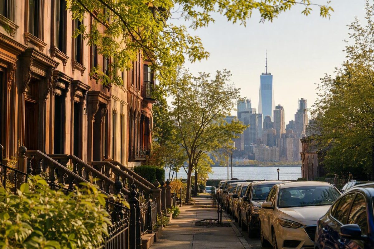
New York City becomes easier to understand once you stop treating it as one enormous, undifferentiated destination. Its large-scale map consists of five boroughs—Manhattan, Brooklyn, Queens, the Bronx, and Staten Island—and each borough contains many neighborhoods. Each borough also shares its boundaries with a New York State county, although boroughs and counties are not useful substitutes for neighborhood names when planning a visit. New York City’s borough and neighborhood framework provides a useful starting point for those distinctions.
The city is experienced more locally, through places such as Midtown, Harlem, Williamsburg, Astoria, Mott Haven, and St. George. Their names can convey location, history, cultural identity, or atmosphere, but their edges are often informal. “Stay in Brooklyn” is therefore not precise enough to explain a commute, and “spend the afternoon Downtown” may mean different things to different people.
This guide is a visitor-oriented geographic primer rather than an official directory. It introduces representative neighborhoods in all five boroughs, with greater detail where the supplied visitor evidence is strongest, and then shows how to compare accommodation areas and group attractions into coherent days. It does not attempt to settle disputed borders or give every borough identical destination coverage where the available evidence does not support it.
Boroughs, neighborhoods, and community districts: what the names mean
New York City has five boroughs: Manhattan, Brooklyn, Queens, the Bronx, and Staten Island. A borough is a large administrative division containing many neighborhoods. Brooklyn is a borough; Williamsburg is a neighborhood within Brooklyn. Queens is a borough; Astoria is a neighborhood within Queens.
Neighborhoods work differently. Their names generally reflect some combination of local convention, history, cultural identity, geography, commerce, and real-estate usage. Their borders are not consistently official or fixed. One map may extend a neighborhood farther east or west than another, while residents may use a broader, narrower, or older name than a publisher does.
Some smaller areas are treated as neighborhoods in their own right by one source and as subdistricts of a larger neighborhood by another. Names may also overlap, expand, contract, or become more prominent over time. That flexibility is part of how neighborhood identity works; it does not mean the names are useless.
Community districts are a separate geography. New York City has 59 community districts, but they do not provide a one-to-one official map of neighborhoods. A district can contain several neighborhoods or parts of neighborhoods, and a neighborhood name can appear across district boundaries. The NYCdata borough and neighborhood reference places numerous neighborhood names within this broader community-district framework.
This is why there is no definitive answer to “How many neighborhoods are in New York City?” Any total depends on the counting method:
- Are smaller enclaves counted separately from the neighborhood around them?
- Are historical and alternate names separate entries?
- How should overlapping identities be handled?
- Does a commercial district count in the same way as a residential community?
- Which map controls when boundaries are disputed?
- What happens when local usage changes?
The directories below are consequently selective and visitor-oriented. They identify names that help explain borough geography, commonly discussed destinations, and possible accommodation areas. They are neither exhaustive nor officially bounded.
A practical hierarchy looks like this:
- New York City is the whole.
- Boroughs are its five large constituent divisions.
- Community districts are a separate official geography.
- Neighborhoods are generally informal places and identities within boroughs.
- Subdistricts and enclaves may sit within broader neighborhood identities.
Once those categories are kept separate, the map becomes much easier to use.
Manhattan neighborhoods: Downtown, Midtown, the Upper Sides, and northern Manhattan
Visitors often orient themselves in Manhattan through broad zones: Downtown, Midtown, the Upper East and West Sides, and northern Manhattan. These are useful directional ideas, not official neighborhood boundaries.
Some tourism guides place Downtown south of 14th Street and Midtown approximately between 14th and 59th Streets. Those dividing lines should be treated as conventions rather than settled borders, especially around Chelsea, Union Square, Flatiron, NoMad, and other central areas. One commercial neighborhood overview uses those approximate divisions while grouping several edge neighborhoods differently from other guides.
Lower Manhattan
At Manhattan’s southern end, the Financial District and Battery area provide a clear geographic anchor. Visitors encounter the harbor, ferry activity, Wall Street, the 9/11 Memorial area, civic buildings, and major transportation spaces.
Lower Manhattan is not a single neighborhood. Representative names include:
- Financial District
- Battery area and Battery Park City
- Tribeca
- Civic Center
- Chinatown
- Little Italy
- SoHo
- Lower East Side
Their exact edges can be drawn differently, but many can be combined into a downtown day without returning to Midtown between stops.
The Civic Center is helpful to recognize even if it is not where you spend a full day. City Hall, courthouses, and federal buildings help explain why the area between the Financial District, Chinatown, and the Brooklyn Bridge feels different from nearby retail and residential districts.
The Villages, Chelsea, Flatiron, and NoMad
North of Lower Manhattan’s core, several adjoining neighborhoods are often combined in visitor itineraries even though they should not be collapsed into one district.
Greenwich Village centers much of its visitor identity around Washington Square Park and the presence of New York University. Travel descriptions commonly associate it with cafés, theaters, jazz, brownstones, and LGBTQ+ history. These are useful editorial associations, not a promise that every block has the same atmosphere.
The East Village, on the other side of Broadway, has its own restaurant, nightlife, and residential patterns. Alphabet City is commonly treated as part of the East Village rather than as an equivalent, wholly separate district, illustrating how smaller identities can be nested within larger ones. That relationship is documented in the CityNeighborhoods Manhattan overview.
Chelsea lies farther north on the West Side. It is closely associated with galleries and much of the High Line, as well as restaurants, hotels, and nightlife. Its location can make it practical for walking among the Village, Meatpacking District, and central Manhattan. Noise, however, cannot be predicted from the word “Chelsea.” Conditions vary by block, building, room orientation, and night of the week.
Flatiron and NoMad are central neighborhood names that may be described as part of Midtown, Midtown South, or a separate band between Downtown and Midtown. Visitors do not need to resolve that classification. It is more useful to understand that they can link the Village and Chelsea with the Empire State Building area and destinations farther east.
Midtown
Midtown contains many places that dominate a first-time visitor’s mental map:
- Times Square
- Broadway’s Theater District
- Rockefeller Center
- Museum of Modern Art
- Bryant Park
- Grand Central Terminal
- Empire State Building
- Fifth Avenue
That concentration explains why Midtown is frequently recommended as a base. A short trip centered on Broadway, observation decks, major stores, and famous landmarks may involve less backtracking when the hotel is nearby. Grand Central and the broader area’s subway stations also provide multiple starting points for trips elsewhere.
The trade-off is that convenience can come with heavy pedestrian traffic, visitor-oriented businesses, street noise, and a sense of being surrounded by attractions rather than a slower residential rhythm. Those conditions are not uniform. Times Square, Midtown East, Midtown West, Murray Hill, Hell’s Kitchen, and the blocks around Bryant Park do not all function alike.
The useful question is therefore not merely “Should I stay in Midtown?” It is “Which part of Midtown, near which station, for which itinerary?”
The Upper East Side and Upper West Side
Central Park provides the clearest distinction between the Upper East Side and Upper West Side. Both offer park access, but they support different visitor priorities.
The Upper East Side is the natural reference point for Museum Mile, the stretch of Fifth Avenue associated with several museums. It can suit a trip that gives substantial time to art, Central Park, and Manhattan’s East Side. Hotel atmosphere, evening activity, and transit convenience still vary within the area.
The Upper West Side offers access to the western side of Central Park and proximity to the American Museum of Natural History. Travel writers often suggest it to families or visitors seeking a less intensely touristed base than Times Square. That does not establish that every block is quiet or that every route is convenient. It means the area is worth comparing when park and museum access matter more than being beside Broadway theaters.
Harlem and Washington Heights
Northern Manhattan should not disappear from the map once a guide reaches Central Park.
Harlem is central to African American history and culture in New York. It is commonly associated with jazz, brownstone streets, soul food, churches, cultural institutions, and the Apollo Theater. Those themes offer an entry point, not a complete description of a large and internally varied area.
Farther north, Washington Heights provides another major neighborhood identity. Visitors may also encounter Hamilton Heights, Morningside Heights, and Inwood while researching northern Manhattan. These names demonstrate why “Uptown” is too broad to function as a precise neighborhood label. A Manhattan tourism orientation identifies Harlem and Washington Heights as distinct parts of northern Manhattan.
Manhattan receives the greatest share of detail in many visitor guides, but it is only one borough. Neighborhood-level thinking becomes even more important beyond it.
Brooklyn neighborhoods: waterfront districts, brownstone areas, and destinations farther south
Brooklyn is a borough containing many distinct neighborhoods, not one large alternative neighborhood to Manhattan. Deciding to visit or stay in Brooklyn says very little until the location is narrowed down.
A selective Brooklyn orientation includes:
- Williamsburg
- Greenpoint
- DUMBO
- Brooklyn Heights
- Downtown Brooklyn
- Fort Greene
- Park Slope
- Prospect Heights
- Cobble Hill
- Carroll Gardens
- Bushwick
- Bedford-Stuyvesant
- Crown Heights
- Bay Ridge
- Coney Island
The list is representative rather than comprehensive. It deliberately extends beyond the northern and waterfront neighborhoods that dominate many accommodation guides.
DUMBO, Brooklyn Heights, and Downtown Brooklyn
DUMBO stands for Down Under the Manhattan Bridge Overpass. The neighborhood is closely associated with the Brooklyn waterfront visitor area, including Brooklyn Bridge Park, Jane’s Carousel, views toward Manhattan, and access to the Brooklyn Bridge. These associations and the acronym expansion appear in a visitor accommodation guide covering DUMBO and nearby Brooklyn districts.
DUMBO, Brooklyn Heights, and Downtown Brooklyn can all function as visitor bases, but they are not interchangeable. The exact hotel and nearest station determine which routes are genuinely convenient. A property described as “near the Brooklyn Bridge” may be close to the waterfront but less useful for a particular subway trip. A Downtown Brooklyn hotel may have several stations nearby while placing the visitor in a busier commercial environment than expected.
Brownstone Brooklyn and Prospect Park
It is not an official district.
Park Slope is frequently discussed in connection with Prospect Park, making it a plausible option for visitors prioritizing the park or nearby Brooklyn destinations. It should not be declared universally best for families. A family’s decision may depend on room configuration, station accessibility, stroller routes, evening plans, and how often the itinerary returns to Manhattan.
Prospect Heights also provides orientation toward Prospect Park and nearby cultural destinations, while Crown Heights extends the visitor’s map farther east. Cobble Hill and Carroll Gardens are recognizable names south of Downtown Brooklyn, each with its own local identity and commercial streets.
Williamsburg, Greenpoint, Bushwick, and Bedford-Stuyvesant
Williamsburg is commonly recommended to repeat visitors interested in restaurants, nightlife, and spending more time within a neighborhood rather than moving continuously among Manhattan landmarks. It can work well when the itinerary includes northern Brooklyn or destinations reached conveniently from the hotel’s nearest train.
The trade-off is that many classic Manhattan sightseeing plans require another river crossing, transfers, or a longer door-to-door journey. That does not make Williamsburg impractical; it makes its practicality conditional.
Station access, walking distance, and suitability for a particular itinerary can vary considerably within each area.
There is no dependable citywide rule that Brooklyn accommodation will always cost less than Manhattan accommodation. Rates vary by date, demand, room type, taxes, cancellation terms, and precise location. Compare current offers rather than treating a borough name as a price category.
Bay Ridge and Coney Island
Bay Ridge and Coney Island demonstrate how far Brooklyn extends beyond the neighborhoods closest to Lower Manhattan.
Their inclusion matters even if a short-stay visitor uses neither as a base. Travel coverage can create the false impression that Brooklyn ends around Williamsburg, DUMBO, or Park Slope. The borough continues much farther south and east, with many communities omitted from a visitor-oriented shortlist.
Queens neighborhoods: close-in bases, cultural districts, airports, and the Rockaways
Queens is another borough of many neighborhoods, not simply the territory between Manhattan and the airports. A representative introductory directory includes:
- Long Island City
- Astoria
- Jackson Heights
- Flushing
- Forest Hills
- Jamaica
- Rockaway Beach
These examples are useful points of orientation, not a complete inventory.
Long Island City and Astoria
Long Island City and Astoria are frequently discussed as alternatives to Manhattan accommodation. Both can work, but neither name supplies enough information to make a booking decision.
For Long Island City, check the hotel’s exact station, the routes serving it, the amount of walking required, and whether those routes align with your plans. A short segment on a subway map is not the same as a short hotel-to-attraction journey. Waiting, station entrances, transfers, service changes, and the final walk all count.
Astoria requires the same analysis. A stay may suit someone planning substantial time in Queens or someone whose Manhattan destinations align with the nearby service. It may be less efficient for an itinerary concentrated in areas that require repeated transfers or indirect journeys.
Claims about value are unsettled. Some commercial travel guides portray Long Island City or Astoria as lower-cost alternatives, while contributors in a user-generated Tripadvisor discussion about sightseeing bases dispute whether Long Island City remains reliably inexpensive. Neither source provides a current, systematic comparison of equivalent rooms.
Do not resolve that disagreement from reputation alone. Compare actual rates for the same dates, room requirements, taxes, and cancellation terms.
Jackson Heights, Flushing, Forest Hills, and Jamaica
Jackson Heights, Flushing, and Astoria appear prominently in citywide and tourism-oriented neighborhood lists. They are useful names to recognize when researching Queens or considering time beyond Manhattan. Their prominence should not be converted into unsupported superlatives about which is best for food, diversity, or value.
Jamaica is both a neighborhood name and an important transportation reference. Its relationship to JFK can make it relevant to airport logistics, but that does not automatically make it a practical base for a Manhattan-heavy sightseeing trip.
Airports and Rockaway Beach
Both John F. Kennedy International Airport and LaGuardia Airport are in Queens, a fact reflected in visitor guidance that treats airport-area lodging primarily as a flight-related choice rather than a general sightseeing strategy. The same accommodation guide distinguishes airport logistics from neighborhood-based sightseeing.
An airport-area hotel may be sensible when an arrival, departure, or overnight connection dominates the decision. A first-time visitor spending most days in Manhattan should compare the complete airport-hotel-to-attraction journey rather than focusing only on the room rate.
Rockaway Beach belongs in a basic Queens orientation because it demonstrates the borough’s geographic range. Queens extends far beyond the close-in areas marketed as quick alternatives to Midtown.
The central rule for Queens is simple: calculate door to door. Begin at the hotel entrance, identify the actual station and route, account for transfers and walking, and map the journey to the places that matter most to you.
Bronx neighborhoods: a citywide guide should not stop at Manhattan
The Bronx is one of New York City’s five boroughs and deserves more than a passing mention. Accommodation-focused articles often name it without offering meaningful internal geography, leaving visitors with the mistaken impression that the borough is one undifferentiated place.
A representative Bronx directory includes:
- Riverdale
- North Riverdale
- Kingsbridge
- Fordham
- Belmont
- Mott Haven
- Melrose
- Hunts Point
- City Island
- Morris Park
- Co-op City
- the Concourse
These documented neighborhood names demonstrate internal variety but do not establish official borders, visitor rankings, or a complete inventory. The same borough-wide references also show why a neighborhood directory and a community-district map are not interchangeable.
They occupy different positions and relate differently to Manhattan and the rest of the Bronx. Between and beyond them are neighborhoods with their own commercial centers, residential patterns, destinations, and transit arrangements.
City Island further demonstrates why the borough cannot be reduced to a single urban image.
“The South Bronx” can be useful as a broad regional expression, but it should not be presented as one precisely bounded neighborhood. Nor should it be used to support borough-wide judgments about convenience, character, or safety.
For visitors, the practical question is always “convenient for what?” A location may be well placed for a Bronx-centered itinerary and poorly placed for repeated returns from Lower Manhattan. Another property may produce a different result. Compare the exact destination, station, transfers, walking distance, and current service conditions.
This section is intentionally a geographic orientation rather than a full destination ranking. Limited coverage in accommodation guides reflects their narrow focus on where a short-stay, Manhattan-oriented visitor might sleep; it does not establish that the Bronx has little to offer.
Staten Island neighborhoods: from St. George to the South Shore
Staten Island is one of the five boroughs and should not appear merely as a blank area beside a ferry route. Its neighborhood geography extends from the North Shore to the South Shore.
A selective orientation includes:
- St. George
- New Brighton
- Tompkinsville
- Clifton
- Stapleton
- Dongan Hills
- New Dorp
- Great Kills
- Eltingville
- Tottenville
This is not an official or comprehensive list, and the order should not be read as defining exact borders.
Nearby names such as New Brighton, Tompkinsville, Stapleton, and Clifton show that the North Shore consists of multiple neighborhoods rather than a single ferry district.
Tottenville works as a southern anchor, but it should not be treated as though a sharp, universally agreed line separates it from every adjoining community.
Travel between Staten Island and many major tourist areas commonly involves the ferry plus additional walking or transit connections. The ferry is therefore only one segment of the complete journey, as a visitor logistics guide notes when discussing Staten Island travel.
Staten Island’s practicality depends on the itinerary. A location may make sense for a borough-focused visit, a particular event, or plans centered near the ferry. The same location may add substantial travel to a short trip dominated by Midtown, Upper Manhattan, or Brooklyn attractions.
As with the Bronx section, this is a geographic primer rather than a claim that every listed neighborhood is a visitor base or destination of equal relevance.
Where to stay: match the neighborhood to the trip rather than chasing a universal winner
There is no universally best New York neighborhood for accommodation. The practical choice depends on your planned sights, trip length, preferred street environment, tolerance for evening activity, and the transit connection near the actual property.
Midtown is commonly recommended to first-time visitors and people taking short trips because many prominent attractions and transportation connections are nearby. That recommendation is a useful default, not an objective verdict. Travel writers who favor Midtown also acknowledge its crowds, visitor concentration, noise, and potentially high room rates; other central areas may suit travelers who place greater weight on neighborhood atmosphere. One such first-time visitor accommodation guide frames Midtown as convenient while treating its drawbacks as part of the choice.
Use this comparison as a shortlist, not a ranking:
| Area | Nearby visitor priorities | General atmosphere, with qualifications | Likely trade-offs | What to verify before booking |
|---|---|---|---|---|
| Midtown | Broadway, Times Square, Rockefeller Center, Bryant Park, Grand Central, Empire State Building, Museum of Modern Art | Fast-paced and highly visitor-oriented in many sections; east, west, and central blocks differ | Crowds, street noise, tourist concentration; rates may be high on particular dates | Exact station and routes, theater walking distance, recent noise comments, room orientation, current total rate |
| Lower Manhattan | Financial District, Battery, 9/11 Memorial area, ferries, Civic Center, Chinatown, downtown museums, access toward Brooklyn | A mixture of office, civic, waterfront, historic, and residential environments | Farther from some Midtown and Upper Manhattan priorities; evening activity varies by location | Weekend service, late-evening options near the hotel, ferry or subway access, route to Midtown |
| Greenwich Village and Chelsea | Washington Square Park, restaurants, jazz and theater, galleries, High Line, nightlife | Often characterized as more neighborhood-oriented than Times Square, but nightlife blocks can be busy | Block-level noise, limited large-hotel supply in some sections, rates requiring current comparison | Nearest useful subway route, late-night activity, room position, walking distance to priorities |
| Upper West Side | Central Park, American Museum of Natural History, Lincoln Square, western Manhattan | Commonly described as more residential and less intensely touristed than Midtown; not uniformly quiet | Longer journeys to Lower Manhattan or parts of Brooklyn; less useful for some East Side plans | Station accessibility, local versus express service, cross-park plans, evening return route |
| Upper East Side | Museum Mile, Central Park, East Side museums | Frequently presented as polished or residential, although those are broad editorial descriptions | Some properties are farther from the most useful station; nightlife preferences are subjective | Exact avenue, station distance, museum schedules, route to Broadway or downtown |
| Williamsburg and Downtown Brooklyn | Brooklyn dining and nightlife, DUMBO, waterfront areas, access toward Lower Manhattan | Williamsburg is often framed as a neighborhood-atmosphere choice; Downtown Brooklyn is more commercial | Additional commuting for many Manhattan sights; route quality depends on the property | Exact line, weekend service, river-crossing route, final walk, current total rate |
| Long Island City or Astoria | Queens exploration and selected routes into Manhattan | Often marketed as Manhattan alternatives, but experience and convenience vary by block and station | Savings are not guaranteed; complete trips may be longer than advertised train segments | Current rate and taxes, exact station, transfer pattern, route alternatives, weekend and late-evening service |
Match the base to the center of gravity
Begin by identifying the center of gravity in your itinerary.
If Broadway, Times Square, Rockefeller Center, and the Empire State Building dominate, Midtown is an obvious candidate. If the Financial District, Battery, ferries, Chinatown, the 9/11 Memorial area, and Brooklyn’s waterfront dominate, Lower Manhattan may produce a more coherent base.
For museums and Central Park, compare the two Upper Sides rather than treating them as equivalents. Give more weight to the Upper East Side when Museum Mile and East Side destinations dominate. Consider the Upper West Side when the American Museum of Natural History and western park access fit better.
For galleries, the High Line, restaurants, and nightlife, compare Chelsea with Greenwich Village and adjacent areas. Do not rely on a broad claim that one neighborhood is quiet and another lively. Inspect the property’s immediate surroundings, recent comments about noise, and the room’s position in the building. Travel writers commonly associate Greenwich Village with cafés, jazz, theaters, and LGBTQ+ history, and Chelsea with galleries, nightlife, and the High Line, while emphasizing property-level variation in their neighborhood advice.
Williamsburg can reward a repeat visitor who wants evenings and meals close to the hotel rather than treating Brooklyn only as a day trip. Downtown Brooklyn may be more practical for someone prioritizing access toward DUMBO and Lower Manhattan. Long Island City and Astoria can work when the exact routes support the itinerary. None should be selected merely because it lies outside Manhattan.
Analyze the hotel, not just the label
A neighborhood label is too broad to serve as transit analysis. Once you have narrowed the map:
- Plot the attractions and events you consider essential.
- Identify two or three areas that appear to limit repeated long crossings.
- Locate actual hotels within those areas.
- Check the nearest station entrance, not only the station name.
- Confirm which routes serve it and whether your main trips require transfers.
- Include the walk at both ends of every journey.
- Review current service conditions for the days and times you expect to travel.
- Check accessibility details if stairs, elevators, or long station corridors matter.
Consider two hypothetical Midtown properties: one near Grand Central and another near Times Square. Both may accurately advertise a Midtown location, yet they do not offer identical station access or the same walk to a Broadway theater. The broad neighborhood helps create the shortlist; the property and station determine how the itinerary actually works.
A hotel on the less convenient edge of a desirable neighborhood may be harder to use than one just outside it but beside a route aligned with your plans. Conversely, a station that appears ideal on a schematic map may involve an inconvenient entrance, transfer, or final walk.
Do not choose from room price alone, but do not assume that the most central room justifies any premium either. Compare current total costs with what the location adds or removes from the day. Avoid neighborhood-wide safety rankings, blanket noise labels, and undated lists of “cheap areas.” Those judgments are too broad or unstable to replace current property-level research.
Turn neighborhood knowledge into walkable New York days
Neighborhoods are not only a way to choose a hotel. They provide a framework for building days that feel geographically coherent.
Instead of selecting unrelated attractions from several boroughs and forcing them into one schedule, group priorities within adjoining neighborhoods. This is a planning heuristic, not a guarantee of shorter travel or a better trip. Opening hours, reservations, weather, mobility, service changes, and personal pace can all alter the result.
A Lower Manhattan day
A simple Lower Manhattan structure begins near the harbor or Battery and continues through the Financial District. From there, choose the memorial area, civic spaces, or both according to your interests. Add one deliberate eastward move toward the Seaport or East River rather than shuttling repeatedly between the two sides of downtown.
Finish around Chinatown or the nearby East River area. This creates a broad south-to-north or south-to-northeast progression through adjoining districts while leaving room to notice the transition from waterfront and financial streets to civic spaces and denser neighborhood blocks.
This structure is adapted from New York Know’s walking-first Lower Manhattan route, which recommends a harbor start, a gradual movement through financial and civic areas, and a finish around Chinatown or the East River. Treat the sequence as a template rather than a fixed itinerary.
A Midtown cluster
A Midtown day might draw from Broadway, Times Square, Rockefeller Center, Bryant Park, Grand Central, and the Empire State Building. That does not mean attempting every attraction at once.
Choose an anchor. A Broadway performance can determine the evening, with Times Square and Rockefeller Center arranged around it. Grand Central and Bryant Park can form another compact pairing. The Empire State Building may fit more naturally into a route arriving from Flatiron or NoMad than one focused on the western Theater District.
The objective is not maximum landmark density. It is a sequence that avoids crossing Midtown back and forth without a clear reason.
An Upper Side museum-and-park day
For a museum-and-park day, build around one side of Central Park.
On the east, combine the Upper East Side, Museum Mile, and a section of the park that fits the day’s entrance and exit points. On the west, organize the day around the Upper West Side, the American Museum of Natural History, and nearby park access.
Crossing Central Park can be enjoyable and may be part of the plan. Repeatedly zigzagging across it because attractions were scheduled without regard to geography is different. Decide whether the museum or park is the main anchor, then choose supporting stops on the same side where practical.
A Brooklyn waterfront cluster
DUMBO, Brooklyn Bridge Park, Brooklyn Heights, and Downtown Brooklyn form a natural visitor cluster. Depending on your starting point, you might arrive in Downtown Brooklyn and walk toward the waterfront, or cross the Brooklyn Bridge and continue through DUMBO before moving toward Brooklyn Heights.
The order should account for opening hours, weather, bridge conditions, mobility, and the return route. A sunset preference may reverse an otherwise logical sequence. What matters is that the areas adjoin one another and can form a connected waterfront day.
Before finalizing any neighborhood-based itinerary, verify:
- Current transit service and planned disruptions
- Actual walking distance rather than straight-line distance
- Attraction hours and timed-entry requirements
- Station and venue accessibility
- Weather exposure and places to pause
- The route from the final stop back to the hotel
New York Know describes its editorial approach as choosing a practical base, grouping sights by area, and building days that make sense on foot. That area-based planning philosophy cannot guarantee a particular travel time or experience, but it offers a clearer organizing method than treating the city as an unconnected checklist.
Frequently asked questions
How many neighborhoods are there in New York City?
There is no definitive official total. Any count changes depending on whether it includes nested subdistricts, alternative and historical names, commercial districts, disputed areas, and neighborhoods that overlap other boundaries.
A precise total would create false certainty. It is more accurate to say that New York has many neighborhoods distributed among five boroughs, with names and borders that can differ by source and local convention.
Are New York City neighborhood boundaries official?
Generally, no. Neighborhood names and boundaries are usually informal and may vary among maps, publishers, residents, historical accounts, and real-estate usage.
Official geographic systems exist, including borough and community-district boundaries, but they do not create a one-to-one official neighborhood map. One community district can contain several neighborhoods or portions of them, while a neighborhood identity may cross a district boundary.
What is the difference between a borough and a neighborhood in New York?
A borough is one of New York City’s five large administrative divisions: Manhattan, Brooklyn, Queens, the Bronx, or Staten Island. A neighborhood is a smaller, generally informal place within a borough.
Brooklyn is a borough; Williamsburg is a neighborhood in Brooklyn. Queens is a borough; Astoria is a neighborhood in Queens. Borough boundaries are fixed, while neighborhood boundaries are often approximate or disputed.
Which neighborhood is commonly recommended for a first New York trip?
Midtown is commonly recommended because Broadway, Times Square, Rockefeller Center, Bryant Park, Grand Central, the Empire State Building, and numerous transit connections are within or near the broader area.
It is not automatically the right choice. Lower Manhattan may suit a downtown-focused trip, while the Upper West Side, Upper East Side, Chelsea, or Greenwich Village may better match particular museum, park, dining, or atmosphere priorities. The practical answer depends on the itinerary and exact hotel location.
Is it better to choose a hotel by neighborhood or by subway station?
Use both, but make the final decision at the property-and-station level. The neighborhood helps identify a broad area with suitable attractions and a preferred general environment. The exact station shows whether the hotel supports your itinerary.
Map your priorities first, shortlist appropriate neighborhoods, and then compare properties by station entrance, routes, transfers, walking distance, accessibility, and current service conditions. A useful station near the edge of one neighborhood may be more practical than an inconvenient station in the center of a more famous one.
The five boroughs provide New York’s large-scale map, but informal neighborhoods provide much of its day-to-day texture. Learn representative names, accept that many boundaries are approximate, and use neighborhood labels as orientation tools rather than rigid definitions. Then map your own priorities and choose an exact hotel, station, and daily route that support the trip you actually intend to take.