 New York Know
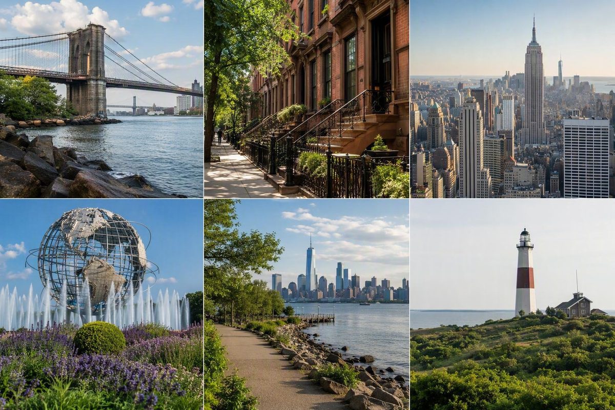
New York City’s five boroughs are the Bronx, Brooklyn, Manhattan, Queens, and Staten Island. Each is a major geographic and administrative division containing many neighborhoods. Boroughs help you understand the city map, but they are usually too large to work as day-by-day itineraries.
That distinction matters. “Spend Tuesday in Brooklyn” could mean walking the Brooklyn Bridge waterfront, visiting museums and gardens around Prospect Park, or making Coney Island the day’s destination. Those are three substantially different outings. The same principle applies throughout New York: learn the borough first, then plan around a specific neighborhood or cluster of nearby places.
The five NYC boroughs at a glance
Each borough corresponds to a New York State county, although three use a different county name. Brooklyn is Kings County, Manhattan is New York County, and Staten Island is Richmond County. The Bronx and Queens share names with their counties. NYC311 lists the official borough-to-county mapping.
| Borough | Corresponding county | Broad geographic position | Stable superlative | Representative neighborhoods or places | Useful visitor connections |
|---|---|---|---|---|---|
| The Bronx | Bronx County | North of Manhattan; directly connected to the New York State mainland | Northernmost borough | Yankee Stadium, Arthur Avenue, Bronx Zoo, New York Botanical Garden | Subway or bus from Manhattan; organize the day around one Bronx anchor |
| Brooklyn | Kings County | South and east of Manhattan, on western Long Island | Most populous borough | Brooklyn Heights, Brooklyn Bridge Park, Prospect Park, Brooklyn Museum, Coney Island | Subway, bus, ferry, or a walk across the Brooklyn Bridge, depending on the destination |
| Manhattan | New York County | Between the Hudson and East Rivers, with Lower Manhattan at the southern end | Smallest and most densely populated borough | Lower Manhattan, Midtown, Harlem, Central Park, Broadway, Wall Street | Extensive subway and bus connections; many compact areas reward walking |
| Queens | Queens County | East of Manhattan and north and east of Brooklyn, on western Long Island | Largest borough by land area | Long Island City, Astoria, Flushing, Jamaica, the Rockaways, Flushing Meadows Corona Park | Subway, bus, and ferry options vary by area; JFK and LaGuardia airports are here |
| Staten Island | Richmond County | Across New York Harbor, southwest of Manhattan and west of Brooklyn | Least populous and southernmost borough | St. George, Historic Richmond Town, Alice Austen House, Freshkills Park | Staten Island Ferry from Manhattan, followed by local transportation where needed |
These comparisons use stable rankings rather than exact population totals from mixed reference years. Queens is the largest borough by land area, Brooklyn the most populous, Manhattan the smallest and most densely populated, and Staten Island the least populous. The Bronx is the only borough directly connected to the New York State mainland. These geographic comparisons are documented in the New York Metropolitan Transportation Council’s borough overview.
The table is an orientation tool, not a ranking. It does not identify a “best” borough, and the examples are not comprehensive inventories. The right choice depends on your interests, available time, accommodation location, walking tolerance, and the specific neighborhoods involved.
Borough, county, neighborhood: how New York’s geography works
A borough is a major administrative division of New York City. Neighborhoods help people describe where they live, work, eat, or spend time, but they are not additional boroughs.
For example:
- Harlem is a neighborhood in upper Manhattan.
- Long Island City and Flushing are in Queens.
- Coney Island is a Brooklyn neighborhood and destination.
- Brooklyn, Queens, and Manhattan are boroughs, not neighborhoods.
Each borough is coextensive with a New York State county: the borough and county cover the same geographic territory, even when their names differ. Borough authority is subordinate to New York City government, and the five boroughs are not independent cities or autonomous municipal governments. The borough-county relationships and consolidation within one municipal government are summarized in this overview of New York City’s borough structure.
Brooklyn’s former status as an independent city remains historically important, but it does not describe Brooklyn’s present position.
Why Brooklyn and Queens are on Long Island
Brooklyn and Queens occupy the western portion of geographic Long Island. Nassau and Suffolk counties lie east of Queens and outside New York City.
Everyday language creates confusion here. People commonly use “Long Island” to mean Nassau and Suffolk rather than Brooklyn and Queens. Geographically, however, Brooklyn and Queens are on the island. Saying “I’m going from Queens to Long Island” therefore makes sense colloquially—usually meaning a trip from Queens into Nassau or Suffolk—even though the traveler starts on the same physical island.
Long Island City adds another potential misunderstanding. It is a neighborhood in Queens, not a separate city today, another borough, or a synonym for the whole island.
The mainland and the “outer boroughs”
The Bronx is the only borough directly connected to the New York State mainland. Manhattan and Staten Island are islands, while Brooklyn and Queens share the western portion of Long Island.
The term outer boroughs generally means Brooklyn, Queens, the Bronx, and Staten Island: the four boroughs other than Manhattan. It is convenient shorthand, not a governmental category, and it can flatten enormous differences. Downtown Brooklyn and the Rockaways, for example, are both in the outer boroughs but have very different geography, transportation patterns, and reasons to visit.
New York City has five official boroughs, not six. “Sixth borough” is an informal label sometimes applied to nearby places or communities with strong New York connections.
How five boroughs became one New York City
The modern five-borough city emerged through consolidation. Before that change, the places now grouped within New York City had different municipal and county arrangements, and Brooklyn had been an independent city.
A short timeline explains the present structure:
- 1898: The consolidation creating modern New York City took effect. Manhattan, Brooklyn, the Bronx, Queens, and Staten Island were brought within one municipal government, and Brooklyn ceased to be an independent city. The borough history records the 1898 consolidation.
- 1899: The eastern portion of the former Queens County became Nassau County. The western portion remained within New York City as the Borough and County of Queens. The same borough history documents the 1899 county change.
- 1914: Bronx County was created after the Bronx had previously been associated with New York County.
- 1975: The Borough of Richmond was renamed the Borough of Staten Island, while the corresponding county retained the name Richmond County.
These dates explain why borough and county names can look inconsistent. “Staten Island, Richmond County” is not an error: it reflects the borough’s later name change without a corresponding county renaming. Brooklyn’s county remains Kings County, and Manhattan’s remains New York County.
The timeline also prevents another misunderstanding. Consolidation did not leave five separate municipalities loosely joined in a federation. The boroughs became parts of one city government. Their distinct histories remain visible in place names, street patterns, architecture, and local identity, but they are not autonomous cities today.
Manhattan: famous sights within very different neighborhoods
Manhattan corresponds to New York County. It is the smallest and most densely populated borough, but those facts do not make it a single, uniform visitor experience.
Representative landmarks include Central Park, Broadway, Times Square, the Empire State Building, Wall Street, and the 9/11 memorial area. They can anchor a trip, but they sit in districts with different street patterns, walking rhythms, and nearby attractions.
Consider the range within Manhattan:
- Lower Manhattan includes the harbor-facing southern tip, the Financial District, civic areas, and the World Trade Center district.
- Midtown contains Times Square, much of the Broadway theater district, the Empire State Building area, and major commercial corridors.
- The Upper East Side supports a different kind of day built around museums, residential streets, and the eastern side of Central Park.
- Greenwich Village rewards exploration through smaller streets, squares, and adjacent downtown areas.
- Harlem is in upper Manhattan, not a separate borough.
- Washington Heights and Inwood sit farther north and should not be treated as casual additions to a tightly scheduled Lower Manhattan day.
Calling all of this “Manhattan” is geographically correct but practically unhelpful. A one-day plan that jumps from Wall Street to Central Park, Greenwich Village, Times Square, and Inwood may connect famous names, but it sacrifices neighborhood continuity and consumes substantial time in transit.
A walking-first Lower Manhattan example
Lower Manhattan shows how directional planning can turn scattered map pins into a coherent day.
Choose a starting point near the harbor. From there, move through the Financial District toward civic or memorial spaces, noticing how the street pattern and public spaces change. Finish in a neighboring area to the north or east instead of repeatedly returning to the southern tip. The aim is not to prescribe every turn but to give the day a clear geographic flow. A detailed walking-first Lower Manhattan itinerary can help with the street-level sequence.
Midtown requires a different structure. Broadway, Times Square, and the Empire State Building can fit into a Midtown-focused day, but adding Central Park depends on your attraction schedule and desired walking distance. The Upper East Side works better when organized around the park and museums than when squeezed between downtown appointments.
Manhattan may contain many familiar first-trip landmarks, but it is not automatically the right base for every traveler. Nor is every part equally busy, expensive, or convenient. Choose a neighborhood by the journeys you expect to make, not by the borough name alone.
Brooklyn: waterfronts, parks, and neighborhood-scale days
Brooklyn is Kings County, New York City’s most populous borough, and part of geographic Long Island. It remained an independent city until the 1898 consolidation.
Its scale makes borough-wide labels particularly unreliable. Brooklyn includes waterfront districts, major parks, commercial centers, beaches, museum areas, industrial landscapes, and many residential neighborhoods. Calling the entire borough “trendy,” “residential,” or “more affordable than Manhattan” replaces useful planning with stereotype.
For visitors, it helps to distinguish at least three kinds of Brooklyn day.
The Brooklyn Bridge waterfront cluster
The Brooklyn Bridge, Brooklyn Bridge Park, and Brooklyn Heights form a logical geographic group. Depending on your direction and energy, you can cross the bridge on foot and continue along the waterfront, or arrive in Brooklyn by transit and make the bridge the beginning or end of the route.
This area rewards a walking pace. Its appeal lies not only in individual viewpoints but in the transitions among bridge approaches, park spaces, waterfront edges, and neighborhood streets.
It can fill a substantial part of a day without distant additions. If you include the bridge crossing, treat it as both an attraction and a transportation segment: its distance and time count toward the day’s walking total.
The Prospect Park cultural cluster
Prospect Park, the Brooklyn Museum, and nearby garden or cultural destinations form a separate cluster. The area can support a slower day organized around one major institution, time outdoors, and nearby meals or neighborhood walking.
You can combine the two clusters in a long day by using transit between them, but they do not make one short continuous walk. Trying to fit every famous Brooklyn stop into one outing can leave little time for the places themselves.
Coney Island as a destination
Coney Island illustrates the difference between a borough and a neighborhood. It is in Brooklyn, but “visiting Brooklyn” does not necessarily mean visiting Coney Island, and a Coney Island outing does not offer a comprehensive picture of Brooklyn.
It may be the main purpose of a Brooklyn day, but it should not be added casually just because it shares the borough name.
A published one-day Brooklyn plan demonstrates that the waterfront and Prospect Park attractions can be combined, but it also exposes the tradeoff: more coverage requires more movement and leaves less time at each stop. The itinerary explicitly acknowledges that a day barely introduces a borough of this size, making it evidence of possibility rather than sufficiency.
Queens: the largest borough by area and New York’s aviation gateway
Queens is Queens County, the city’s largest borough by land area, and part of geographic Long Island. Both John F. Kennedy International Airport and LaGuardia Airport are in Queens, so many visitors pass through the borough before deliberately exploring it. The airport locations and land-area distinction are summarized in Choose NYC’s borough overview.
Queens is not one compact sightseeing district. Long Island City, Astoria, Flushing, Jamaica, the Rockaways, and Flushing Meadows Corona Park occupy different parts of the borough and call for different routes.
- Long Island City is in western Queens, across the East River from Manhattan. Despite its name, it is a Queens neighborhood.
- Astoria offers another western Queens base for a neighborhood-focused outing.
- Flushing contains Queens’ Chinatown and can anchor a food- and neighborhood-oriented day.
- Flushing Meadows Corona Park is associated with World’s Fair remnants and the Unisphere.
- Jamaica is a major Queens area with commercial and transportation roles.
- The Rockaways offer a coastal experience far removed from the compact streets of Long Island City.
These examples are illustrative, not comprehensive. Queens has strong international and cultural associations visible in its communities, food, arts, and public spaces. That does not require an unsupported claim that it is definitively the most diverse place in the city or the world.
The practical lesson is to select a particular part of Queens. “A day in Queens” could mean Long Island City and Astoria, Flushing and Flushing Meadows Corona Park, or a Rockaways outing. Those are not interchangeable plans and should not be combined merely because they share a borough.
Keep three meanings separate:
- Long Island City is a neighborhood in Queens.
- Long Island is the physical island containing Brooklyn, Queens, Nassau County, and Suffolk County.
- In everyday regional speech, Long Island often means Nassau and Suffolk counties specifically.
Understanding which meaning is intended prevents common planning errors.
The Bronx: mainland geography, cultural history, and major green spaces
The Bronx is Bronx County, New York City’s northernmost borough, and the only borough directly connected to the New York State mainland.
Representative destinations include Yankee Stadium, the Bronx Zoo, the New York Botanical Garden, and Arthur Avenue. The borough is also associated with the origins of hip-hop. NYC’s official five-borough tourism overview places these cultural and visitor themes within a city made up of many distinct communities.
Green space is central to many Bronx visits. The zoo and botanical garden are major destinations, while parks and neighborhood landscapes complicate any image of the borough as uniformly dense or built-up. Older planning reports contain parkland percentages, but those historical figures should not be presented as current measurements. The durable point is that substantial parks and outdoor institutions shape the borough’s geography.
Build the day around one Bronx anchor
A workable visitor day generally begins with one geographic anchor:
- Make the New York Botanical Garden the primary destination, then add nearby stops that suit your schedule.
- Center the outing on Arthur Avenue and leave time for the surrounding area instead of treating a meal as a hurried side trip.
- Plan around Yankee Stadium when attending an event, allowing realistic time before and after it.
- Treat the Bronx Zoo as a major activity rather than one item in a chain of distant attractions.
This is more useful than inserting “the Bronx” between unrelated Manhattan sights. A rushed stop may let you say you entered the borough, but it reveals little about its scale or neighborhood variety.
The Bronx contains distinct communities with different street patterns, histories, commercial areas, and visitor experiences. No single attraction or lifestyle label can represent the borough. Commercial claims that it is categorically New York’s cheapest borough are also unsuitable as general visitor guidance; housing comparisons depend on neighborhood, property type, date, and methodology.
Staten Island: ferry arrival, historic places, and a different urban scale
Staten Island corresponds to Richmond County. It is New York City’s southernmost and least populous borough.
Its names preserve an unusual part of city history. The borough was called the Borough of Richmond until 1975, when it became the Borough of Staten Island; the county retained the name Richmond County.
Representative places include:
- The Staten Island Ferry
- St. George
- Historic Richmond Town
- The Alice Austen House
- Freshkills Park
The Staten Island Ferry connects Manhattan and Staten Island and is described as free in the supplied visitor guidance. Because fares and operations can change, confirm current information with the operator before travel. The ferry can be part of the experience rather than merely transportation, but the crossing is not the same as seeing the borough. Arrival at St. George provides an entry point, not a comprehensive view of destinations farther away.
Commercial guides often use words such as “suburban,” “quiet,” or “residential” to describe Staten Island. Those may reflect impressions of some areas, but they do not apply uniformly. The borough includes varied landscapes and communities, and its visitor destinations are not all concentrated near the ferry terminal.
If you want more than the crossing, choose a purpose. A short outing might focus on St. George and its immediate surroundings. A longer visit could center on a historic or cultural site, with onward transportation planned before departure. Freshkills Park represents another kind of destination and should not be assumed to fit into a casual terminal-area walk.
A multi-day educational itinerary combines the ferry, St. George, and Freshkills Park within a broader five-borough trip. It also warns that schedules and logistics can change and that broad city itineraries can require extensive walking and stair use. Road Scholar’s five-borough itinerary is therefore more useful as a scale check than as a permanent operating guide.
Do not rely on a static article for current ferry frequency, local transportation schedules, fares, attraction access, or accessibility arrangements. Verify those details shortly before travel.
How to choose and explore NYC boroughs without turning the trip into a commute
The most useful question is not “Which borough is best?” It is “Which specific area fits what I want to do, where I am staying, and how much movement I want in one day?”
Start with five variables:
- Interests: architecture, museums, food, parks, beaches, sports, nightlife, history, or waterfronts.
- Accommodation location: a compact plan near your base may be more rewarding than a supposedly essential sight requiring several transfers.
- Available days: a short first trip calls for different choices from a longer return visit.
- Walking tolerance: count bridge crossings, museum time, station corridors, stairs, and standing—not only the distance shown on a walking map.
- Neighborhood geography: identify what naturally clusters before deciding which borough name belongs on the day.
Visitors can explore the five boroughs without renting a car by combining walking with subways, buses, and ferries. That does not mean every journey is direct. The relevant mode and connection depend on the particular starting point and destination.
Planning model 1: A short first trip
For a short visit, choose a few compact areas rather than trying to collect all five boroughs.
A workable outline might include:
- One Lower Manhattan day with a clear geographic direction.
- One Midtown and Central Park day adjusted around timed reservations.
- One outer-borough cluster, such as the Brooklyn Bridge waterfront, a Prospect Park cultural day, Long Island City and Astoria, or Flushing and Flushing Meadows Corona Park.
This model creates contrast without turning the trip into constant transit. It also leaves room for meals, weather delays, rest, and unscheduled discoveries.
Planning model 2: A longer trip with neighborhood depth
With more days, add one or two outer-borough neighborhood days based on your interests.
For example:
- Pair a Manhattan-focused first half with separate Brooklyn and Queens days.
- Add a Bronx day anchored by the botanical garden, zoo, Arthur Avenue, or an event.
- Include Staten Island when the ferry and a specific destination support a meaningful outing.
- Reserve Coney Island or the Rockaways for days when the coastal destination itself is the point.
The goal is not equal time in every borough. It is enough time in each chosen area to understand how its places fit together.
Planning model 3: A dedicated five-borough trip
A five-borough trip is possible without a car, but it requires accepting more travel time and planning.
Give each borough a substantial block rather than making brief border crossings. Build around one or two anchors per day, accounting for:
- Long station corridors and stairs
- Bus or ferry connections
- Waiting and transfer time
- Bridge and waterfront walking
- Attraction entry procedures
- The return trip to your accommodation
Commercial five-borough itineraries document days involving long walks, stair use, and multiple modes of transportation. They demonstrate that broad coverage is possible, not that one day is sufficient to understand any borough.
Reduce unnecessary crossings
New York Know’s neighborhood-based planning approach is to choose a base, group sights by area, and build days that work on foot. That principle matters in borough planning because borough boundaries do not automatically create convenient sightseeing clusters.
Before committing to a route, mark each priority on a map. Find the natural cluster, choose a starting point, and give the day a general direction. If the route repeatedly sends you across the same river or through the same transfer hub, divide it into separate days.
Finally, check current information with transit operators and attractions before traveling. Fares, routes, schedules, admission rules, reservation requirements, and accessibility arrangements can change. A route that makes geographic sense still needs an up-to-date operational check.
Frequently asked questions
What are the five boroughs of New York City?
The five NYC boroughs are the Bronx, Brooklyn, Manhattan, Queens, and Staten Island.
Is a New York City borough the same as a county?
Each borough covers the same geographic territory as a New York State county, but boroughs and counties have different governmental contexts. The mappings are:
- The Bronx — Bronx County
- Brooklyn — Kings County
- Manhattan — New York County
- Queens — Queens County
- Staten Island — Richmond County
The overlapping boundaries do not make the boroughs independent cities.
Are Brooklyn and Queens part of Long Island?
Yes. Brooklyn and Queens occupy the western portion of geographic Long Island. In everyday speech, however, “Long Island” commonly means Nassau and Suffolk counties, east of New York City.
Long Island City is different again: it is a neighborhood in Queens.
What does “outer boroughs” mean?
“Outer boroughs” generally refers to Brooklyn, Queens, the Bronx, and Staten Island—the four NYC boroughs other than Manhattan. It is informal shorthand, not a separate governmental category, and it does not imply that the four boroughs are similar.
Can visitors explore all five NYC boroughs without a car?
Yes. Visitors can combine walking, subways, buses, and ferries to explore all five boroughs without renting a car. The practical challenge is the time and energy required.
A five-borough plan may involve transfers, stairs, long walks, and ferry or bus connections. Build each day around a compact area, verify current transit and accessibility information, and do not assume every attraction has a direct connection from your accommodation.
New York is one city, five boroughs, and hundreds of neighborhoods. Use boroughs to understand the map, but use neighborhoods to plan the day. A successful visit does not require collecting all five boroughs. It requires choosing a coherent area, understanding what surrounds it, and leaving enough time to experience the transitions rather than spending the day crossing the city.