 New York Know
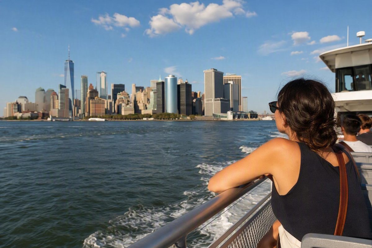
NYC Ferry can be a useful part of a New York itinerary, but only when the geography works. The best ferry trips begin and end near the waterfront, connect areas you already want to explore, and do not create a long inland journey after you step off the boat.
That means planning beyond the line on the map. Identify the correct service, allow for the walk to the landing, check the departure schedule, and consider how far the destination landing is from your next stop. A published 49-minute ferry ride is not a 49-minute door-to-door journey once waiting, boarding and walking are included.
Freshness note
NYC Ferry routes, stops, operating days, departure times and seasonal services can change. Weather and service revisions can also affect a trip. Use this guide to understand the network, then verify the configuration operating on your travel date.
Start with the current NYC Ferry service list—and its naming complication
The official NYC Ferry routes and schedules page lists seven named services:
- East River
- South Brooklyn
- Astoria
- Rockaway-Soundview
- St. George
- Governors Island Shuttle
- Rockaway-Rocket
Seven names do not necessarily mean seven equivalent, year-round routes. The list includes a shuttle and a specialized Rockaway service alongside the principal network routes. The route list alone does not establish that every item operates every day, follows the same boarding process or uses the same ticket type.
This helps explain why visitors encounter different route counts in different guides. One source may count only ordinary routes, another may include seasonal or reserved services, and an older guide may describe a previous network configuration. For trip planning, the schedule applying to your date matters more than a headline route count.
There is also a specific naming complication. The official route page uses Rockaway-Soundview as a combined name, while NYC311 documents separate Rockaway and Soundview stop patterns and approximate running times. The supplied information does not establish whether those patterns currently operate as one through service, two services or a schedule-dependent combination.
Do not try to resolve that discrepancy by interpreting the name. Open the current schedule and confirm:
- whether your origin and destination appear on the same trip;
- whether a transfer is required;
- which terminal destination indicates the correct direction;
- whether the service operates on your date;
- and whether a stop change or suspension applies.
The downloadable system map is useful for understanding the geography. The route-specific schedule is the better tool for deciding what you can board. A map can remain visually straightforward even when a seasonal variation, temporary suspension or revised stop pattern complicates the journey.
Check before leaving
- Open the route-specific schedule for your date.
- Check the live ferry status.
- Review the NYC Ferry service alerts for delays, weather changes, stop closures and route revisions.
NYC Ferry places its map, schedules and live-status tools on its official trip-planning pages.
Make this a same-day check. A schedule reviewed while building an itinerary weeks earlier may no longer describe the service operating when you travel.
Route-by-route stops and approximate ferry times
The table below uses stop patterns and approximate end-to-end running times reported by NYC311. It is a planning reference, not a definitive current route matrix. In particular, the official name Rockaway-Soundview does not align neatly with the separate Rockaway and Soundview patterns documented by NYC311.
Route-table source check: August 19, 2026. The reported patterns and runtimes come from the NYC311 NYC Ferry service guide. Verify every trip against the route-specific official schedule before departure.
All runtimes are approximate ferry time only. They exclude the walk to the landing, waiting, boarding, transfers and travel from the arrival landing to your final destination.
| Service or documented pattern | Stops reported by NYC311, in route order | Useful Manhattan hubs | Approximate end-to-end ferry time |
|---|---|---|---|
| Astoria | Astoria → Roosevelt Island → Long Island City → East 34th Street → Brooklyn Navy Yard → Wall Street/Pier 11 | East 34th Street; Wall Street/Pier 11 | 49 minutes |
| East River | Hunters Point South → East 34th Street → Greenpoint → North Williamsburg → South Williamsburg → DUMBO → Wall Street/Pier 11 | East 34th Street; Wall Street/Pier 11 | 49 minutes |
| Rockaway pattern | Rockaway → Sunset Park → Wall Street/Pier 11 | Wall Street/Pier 11 | 57 minutes |
| Soundview pattern | Throgs Neck/Ferry Point Park → Soundview–Clason Point → East 90th Street → East 34th Street → Stuyvesant Cove → Wall Street/Pier 11 | East 90th Street; East 34th Street; Stuyvesant Cove; Wall Street/Pier 11 | 56 minutes |
| South Brooklyn | Bay Ridge → Sunset Park → Governors Island, subject to a seasonal exception → Red Hook → Brooklyn Bridge Park Pier 6/Atlantic Avenue → Wall Street/Pier 11 → DUMBO → Corlears Hook | Wall Street/Pier 11; Corlears Hook | 53 minutes |
| St. George | St. George → Battery Park City → Midtown West/Pier 79 | Battery Park City; Midtown West/Pier 79 | 35 minutes |
| Rockaway Rocket | Long Island City → Greenpoint → Rockaway | No Manhattan stop in this documented pattern | 81 minutes |
| Governors Island Shuttle | Appears on the official service list; verify the current stop pattern | Check the current schedule | Not established here |
Astoria
The NYC311 pattern links Astoria, Roosevelt Island, Long Island City, East 34th Street, Brooklyn Navy Yard and Wall Street/Pier 11. It can be relevant when both the Queens or Roosevelt Island end and the Manhattan destination are reasonably close to the water.
Do not assume that the service name “Astoria” tells you every stop on every departure. Current schedule displays may reflect a configuration different from a static route description.
East River
The documented East River pattern begins at Hunters Point South, crosses to East 34th Street and then serves Greenpoint, North Williamsburg, South Williamsburg, DUMBO and Wall Street/Pier 11.
That pattern can support a waterfront day moving between western Queens, northern Brooklyn, DUMBO and Lower Manhattan. It does not mean that every attraction in those neighborhoods is close to its ferry landing.
Rockaway and Soundview
NYC311’s Rockaway pattern connects Rockaway, Sunset Park and Wall Street/Pier 11. Its Soundview pattern links the Bronx waterfront with East 90th Street, East 34th Street, Stuyvesant Cove and Wall Street/Pier 11.
Because the official route list now uses the combined name Rockaway-Soundview, verify the complete origin-to-destination movement. Seeing both place names in one service label does not, by itself, establish a direct ride between every documented stop.
South Brooklyn
The documented South Brooklyn pattern covers several distinct waterfront areas, including Bay Ridge, Sunset Park, Red Hook, Brooklyn Bridge Park Pier 6/Atlantic Avenue, DUMBO, Corlears Hook and Wall Street/Pier 11. Governors Island appears with a seasonal exception discussed below.
This is not simply a generic “Brooklyn ferry.” The landing serving the neighborhood you want may be on South Brooklyn, East River, Astoria or another service. Choose by stop name, not borough name.
St. George
The St. George route connects the Staten Island landing with Battery Park City and Midtown West/Pier 79. It belongs to NYC Ferry’s network and should not be confused with the separate Staten Island Ferry.
The route may fit when your Manhattan destination is on the west side near one of its landings. It is less naturally suited to an attraction far inland or on the east side unless the onward connection still makes sense.
Rockaway Rocket
Rockaway Rocket is different from the documented regular Rockaway pattern. NYC311 reports a Long Island City–Greenpoint–Rockaway journey of approximately 81 minutes and characterizes the service as seasonal and reserved.
Do not select it merely because “Rockaway” appears in the name. Confirm whether it operates on your date, whether its departure landing works for your itinerary and whether the required reserved ticket is available.
Governors Island Shuttle
The Governors Island Shuttle appears on the official service list, but the supplied route-list information does not establish its current stops, operating calendar or runtime. Use its date-specific schedule rather than assuming a departure point or daily operation.
Choose a route by destination, not by the view from the map
The easiest way to use NYC Ferry is to begin with your destination. Find the nearest practical landing, then identify the service and direction that reach it. You do not need to memorize the whole network.
Wall Street and Lower Manhattan
Wall Street/Pier 11 appears in several documented stop patterns and is the most useful interchange area for many Lower Manhattan ferry trips. It can support journeys involving Queens, Brooklyn, the Bronx and Rockaway.
Pier 11 is not one universal boarding line. Different vessels may serve different routes and directions. Before boarding, confirm both the route and the terminal destination shown for the boat.
For a Lower Manhattan day, the ferry works best as one clear arrival or departure. You might explore the Financial District and Seaport on foot, then take one ferry to DUMBO or another waterfront neighborhood instead of repeatedly returning to Pier 11 between unrelated sights.
East 34th Street and the Queens waterfront
Both Astoria and East River use the East River corridor, but their documented patterns serve different purposes.
The Astoria pattern includes Long Island City, Roosevelt Island, Astoria, Brooklyn Navy Yard, East 34th Street and Wall Street/Pier 11.
The East River pattern begins at Hunters Point South and continues through Greenpoint, Williamsburg and DUMBO to Wall Street/Pier 11, with East 34th Street also in the pattern.
For a Queens trip, the important distinction is not simply “Long Island City.” It is which landing you can conveniently reach and which route continues toward your destination. Hunters Point South and the Long Island City stop in the Astoria pattern should not be treated as interchangeable dots.
Waterfront Brooklyn
Brooklyn ferry destinations are spread across several services. Depending on the route, relevant stops include:
- DUMBO;
- North and South Williamsburg;
- Greenpoint;
- Brooklyn Navy Yard;
- Red Hook;
- Brooklyn Bridge Park Pier 6/Atlantic Avenue;
- Sunset Park;
- Bay Ridge.
Do not assume that one ordinary route visits all of them. East River serves the documented Greenpoint–Williamsburg–DUMBO corridor, while South Brooklyn follows a different sequence that includes Red Hook, Atlantic Avenue, Sunset Park and Bay Ridge. Brooklyn Navy Yard appears in the documented Astoria pattern.
This matters when planning a walking day. DUMBO and Brooklyn Bridge Park Pier 6 are both waterfront destinations, but they serve different parts of the shoreline. Choose the landing that supports the walk you want.
The Bronx waterfront
For Throgs Neck/Ferry Point Park, Soundview–Clason Point or the East 90th Street corridor, use the documented Soundview pattern as your starting point.
Then check the current schedule carefully because the official route list uses the combined Rockaway-Soundview name. Confirm whether your intended stops are connected on the departure you plan to take and whether a transfer is involved.
Staten Island
NYC Ferry’s documented St. George service links St. George with Battery Park City and Midtown West/Pier 79.
The Staten Island Ferry is a separate service with its own route, terminals and fare structure. It does not belong in the NYC Ferry route list merely because both operations reach Staten Island.
Rockaway
For Rockaway, distinguish between two planning patterns:
- the documented regular service via Sunset Park and Wall Street/Pier 11;
- the seasonal, reserved Rockaway Rocket serving Long Island City and Greenpoint.
The regular pattern may better suit a Lower Manhattan origin. The Rocket may be relevant to a Queens or northern Brooklyn origin when it is operating and reservations are available. Check the day’s schedule and departure landing before choosing either one.
Governors Island
Compare the current Governors Island Shuttle schedule with the current South Brooklyn schedule. The supplied evidence does not establish one universally available access pattern.
South Brooklyn includes Governors Island subject to a seasonal exception, while the official service list separately names a Governors Island Shuttle. This is precisely the kind of situation in which a date-specific schedule matters more than a generalized network description.
A practical destination rule
A ferry is a natural candidate when:
- your starting point is close to a landing;
- your destination is close to another landing;
- the departure time fits your day;
- and the route avoids unnecessary backtracking.
If the attraction is inland, add the onward walk, bus, subway or taxi before deciding. A landing can look close on a citywide map while still leaving a substantial last mile.
How to read the map, schedule, direction and live status
Use the same planning sequence for every NYC Ferry trip.
1. Find both landings on the system map
Identify the landing nearest your actual origin and the one nearest your actual destination. Do not plan from neighborhood names alone. A large neighborhood may have multiple waterfront access points served by different routes.
Estimate the walk at both ends before comparing the ferry with another mode.
2. Open the relevant route schedule
Once you know the landings, open the schedule for the service that appears to connect them. Confirm that both stops appear in the current pattern and that the service runs on your date.
Avoid relying on an old screenshot. A timetable that applied to a weekday in one season may not describe a weekend, holiday or later service period.
3. Identify the terminal that indicates direction
Direction is often communicated through the route’s terminal destination. If your stop is in the middle of a route, you need the vessel traveling toward the correct terminal.
Before boarding, confirm four details:
- the route name;
- the route color, where displayed;
- the direction or terminal destination;
- the vessel and dock signage.
A boat arriving at the correct landing is not necessarily your boat. Shared landings can serve more than one route or direction.
4. Check live status and service alerts
Check live status before beginning the walk to the dock, then review alerts. This is particularly important during poor weather, seasonal transitions or periods of route revision.
The map explains the network. Live information tells you whether the planned movement is working now.
A bounded historical Astoria example
A recorded June 2025 trip from Wall Street/Pier 11 to East 90th Street included Brooklyn Navy Yard, East 34th Street, Long Island City, Roosevelt Island and Astoria as intermediate stops. The NYC Walking Show’s Astoria ride-through is useful as a historical illustration of following a vessel through several stops, not as evidence of the current timetable.
That historical stop pattern does not match the NYC311 pattern reproduced in the route table above. Do not use it to plan a present-day journey. Check the current official stop order and terminal labels instead.
The underlying direction lesson remains useful: if boarding at East 34th Street for Brooklyn Navy Yard, do not look only for the word “Astoria.” Determine which terminal name indicates travel toward Brooklyn Navy Yard on the schedule operating that day.
Operating hours are not a timetable
NYC311 describes the system as generally operating from approximately 5 AM to 10 PM, depending on route and season. That broad window does not mean every route starts at 5 AM, continues until 10 PM or operates at the same interval throughout the day.
Exact frequencies and departure times are not reproduced here because the supplied evidence does not establish a complete current timetable. Use the route-specific schedule.
Fares, tickets and the 120-minute transfer rule
Fare verification note — checked against NYC311 on August 19, 2026
The date applies to the fare and ticket rules below, not to every route configuration in this article. Prices and conditions can change, so confirm them again before buying.
According to NYC311’s current fare and ticket information:
- Standard single ride: $4.50
- 10-trip pass: $29
- Eligible Ferry Discount Program ride: $1.45
Adults and children over 44 inches pay the standard fare, while children under 44 inches ride free. NYC311 identifies the discount categories as riders age 65 or older, people with disabilities, Fair Fares NYC participants and New York City high school students.
Tickets can be purchased through the NYC Ferry app or a ticket vending machine at a landing.
The free-transfer rule requires careful reading. NYC311 says transfers to another NYC Ferry route are free for 120 minutes after the start of a one-way trip. The rule does not turn a return journey into a free transfer.
A qualifying example is:
- ride one NYC Ferry route to a shared landing;
- change to another NYC Ferry route;
- make the change within the applicable 120-minute window.
A non-qualifying assumption is:
- take the ferry to a destination;
- spend time there;
- board for the journey back;
- expect the return to be free because it falls within 120 minutes.
That is a round trip, not simply a transfer between routes.
NYC311 also describes tickets as expiring 90 days after purchase and as non-refundable and non-transferable. If buying several tickets in advance, consider whether you are likely to use them within that period.
Older guides may show a $4 fare, a $30 bundle, a $1.35 discount fare or a 90-minute transfer window. Those figures conflict with the NYC311 information checked for this article. Do not average old numbers or assume the most commonly repeated figure is current.
Seasonal, reserved and schedule-dependent services
Not every item on the NYC Ferry service list works in the same way. Separate ordinary first-come service from seasonal, reserved and shuttle services before building a day around one.
Rockaway Rocket
NYC311 characterizes Rockaway Rocket as seasonal and reports an approximately 81-minute journey serving Long Island City, Greenpoint and Rockaway.
NYC311 also reports that a one-way ticket costs $12, must be booked in advance through the NYC Ferry app and guarantees a place. This makes Rockaway Rocket an exception to the first-come, first-served boarding model reported for regular service.
Do not use an undated summer operating range from an old guide to decide whether the Rocket runs during your trip. Confirm the current season, operating days, departure landing and reservation availability in the app or current route schedule.
Also distinguish the Rocket from regular Rockaway service. A reservation for one does not describe the route, departure point or boarding conditions of the other.
Governors Island Shuttle
The Governors Island Shuttle appears on the official service list, but that list does not establish:
- its current operating dates;
- which days of the week it runs;
- its current stop pattern;
- or how it relates to South Brooklyn service on a particular day.
NYC311 documents an additional South Brooklyn caveat: Governors Island is excluded from that route on summer weekends and holidays. Do not generalize that exception to every date or treat it as proof that another shuttle always replaces the stop.
Open the current Governors Island schedule for the day you intend to travel. For a round trip, verify both directions rather than assuming the outbound and return options are identical.
Seasonal-service checklist
Before leaving for a seasonal or schedule-dependent service:
- confirm that it is operating that day;
- verify the correct landing;
- determine whether advance booking is required;
- check which ticket type applies;
- confirm the return schedule;
- review same-day service alerts.
Boarding, accessibility, bikes, strollers, children and pets
NYC311 describes regular NYC Ferry boarding as first-come, first-served. Allow time to locate the correct queue and keep an alternative plan in case service changes or capacity affects your trip.
Bikes and strollers
NYC311 says bicycles and strollers are permitted without an additional fee. Follow crew instructions about boarding and placement, and do not assume that available space will be identical on every vessel or departure.
Children
The free-fare rule is based on height rather than age. Children under 44 inches ride free; children over 44 inches are subject to the standard fare unless another eligible program applies.
If a child is close to the threshold, clarify the rule before arriving. Being young does not by itself determine the fare.
Accessibility
NYC311 describes all NYC Ferry landings and vessels as accessible and says each vessel has an accessible restroom. A traveler with a specific access requirement may still want to check same-day conditions, particularly if an alert changes the boarding location or route.
Dogs
The documented rule is narrower than an unrestricted pet policy:
- service dogs are allowed;
- other dogs must be in a carrier or wear a muzzle.
Do not interpret this as permission for every type of animal. If traveling with an animal other than a dog, request current guidance from NYC Ferry before the trip.
Vehicles
NYC311 says cars, motorcycles and trucks are prohibited. NYC Ferry is a passenger service, not a vehicle ferry.
Rockaway shuttle bus
NYC311 reports a free shuttle bus associated with the Rockaway landing at Beach 108th Street. Verify its current route, stops and schedule before relying on it for the final part of a beach journey.
The shuttle may help with the last mile, but it introduces another timed segment. Include potential waiting and the return connection when comparing the ferry with other ways of reaching Rockaway.
What not to assume
The supplied evidence does not establish universal rules for luggage limits, parking at landings, shelters, restrooms at every terminal or payment methods accepted by each vending machine. If one of those details is essential, verify it directly rather than extrapolating from another landing.
Boarding checklist
Before joining the line:
- arrive with enough time to find the landing;
- have your ticket ready;
- confirm the route name;
- confirm the direction or terminal destination;
- check the dock and vessel signage;
- follow crew instructions;
- keep an alternative route in mind.
When NYC Ferry fits a visitor itinerary—and when another ferry or transit mode does not
NYC Ferry is a selective waterfront transportation option. It is not a comprehensive replacement for the subway or buses.
The central limitation is the last mile. Ferry landings are necessarily on the waterfront, while many major attractions are inland. A boat may move efficiently along the river but still leave you with a substantial walk, bus ride, subway connection or taxi trip.
A ferry is most useful when it creates one deliberate movement within an area-based day.
A walking-first planning method
Build the day in this order:
- Choose a compact area to explore.
- Identify a ferry landing that works as the area’s beginning or end.
- Use the ferry for one cross-river or north–south movement.
- Walk through the neighborhood instead of repeatedly returning to the waterfront.
- Add another transit mode only when the day genuinely requires it.
This keeps the ferry from forcing the rest of the itinerary into awkward loops. The boat should support the day’s geography, not dictate a sequence of distant stops.
Itinerary pattern: Lower Manhattan to DUMBO or waterfront Brooklyn
Spend part of the day following a compact walking-first Lower Manhattan route, then use Wall Street/Pier 11 for one movement to DUMBO or another route-appropriate Brooklyn landing.
After arriving, continue through a compact part of Brooklyn on foot. Do not assume the ferry will also be the most practical return option. Compare its next departure with nearby subway, bus and walking choices.
Itinerary pattern: Hunters Point South to Lower Manhattan
The documented East River pattern connects Hunters Point South with Greenpoint, Williamsburg, DUMBO and Wall Street/Pier 11.
This may work as the main transit movement of a Queens-to-Lower-Manhattan day. It becomes less attractive if you must first travel a long distance across Queens to reach the landing and then continue far inland after arriving at Wall Street.
Itinerary pattern: St. George to Battery Park City or Midtown West
The St. George route may suit a journey between Staten Island and Manhattan’s west side because its documented Manhattan stops are Battery Park City and Midtown West/Pier 79.
Choose between them according to the next part of the day. Battery Park City can support a Lower Manhattan walk; Pier 79 can support a west-side itinerary. Neither is a generic gateway to every Manhattan attraction.
Itinerary pattern: A Rockaway day
A Rockaway day requires more than selecting “Rockaway” in an app. Decide whether you are considering regular service via Sunset Park and Wall Street or the seasonal reserved Rocket from Long Island City and Greenpoint.
Include the documented shuttle or other onward transportation from the landing. Most importantly, check the return schedule before leaving. A beach outing is not well planned if the return journey is considered only after arrival.
NYC Ferry versus NY Waterway
NYC Ferry is the municipal route network discussed throughout this guide.
NY Waterway is a separate operator serving Manhattan–New Jersey routes and other Hudson River connections. Its Manhattan terminals include Midtown, Pier 11/Wall Street and Brookfield Place, but its services do not become part of NYC Ferry merely because the operators use nearby Manhattan landings. Consult NY Waterway’s routes and schedules for a New Jersey journey.
Tickets, fares, schedules and transfer rules belong to the operator you are actually using.
NYC Ferry versus the Staten Island Ferry
NYC Ferry’s St. George route serves Battery Park City and Midtown West/Pier 79.
The Staten Island Ferry is a separate operation. Do not assume an NYC Ferry ticket, map, transfer rule or app instruction applies to it. Confirm the operator and Manhattan terminal before heading to the waterfront.
NYC Ferry versus Statue of Liberty boats
NYC Ferry does not serve the Statue of Liberty.
Seeing the Statue of Liberty from a vessel or waterfront is not the same as taking a boat that lands at the monument.
Airports and NYC Ferry
NYC Ferry does not provide direct service to JFK or LaGuardia. Any airport-related journey requires additional ground transportation.
A journey through Rockaway toward JFK still needs onward connections rather than ending at an airport terminal. Likewise, an Astoria-area ferry trip does not become direct LaGuardia service because buses operate elsewhere in the surrounding area.
For an arrival or departure day, compare the reliability and complexity of the complete chain. Multiple transfers with luggage may be a poor trade even when one segment looks appealing on the map.
The final decision rule
A ferry ride can combine transportation with open-water city views. That may be a welcome part of a visitor’s day, but it does not make the ferry universally faster, cheaper, easier or more comfortable than another mode.
Choose NYC Ferry when both ends of the journey work with the waterfront and the ride helps form one coherent neighborhood day. Before leaving, complete four final checks:
- current route schedule;
- correct direction;
- live ferry status;
- service alerts.
Then compare the complete journey: walk to the landing, waiting time, ferry ride and onward travel. The onboard runtime is only one part of the trip.
NYC Ferry FAQ
What are the NYC Ferry routes?
The official route list names East River, South Brooklyn, Astoria, Rockaway-Soundview, St. George, Governors Island Shuttle and Rockaway-Rocket.
These seven names should not be interpreted as seven equivalent year-round routes. Some are specialized or schedule-dependent. The combined Rockaway-Soundview name also differs from NYC311’s separately documented Rockaway and Soundview patterns, so check the current schedule for your specific journey.
How much is NYC Ferry, and can I transfer for free?
As checked against NYC311 on August 19, 2026, the reported standard single fare is $4.50, the 10-trip pass is $29, and an eligible Ferry Discount Program ride is $1.45.
NYC311 says transfers to another NYC Ferry route are free for 120 minutes after the start of a one-way trip. A round trip does not qualify as a free transfer. Verify prices and ticket rules before purchasing because older guides contain conflicting figures.
Does NYC Ferry go to Staten Island, the Statue of Liberty or New Jersey?
NYC Ferry serves Staten Island through its St. George route, with documented connections to Battery Park City and Midtown West/Pier 79.
It does not serve the Statue of Liberty or New Jersey. Statue of Liberty boats, the Staten Island Ferry and NY Waterway’s New Jersey services are separate operations.
Are the Governors Island Shuttle and Rockaway Rocket seasonal?
NYC311 documents Rockaway Rocket as seasonal and reserved. It reports an 81-minute Long Island City–Greenpoint–Rockaway journey and a separate $12 one-way ticket that must be booked through the NYC Ferry app.
The Governors Island Shuttle appears on the official route list, but its current season, operating days, stops and relationship to South Brooklyn service must be verified in the date-specific schedule. Do not assume either service operates daily or year-round.
Can I take a bike, stroller, child or dog on NYC Ferry?
NYC311 says bikes and strollers are allowed without an additional fee. Children under 44 inches ride free; the rule is based on height rather than age.
Service dogs are permitted. Other dogs must be in a carrier or wear a muzzle. NYC311 also describes the landings and vessels as accessible and says each vessel has an accessible restroom. Regular boarding remains first-come, first-served.