 New York Know
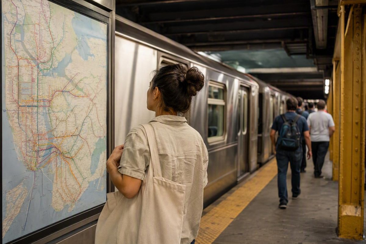
The NYC subway looks complicated because it is large, interconnected, and frequently adjusted. You do not need to memorize it. You need a repeatable routine.
For most visitor trips, that routine is straightforward: identify the station near your destination, plan the route, check current service, confirm the entrance and direction, and verify that the arriving train stops where you need it to stop. Once those habits become automatic, the map becomes a practical tool rather than a puzzle.
The larger goal is not to spend your trip mastering transit. Use the subway for necessary distance while keeping most of each day compact enough to understand on foot.
The five-step subway routine for visitors
Before your first ride—and before any ride that could be affected by evening or weekend work—follow these five steps:
- Identify your destination station. Start with the place you are visiting, then determine which nearby station and exit area are useful. A station with the most familiar name is not always the closest or most convenient.
- Plan the route. Note the train’s letter or number, the direction of travel, any transfer, and whether your destination is served by a local or express train.
- Check current MTA service. Look for changes affecting your line, direction, stations, or travel window.
- Confirm the entrance and direction. Read the sign above or beside the entrance before tapping in. Some entrances lead only to one direction.
- Verify the train before boarding. Check its letter or number, direction or terminal, and stopping pattern.
The Metropolitan Transportation Authority is the final operational authority. Its website provides official maps, nearby stations, schedules, service information, accessibility resources, and elevator and escalator status. Use the MTA homepage and operational tools to resolve conflicts between a saved map, a route-planning app, and what is actually running.
A route appearing on a subway map is not a promise that a train will follow that route when you travel. Planned work, unexpected delays, reroutes, suspended sections, skipped stops, and equipment outages can all affect a journey. Changes are especially important late at night and on weekends, when maintenance can produce service patterns that differ from typical weekday service.
Check once while planning and again immediately before leaving. If you planned a weekend journey several days in advance, treat the original route as provisional until you review current information.
It helps to separate two categories of information:
- Evergreen concepts: uptown and downtown, local and express, paid-area transfers, entrance signs, and matching a train’s letter or number.
- Volatile details: fares, fare caps, temporary service changes, schedules, elevator outages, and the stops served at a particular time.
This guide explains the first category. For the second, consult current MTA information when you travel.
How the subway fits together
The NYC subway directly serves Manhattan, Brooklyn, Queens, and the Bronx. It does not directly serve Staten Island. Reaching Staten Island requires a connecting mode, such as a ferry or bus, and travelers may use the Staten Island Railway after reaching the island. That railway is not physically connected to the subway.
Several other trains appearing on New York-area maps are also separate systems. PATH, AirTrain, the Long Island Rail Road, Metro-North Railroad, NJ Transit, and Amtrak are not NYC subway services. They may use separate stations, fares, payment systems, transfer rules, and schedules. Do not assume that payment for one system provides access to another.
The subway generally operates around the clock, but that does not mean every line, station, direction, or section follows its normal pattern at every hour. Overnight stopping patterns can differ, and planned work or disruptions may alter part of a route. NYC Tourism’s visitor transportation overview describes the MTA subway and bus network as operating around the clock while advising travelers to check current information, particularly on weekends and late weekday nights.
Think of round-the-clock operation as system availability, not a guarantee that your preferred train will serve your preferred platform exactly as it does during the day.
For overnight travel, use that diagram to understand the intended overnight network and then check current alerts. Do not plan solely from the typical-weekday diagram.
You may encounter different totals for stations, routes, lines, and services. Those figures often count different things—for example, whether connected stations are treated separately or consolidated into one complex. The totals are not necessary for taking a trip, so visitors are better served by concentrating on the train symbols and stations relevant to their route.
One historical detail helps explain the system’s varied layouts: the original underground subway opened in 1904. The opening date and broader system context are summarized in the New York City Subway overview.
Choose the right official subway map
There is no single best subway map for every task. A diagram that makes services and transfers easy to see may distort geography, while a geographic map that clarifies neighborhoods may appear more crowded.
The MTA’s official subway map directory provides typical-weekday, late-night, geographic, accessible-station, large-type, neighborhood, and individual-line resources. Whatever format you choose, compare it with current service information before traveling.
| Official map or diagram | Best use | What to remember |
|---|---|---|
| Typical-weekday subway diagram | Understanding ordinary service relationships, train symbols, stops, and transfers | It simplifies geography and may not show temporary changes. |
| Late-night subway diagram | Planning an overnight trip | Use it instead of assuming daytime patterns continue overnight. |
| Dated weekend diagram | Visualizing planned changes for the dates printed on it | It expires and must be compared with current alerts. |
| Geographic subway map | Seeing stations in relation to boroughs, neighborhoods, streets, and one another | It clarifies location, not temporary operations. |
| Accessible-stations map | Building a route through stations identified as accessible | A station designation does not guarantee that every required elevator is operating. |
| Large-type map | Reading larger station names and labels | Better legibility does not make a saved map operationally current. |
| Neighborhood maps | Understanding nearby streets and the area around a station | Use them for local orientation, then verify train service separately. |
| Individual-line text maps | Simplifying the order of stops after choosing a service | Temporary reroutes and skipped stops may not be reflected. |
For a normal weekday trip
Start with the typical-weekday diagram. It is usually the clearest way to see which trains share stations, where transfers are available, and whether a destination is served by a local or express pattern.
After selecting the route, check current service. The diagram shows how the network is normally organized; live information tells you what may be different now.
For neighborhood and street orientation
Use the geographic map when your main question is not “Which services connect?” but “Where is this station in relation to my destination?”
This can prevent a technically valid but inconvenient choice. Two stations may look close on a schematic diagram while sitting on different sides of a neighborhood, park, highway, or waterway. A geographic map can also show whether walking to another line would create a simpler trip.
Neighborhood maps are particularly helpful near the end of a ride. They can help you identify the side of an avenue or the street nearest your destination, although you must still confirm current service separately.
For overnight travel
Use the late-night diagram first. It represents the overnight network rather than typical weekday service. Then check current alerts, because the diagram is a general service picture rather than a guarantee for a particular night.
Do not build a tightly timed plan around an assumed waiting interval. Service patterns and disruptions can change the practical journey.
For weekend travel
The MTA map directory, for example, lists a diagram for August 7–10, 2026; that diagram applies to those dates and should not be treated as evergreen guidance.
Before relying on a weekend diagram:
- Read the printed dates.
- Confirm that it covers your travel window.
- Compare the displayed changes with your route.
- Open the current alert for your service.
- Recheck shortly before departure.
A dated diagram can make widespread planned work easier to understand, but it supplements rather than replaces live information.
For accessibility or larger text
If you need a step-free route, begin with the accessible-stations map instead of trying to retrofit accessibility after choosing a route. The origin, transfers, destination, and required elevators must all work together.
If standard labels are difficult to read, use the large-type map. You can save it to your phone, but remember that a downloaded file cannot update itself when operations change.
For a simple one-line journey
An individual-line text map can remove visual noise after you know which service you need. It is useful for checking the ordinary order of stations and identifying stops on the line’s normal pattern.
That simplicity is not a reason to skip alerts. A normal line map may be incomplete for a train that is rerouted or skipping stops.
Direction, entrances, local trains, and express trains
Uptown and downtown
In Manhattan, uptown generally means north and downtown generally means south. Numbered streets are a useful orientation aid because their numbers generally rise as you move north.
This is a working rule, not a complete geographical system. Lower Manhattan has an older, less regular street pattern, and station layouts can complicate an otherwise simple north–south journey. Outside Manhattan, signs may emphasize borough destinations, neighborhoods, terminals, or compass directions instead of “uptown” and “downtown.”
When a route planner provides a direction, note both the general direction and any terminal or destination shown on station signs. A terminal name can confirm the correct platform when uptown or downtown wording is absent.
Read the entrance before paying
Do not treat every entrance with the same station name as interchangeable. Some entrances serve only uptown or only downtown trains.
Before tapping:
- Find the station name.
- Check the train letters or numbers displayed.
- Look for “Uptown,” “Downtown,” a borough, or a terminal direction.
- Watch for wording that limits the entrance to one direction.
- Confirm that your required service is listed.
If the sign does not match your route, stop before entering. Look for another marked entrance rather than assuming you can cross between platforms after paying.
Match the service, not only the station name
A station name may describe a complex containing several services and connected platforms. Match three pieces of information:
- Train letter or number
- Direction
- Stopping pattern
Being at the correct named station does not help if you take the right service in the wrong direction. Likewise, a train moving in the correct direction may still skip your stop if it is operating express.
Local versus express
A local train makes more stops. An express train skips selected stations. Express does not simply mean “better” or “the train to use for every long journey.” It is useful only when it serves both the place where you board and the place where you get off.
Before boarding an express, verify that your destination is an express stop. Check your route plan, platform information, train display, or station map. If the express does not serve the destination, take the local or follow the planner’s transfer instructions.
Do not infer stopping patterns solely from which track a train uses or how quickly it arrives.
On the platform and train
As a train enters, check the letter or number on its front or side display and compare it with your planned service. Listen to announcements and review onboard displays where available, especially when service is changing.
Basic boarding etiquette keeps doors and platforms moving:
- Let passengers leave before boarding.
- Move into the car rather than stopping in the doorway.
- Keep bags and your body clear of the doors.
- Do not hold the doors open.
If you realize that you are going the wrong way, get off at a suitable station and recheck the route. Confirm the layout before assuming you can switch platforms without leaving the paid area.
Paying with OMNY without losing transfer or fare-cap benefits
OMNY is the contactless payment system used for subway entry. Visitor payment options described by NYC Tourism include:
- Eligible contactless credit, debit, or prepaid cards
- Supported digital wallets on phones
- Supported wearables
- A dedicated OMNY card
Tap your chosen card or device on the reader and wait for confirmation before moving through the turnstile or gate.
The essential habit is consistency: use the same qualifying card or device for every relevant tap when you want eligible transfers or fare-cap activity tracked together. Do not assume that switching among a physical card, phone, watch, another bank card, or another person’s device will combine the activity. NYC Tourism also states that subway riders can transfer among connected subway lines without another fare when they remain within the paid area; its OMNY and visitor payment guidance should be read alongside current MTA rules.
If two travelers are paying separately, each should use a consistent credential. Do not build a fare strategy around switching cards or devices unless current guidance explicitly explains how the taps will be treated.
For subway-to-subway transfers, remaining inside the paid area is the conservative rule. If you exit through a turnstile or gate, do not assume that re-entry elsewhere will be included. Any special transfer arrangement should be verified rather than inferred.
This guide does not publish a definitive base fare, reduced fare, fare-cap threshold, OMNY-card purchase price, child policy, or detailed bus-transfer rule. Those details can change and should be checked through current MTA information when you travel.
Payment check before travel: Confirm current fares, fare-cap rules, transfer eligibility, accepted payment methods, reduced-fare provisions, and family policies through the MTA. Use the same qualifying card or device for each tap unless current guidance says otherwise.
NYC Tourism reports that MetroCard retired at the end of 2025. This guide therefore does not include MetroCard purchase or swipe instructions. If an older travel article conflicts with current MTA payment information, follow the current MTA guidance.
Check service changes before nights and weekends
A subway line can be operating while still being unusable for your particular trip. A change might affect:
- Only one direction
- A group of stations
- Your destination stop
- A transfer station
- A limited section of the route
- Particular dates or hours
- The local or express stopping pattern
That is why checking only whether “the line is running” is not enough.
The MTA may display conditions including delays, suspensions, partial suspensions, reroutes, skipped stops, express-to-local operation, special schedules, or extra service. Do not invent a meaning from the short label. Open the relevant alert and inspect the details through the MTA’s current service tools.
A captured MTA homepage from August 2026 displayed several categories of changes across different services at the same time. That snapshot illustrates how varied conditions can be, but it is not advice for a later trip. The affected services, directions, stations, dates, and hours must be checked live.
What to inspect in an alert
Open the alert for your service and answer four questions:
- Which direction is affected? A northbound change may not apply southbound.
- Which stations or section are affected? The train may operate normally before and after the changed segment.
- What dates and hours apply? Planned work may begin late in the evening, end early in the morning, or cover only part of a weekend.
- What alternative is described? Look for another train, transfer, or mode named in the alert.
Do not read only the headline. “Stops skipped” does not tell you whether your stop is affected, and “reroute” does not necessarily mean the entire service is unavailable.
Pre-departure service checklist
Immediately before leaving:
- Compare your saved route with official alerts.
- Confirm that the origin station is being served.
- Confirm that the destination is served in your direction.
- Check every transfer station in the route.
- Note any substitute transfer or alternative line described in the alert.
- Leave flexibility rather than timing the day around an ideal journey.
- For overnight travel, compare the route with the late-night diagram.
Late-night and weekend diagrams help explain planned patterns. They do not replace live service information.
If the route changes after you board
Announcements may say that a train will skip stops, terminate early, change tracks, or follow a different route. As general contingency guidance:
- Listen to the complete announcement.
- Check onboard displays and platform signs where available.
- If the revised train no longer serves your route, get off at an appropriate stop.
- Recheck the MTA’s route and alert information.
- Follow an alternative stated in the announcement or alert rather than improvising from memory.
If transit personnel are available, you can ask them to clarify an announcement or connection.
Plan an accessible trip station by station
Only portions of the subway system are accessible. A step-free journey must therefore be planned as a continuous chain, not simply as two accessible endpoints.
An accessibility symbol identifies a possible route component; it does not guarantee that every elevator needed for your direction and transfer is operating. An outage at the origin, transfer, or destination can make the planned route unusable.
A step-by-step accessibility workflow
- Choose an accessible origin. Confirm that the accessible entrance serves the direction you need.
- Choose accessible transfers. Verify that the step-free path connects the relevant platforms.
- Choose an accessible destination. Consider where the accessible exit reaches the street.
- Review the accessible geographic map. Use it to understand the route and nearby alternatives.
- Check equipment status immediately before leaving.
- Prepare a fallback. Identify another accessible station or an appropriate alternative mode.
The MTA’s accessibility planning resources explain the available programs and station information. Immediately before departure, consult the separate elevator and escalator status tool, and repeat the check before the return trip.
This process can also help travelers carrying luggage or using a stroller, even when step-free access is a preference rather than an absolute requirement. However, an accessible designation does not establish that a route will be direct or convenient with large bags.
Why each station matters
Treat the journey as three separate tests:
- Can you reach the first train?
- Can you complete every transfer?
- Can you exit at the destination?
If the origin and destination are accessible but a transfer elevator is unavailable, the full route is not step-free.
NYC Tourism describes public-transit buses as accessible, making a bus one possible fallback to investigate when a subway path does not work. That does not guarantee that a particular bus route will meet every traveler’s needs or operate without changes. Verify the route, stop, and current conditions.
Never rely on a general travel article to establish that a particular station or elevator is available. Accessibility is operational information and should be checked through current MTA tools.
Official MTA tools versus independent subway apps
You do not need to choose one tool for every task. A practical approach is to use whichever interface makes planning easiest and then use MTA information as the final operational check.
| Consideration | Official MTA tools | Independent subway apps | Saved or offline map |
|---|---|---|---|
| Authority | Operational authority for maps, service, schedules, accessibility, and equipment status | Not the transit operator | Static copy with no operational authority |
| Route planning | Uses MTA network and service information | May streamline routing, favorites, station searches, or points-of-interest searches | Requires manual route tracing |
| Offline access | Downloaded maps may remain viewable | Some apps advertise offline maps or routing | Usually remains available as a saved file |
| Live alerts | Preferred final source for current and planned changes | May display alerts, subject to the app’s delivery and interpretation | Cannot receive new information |
| Accessibility | Official station and equipment information | Some apps advertise equipment notifications | Shows only what was included when saved |
| Advertising | Not structured as a commercial, ad-supported navigation app | Some apps contain advertising | None within the file itself |
| Subscriptions | Core public information does not depend on a third-party premium plan | Some functions may require purchases or subscriptions | No recurring feature plan |
| Privacy disclosures | Governed by agency policies | Vary by developer and platform | A local file generally requires no active account |
| Historical depth | Focuses mainly on current operations and agency information | Usually designed for present-day navigation | Limited to the saved material |
When an independent app helps
Independent apps may offer route planning, station search, favorites, countdowns, offline maps, and elevator or escalator notifications. Those functions can reduce friction when you are moving among unfamiliar areas.
Treat store descriptions as developer claims, not proof that every route, countdown, or alert will be accurate. Ratings and download totals are platform-specific popularity signals rather than evidence of operational reliability.
Mapway’s New York subway app is one commercial example. Its Google Play listing advertises offline routing, station search, service information, countdowns, favorites, and equipment alerts. The listing identifies the app as unofficial and not associated with the MTA, despite the developer’s statement that it uses licensed MTA maps. It also shows advertising and in-app purchases.
Some individual reviewers report intrusive advertising, inaccurate arrivals, or incomplete service information. Those reports are anecdotal and may relate to particular versions or journeys. They nevertheless support a sensible boundary: a third-party app should not be the final authority when service changes.
The offline limitation
An offline map can help you:
- Identify ordinary train lines
- Follow the usual order of stations
- Locate typical transfer points
- Reorient yourself when connectivity is weak
It cannot reliably show a closure, reroute, new delay, skipped stop, or equipment outage that occurred after the map was saved. Offline routing may also rely on stored assumptions rather than current operations.
A useful combination is:
- Save an official map for reference.
- Use a preferred planner to compare routes.
- Reconnect before departure.
- Check MTA alerts and equipment status.
- Watch and listen for changes in the station.
Where historical resources belong
For history and technical detail, nycsubway.org’s independent archive provides old maps, rolling-stock material, track maps, photographs, technical topics, and information about abandoned or disused stations. The site states that it is not affiliated with a transit agency.
That makes it useful for understanding how the system developed—not for deciding whether a train is running tonight. Keep historical research separate from live trip decisions.
Use the subway to connect neighborhood days, not fragment them
Knowing how to use the subway does not mean taking it between every attraction. A transit-heavy itinerary can consume time through walks to stations, waits, transfers, platform changes, and repeated reorientation.
New York Know’s approach is to group sights geographically, build walkable sequences, and use transit for purposeful connections. The subway handles distance; walking supplies continuity.
Choose a base that matches the trip
Where you stay affects how often you need long journeys. Choose a neighborhood partly according to:
- Where most of your planned days are concentrated
- How much walking you want
- Whether you expect late evenings
- How often you plan to return to the room
- Which areas matter most to you
A useful base does not need to be next to every attraction. It should make the trip’s overall movement workable. The guide to choosing a New York neighborhood for a first trip frames that decision around your expected schedule and walking preferences.
Build days by area
Instead of pairing distant sights merely because both are famous, place nearby destinations in the same day. Look for a natural sequence of streets, parks, museums, waterfronts, commercial districts, or adjoining neighborhoods.
A practical day might follow this pattern:
- Take one longer subway ride to the main area.
- Visit the morning anchor.
- Walk through nearby stops in a sensible order.
- Add a short transit connection only if it improves the route.
- Finish in an adjacent neighborhood.
- Check the route home before the final stop.
This reduces repeated station entries and unnecessary crossings. The same method is developed in How to Plan New York Days Without Crossing the City Repeatedly.
Walking is not merely what happens when you decline to take a train. It reveals transitions that station-to-station travel can hide: where office streets become residential, where the grid gives way to older blocks, or where one neighborhood’s storefronts gradually change into another’s.
Use transit at the edges
One longer ride at the beginning of the day can place you in the right area. From there, explore on foot. Another ride may make sense at the far edge of the route or for the return to your accommodation.
The walking-first Lower Manhattan itinerary demonstrates the principle by keeping the day compact and using the subway after a walking-focused finish. It does not prescribe station-level directions because the correct route depends on the traveler’s destination and current service.
A reusable day-planning template
Use this structure for almost any part of New York:
- Morning area: Choose one neighborhood or closely connected district.
- Walkable sequence: Arrange nearby sights in a logical order.
- Optional midday connection: Add one subway or bus trip if it joins areas that genuinely belong in the same day.
- Final neighborhood: End somewhere suitable for dinner, an evening activity, or a convenient return.
- Checked route home: Before the final stop, review current service, accessibility needs, and the route back.
This is itinerary strategy, not transit operations. Fares, routes, service conditions, and accessibility still require current MTA information.
Frequently asked questions
Does the NYC subway run 24 hours a day?
The system generally operates around the clock, but that does not mean every line, station, direction, or section operates normally at every hour. Overnight stopping patterns can differ, and planned work or disruptions may reroute or suspend part of a service.
For a late-night trip, consult the official late-night diagram, check current MTA alerts, and verify your direction and destination immediately before leaving. Do not assume that the typical-weekday map describes overnight service.
How much is the NYC subway fare, and how should I verify the current price?
Verify the current price and payment rules through the MTA when you travel. Check the base fare along with any relevant fare-cap, transfer, reduced-fare, child, or dedicated OMNY-card provisions.
Use the same qualifying OMNY card or device when you want eligible activity tracked together. Do not assume that taps made with different cards or devices will be combined.
What is the difference between uptown, downtown, local, and express service?
In Manhattan, uptown generally means north and downtown generally means south, although geography and station layouts create exceptions.
A local train makes more stops. An express train skips selected stops. Before boarding, verify the train’s letter or number, direction, and stopping pattern. If your destination is not served by the express, take the local or follow the route planner’s transfer instructions.
Does the NYC subway go to Staten Island?
No. The subway directly serves Manhattan, Brooklyn, Queens, and the Bronx, but not Staten Island.
The Staten Island Railway operates on Staten Island but is not physically connected to the subway. Plan a connecting mode and verify current payment and transfer rules for the complete journey.
Can I use an offline subway map instead of checking MTA alerts?
No. An offline map is useful for seeing ordinary lines, stations, and transfer relationships when connectivity is poor. It cannot reliably reflect a new closure, reroute, delay, skipped stop, or elevator outage.
Save a map as a backup, but reconnect and check current MTA information before departure—especially at night, on weekends, or when you need a specific accessible path.
The repeatable rider workflow remains simple: choose the appropriate map, check live service, tap with one consistent OMNY credential, confirm the entrance and direction, and verify the train’s stops. Let the subway handle necessary distance, but let neighborhoods organize the trip.