 New York Know
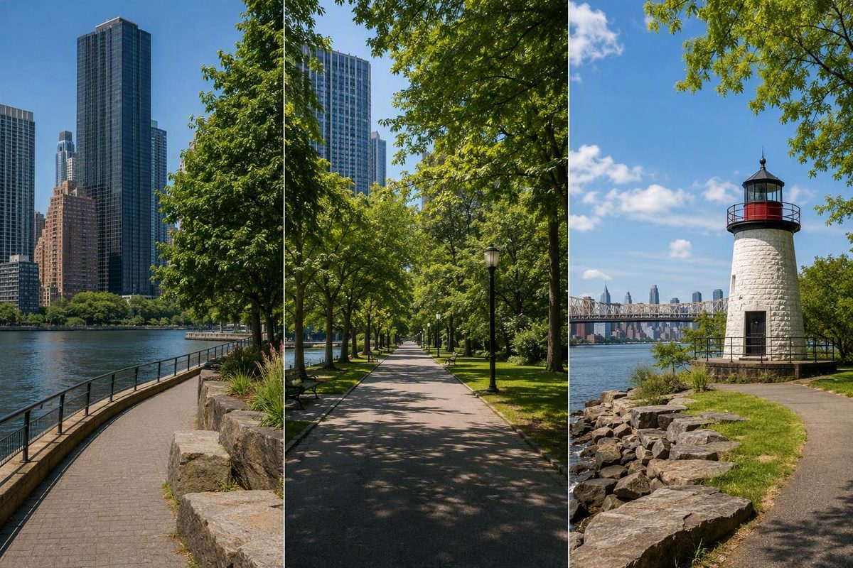
- A walking-first day between Manhattan and Queens*
Roosevelt Island works better as a journey than as a checklist. Its long, narrow geography naturally divides a visit into three parts: memorials, parkland, and historic structures in the south; a lived-in residential center; and architecture, public art, and a lighthouse in the north.
For a compact first visit, arrive by tram and concentrate on the southern cluster. With more time and walking capacity, continue north after returning through the center. This approach reveals how the island changes from academic campus to memorial landscape, neighborhood, and historic waterfront without requiring repeated trips between distant sights.
Roosevelt Island at a glance
Roosevelt Island sits in the East River, with Manhattan to the west and Queens to the east. Although its road connection is through Queens, the island is officially part of Manhattan. It is about two miles long, covers 147 acres, and had 11,722 residents in the 2020 Census. Northtown and Southtown are its two largely residential communities, according to the Roosevelt Island geographic overview.
That residential identity matters. Roosevelt Island is not a purpose-built visitor district where every notable building is open for sightseeing. People live here, attend school, use community facilities, shop along Main Street, and travel to and from the rest of New York. Its waterfront paths, parks, monuments, public art, historic structures, Cornell Tech campus, and tram journey are part of an everyday neighborhood.
The simplest way to understand the island is from south to north:
- South: Cornell Tech, the FDR Hope Memorial, Southpoint Park, Strecker Laboratory, the Smallpox Hospital ruins, and Four Freedoms Park.
- Center: Main Street, Blackwell House, the Chapel of the Good Shepherd, housing, and neighborhood services.
- North: the Octagon, Girl Puzzle, Lighthouse Park, and the Roosevelt Island Lighthouse.
The southern end contains the most concentrated sequence for a short first visit. The north adds residential and institutional history, a strong connection to journalist Nellie Bly, contemporary public art, and a clear waterfront endpoint. It also adds substantial walking.
Do not let the island’s compact appearance on a map encourage an overambitious plan. A straight walk and a sightseeing day are different things. Detours into parks, photographs, transit waits, weather, meals, rest breaks, and changing access conditions can turn a short-looking route into several hours.
How to get to Roosevelt Island
The Roosevelt Island Tramway is both public transportation and an opening sightseeing experience. Its elevated route crosses the East River and provides changing views toward Midtown, Long Island City, the Queensboro Bridge, and surrounding parts of the city. It is a sensible choice when the arrival itself is part of your reason for visiting.
The tram is not automatically the right option for every itinerary. Roosevelt Island can also be reached by the F train, NYC Ferry, the Q102 bus, and the Roosevelt Island Bridge. Vehicles must approach through Queens via the bridge; there is no direct automobile connection from Manhattan. These access choices are summarized in a Roosevelt Island transportation guide.
Use the rest of your day to choose among them:
- Take the tram if you want an elevated approach and the crossing is part of the experience.
- Take the subway if the F train fits your starting point or onward journey more naturally.
- Take the ferry when its current route and schedule connect efficiently with the neighborhoods before or after your visit.
- Use the Q102 bus when its current route suits an origin or destination in Queens.
- Drive only for a specific reason. Road access comes through Queens, and a walking-focused outing does not benefit from being organized around a car.
Arriving by tram and leaving by subway or ferry can give you two different perspectives without requiring a return to the same platform. Treat this as an option rather than a fixed plan: same-day service conditions may make another return route more practical.
Crowding can restrict tram views, particularly during busy periods. A commercial walking-tour provider specifically warns that weekday rush hours and weekends may limit visibility, so do not build the trip around securing a particular side or an unobstructed photograph.
Check before leaving: Use current operator information for the tram and Red Bus, MTA service and elevator alerts for the F train and Q102, and NYC Ferry service notices. Confirm both your arrival and intended return. Fares, schedules, payment rules, transfers, elevators, routes, and operating conditions can change. The official RIOC tram page is the appropriate starting point for tram information.
Choose the right itinerary for your time and walking capacity
Published estimates show why Roosevelt Island should be planned by route rather than mileage. One visitor guide estimates about 40 minutes to walk the island’s length without stops. Another allows approximately 60–90 minutes for the southern attractions alone. These are not dependable end-to-end visit times: pace, park detours, photographs, weather, rest stops, access conditions, and transit crowds can all change the calculation.
Think in terms of four itinerary sizes.
Quick visit: the southern cluster
Arrive by tram, then walk south through or alongside Cornell Tech. Continue into Southpoint Park, see the FDR Hope Memorial and Strecker Laboratory, view the Smallpox Hospital ruins from outside, and finish at Four Freedoms Park. Then return toward the tram, subway, or ferry connection that works best that day.
This is the most coherent short option for a first-time, walking-focused visitor. The route combines the tram, waterfront, contemporary campus, historic medical structures, parkland, and FDR memorials without committing to the northern extension.
Half-day visit: the south and center
Complete the southern route, then turn north and continue through the central neighborhood. Add Blackwell House and the Chapel of the Good Shepherd, with a pause along Main Street for food or rest if current options allow.
The center is an appropriate turnaround point. Stopping here is not an incomplete visit if reaching Lighthouse Park would require rushing, skipping breaks, or undertaking more walking than feels comfortable.
Full-day visit: south to north
Begin with Cornell Tech, Southpoint Park, the Smallpox Hospital exterior, and Four Freedoms Park. After the necessary turnaround at the southern tip, proceed north through Main Street and the central neighborhood to Blackwell House, the chapel, the Octagon, Girl Puzzle, and Lighthouse Park.
The efficient version makes one major reversal at the southern end and then continues north. Avoid heading north immediately after arrival, returning south for Four Freedoms Park, and then walking north a second time. This follows the same area-based principle used in New York Know’s walking-first Lower Manhattan itinerary: keep the major transitions legible and minimize unnecessary crisscrossing.
Low-walking adaptation
Choose one end rather than attempting the whole island:
- Pick the south for Cornell Tech, open park space, FDR-focused memorials, and the Gothic hospital ruin.
- Pick the north for residential and institutional history, the Octagon, Nellie Bly, public art, and the lighthouse.
Investigate the current Red Bus route and service before traveling, but do not assume it will remove every walk or stop exactly where you need it. Anyone relying on step-free travel should separately confirm elevators, grades, path surfaces, entrances, and accessible facilities.
The southern walk: Cornell Tech, Southpoint Park, and Four Freedoms Park
From the tram station, orient yourself toward the southern end. Beginning south creates a continuous sequence and limits repeated crossings of the central blocks.
Cornell Tech marks the transition from the transport hub into the island’s southern landscape. It is a graduate technology campus focused on education, research, and entrepreneurship. Walk through outdoor areas where public access is permitted, but do not assume academic buildings are open for unrestricted sightseeing.
Continue toward the FDR Hope Memorial. Its sculptural group depicts Franklin D. Roosevelt using a wheelchair and a young person using crutches, as shown in a Roosevelt Island walking-tour account. In the context of this itinerary, it provides a disability-focused perspective on Roosevelt before the larger political commemoration at Four Freedoms Park.
The route then approaches Southpoint Park, where two structures make the island’s medical history visible. The smaller Strecker Laboratory is associated with pathological and bacteriological research. Travel sources describe its present function as transit-related, so plan for an exterior historical stop rather than expected visitor entry.
The unmistakable landmark is the Smallpox Hospital, often called the Renwick Ruin. Designed by James Renwick Jr., it survives as a Gothic ruin. It is off limits and must be viewed from outside; do not cross fences or barriers. A self-guided travel source describes both the hospital as a locked landmark and Strecker Laboratory’s transit-related use.
The surviving evidence does not support publishing a single definitive opening year. The official New York State overview dates Renwick’s design to 1856, while another travel source gives 1854. Those dates may refer to different stages of the project, but the distinction is not resolved by the available visitor material. The important planning fact is stable: this is a protected exterior sight, not a ruin open for exploration.
Continue to Franklin D. Roosevelt Four Freedoms State Park at the southern tip. Designed by Louis Kahn, this public memorial commemorates Roosevelt’s Four Freedoms vision. Its formal geometry, trees, lawn, stonework, and position along the narrowing end of the island make the approach part of the experience rather than merely a walk to a single monument.
Allow time to move through the park instead of treating it as a quick photo turnaround. The southern position brings the river, city edges, and the island’s long axis into one view. Confirm current opening information and temporary closures before making the park the endpoint of a tightly timed visit.
The south works especially well as a compact introduction because it creates a clear progression: transit arrival, contemporary academic campus, disability memorial, historic medical landscape, Gothic ruin, and presidential memorial. It presents several layers of Roosevelt Island without requiring a full-length walk.
The central neighborhood: Main Street, Blackwell House, and the chapel
After returning north from the southern parks, the character of the outing changes. Monumental spaces and campus buildings give way to Roosevelt Island’s everyday center. This is where the island most clearly presents itself as a neighborhood rather than an attraction zone.
Main Street is the practical spine. Travel sources identify cafes, delis, restaurants, grocery shopping, and other services along or near it, but individual businesses and operating hours can change. Treat the center as the likely place to look for food or supplies while checking current options instead of depending on a particular venue.
Nearby, Blackwell House anchors the island’s earlier history. Built in 1796, it is described by New York State as New York City’s sixth-oldest surviving farmhouse. The nearby Chapel of the Good Shepherd dates to 1889 and now serves as a community center, according to the official RIOC landmark overview.
Blackwell House’s small scale can be easy to overlook amid later residential development. That contrast is part of its significance: it recalls the period when the island was associated with the Blackwell family and had a much less urban landscape.
Do not assume Blackwell House will be open when you arrive. Available visitor information says interior hours can depend on staffing, so confirm current access if entering the building is important. Otherwise, plan for it as an exterior historical stop.
Approach the Chapel of the Good Shepherd as an active community facility. Its historical importance does not establish continuous drop-in access, so verify any event or interior visit rather than assuming the building operates like a conventional attraction.
The central section also calls for ordinary neighborhood etiquette. Keep residential entrances clear, moderate noise, respect private spaces, and do not treat lobbies or community rooms as extensions of the public sidewalk. The same principle applies around the Octagon farther north.
This is the route’s best decision point. Pause, look for current food or rest options, and assess the remaining daylight, weather, and walking capacity. If the day already feels complete, return from here. If you still want the island’s principal Nellie Bly sites and its northern endpoint, continue toward the Octagon.
The northern walk: the Octagon, Girl Puzzle, and the lighthouse
The northern extension is most relevant to visitors interested in architecture, journalism history, public memory, and open waterfront space. It adds useful context, but it is not a minor detour when combined with the southern parks.
The key architectural stop is the Octagon. It preserves the eight-sided portion of the former New York Lunatic Asylum within an active residential complex. The surviving structure now serves a different purpose from the institution of which it was once part, illustrating how historic fabric was incorporated into Roosevelt Island’s later residential redevelopment.
Do not assume unrestricted access to its interior, lobby, or residential areas. Observe it from appropriate public space unless current programming expressly permits entry.
The site is closely connected to journalist Nellie Bly, who went undercover at the asylum for ten days in 1887 and reported on conditions there. Her work belongs to the history of journalism, psychiatric care, institutional power, and reform—not to a haunted-site narrative. The date and duration are documented in a historical visitor account, although that source’s sensational framing should not be adopted.
Continue north to Girl Puzzle, the contemporary public-art counterpart to the Octagon’s institutional history. The monument honors Nellie Bly and opened in December 2021. Seen after the Octagon, it turns the walk into a conversation between surviving institutional architecture, investigative reporting, and present-day commemoration.
Beyond it, Lighthouse Park provides a clear endpoint. The Roosevelt Island Lighthouse is approximately 50 feet tall and was built in 1872. The official state overview records those details alongside Girl Puzzle’s opening date.
Use the park as a pause before deciding how to return. Depending on your energy and current conditions, you can:
- retrace a waterfront path for a different angle on the city;
- return through the central neighborhood for services and transit;
- or use the Red Bus after checking its current route, stops, and operation.
Do not wait until you are exhausted to investigate the return. If your plan depends on the Red Bus, ferry, an elevator, or another specific connection, verify it before beginning the northern leg.
Reading the island’s history without sensationalizing it
Roosevelt Island’s surviving landmarks can tempt visitors into an easy “dark history” narrative. That framing is incomplete. The island’s past includes domestic and agricultural life, incarceration, infectious-disease treatment, psychiatric care, medical research, residential redevelopment, memorial building, and higher education. No single ruin represents the whole story.
A concise sequence helps connect the places:
- Blackwell’s Island: Blackwell House survives from the period associated with the family whose name the island once carried.
- Institutional island: New York City used the island for facilities connected with incarceration, infectious-disease treatment, psychiatric care, and other public functions.
- Medical research: Strecker Laboratory represents the development of pathological and bacteriological research beside the hospital landscape.
- Journalism and scrutiny: Nellie Bly’s 1887 undercover reporting exposed conditions at the asylum and later became part of the history interpreted through the Octagon and Girl Puzzle.
- Residential redevelopment: During the twentieth century, the island was redeveloped as a residential neighborhood and took the Roosevelt Island name.
- Memorial and academic landscape: Four Freedoms Park and Cornell Tech added political, architectural, educational, and economic layers.
The surviving places now have sharply different functions. The Smallpox Hospital is a restricted ruin. The Octagon is incorporated into an active residence. The Chapel of the Good Shepherd is a community facility. Four Freedoms Park is a public park and memorial. Cornell Tech is an academic campus. Blackwell House may have staffed or programmed access rather than continuous entry.
Those distinctions prevent a common visitor mistake: treating every old building as an abandoned attraction available for exploration. They also help preserve the dignity of the people connected to the institutions. Use neutral language such as psychiatric patients, incarcerated people, and people receiving infectious-disease treatment rather than repeating stigmatizing historical labels.
The ruins and towers are visually compelling, but they should not be reduced to atmospheric backdrops. Buildings show what institutions constructed and what later generations preserved; they do not, by themselves, tell the full experiences of patients, incarcerated people, workers, residents, or families. Ghost stories, unsupported mortality totals, and dramatic maritime-loss claims obscure more than they explain.
Nellie Bly provides one of the clearest ways to connect place, people, and interpretation. The Octagon is the architectural remnant, her reporting is the documented act of scrutiny, and Girl Puzzle is the contemporary memorial response. Walking those places in sequence is more informative than approaching each as an isolated photograph.
Practical planning before you go
Publication-date verification checklist: September 2, 2026
This is a list of what to verify, not a statement that every service or facility is operating. Check each item again for your actual travel date:
- RIOC tram alerts and planned work;
- MTA F-train service and elevator status;
- NYC Ferry routes and service notices;
- Q102 bus alerts;
- the current Red Bus route, stops, and operation;
- Four Freedoms Park hours and temporary closures;
- access conditions in Southpoint Park and Lighthouse Park;
- Blackwell House staffing, programs, and interior access;
- any announced access to community or campus spaces;
- the return service you intend to use, not only your arrival mode.
The most important access rule is simple: do not assume that a historic structure permits entry. The Smallpox Hospital is restricted. The Octagon is part of an active residential complex. The chapel serves as a community facility. Blackwell House access may vary. Strecker Laboratory should be treated as an exterior stop.
Waterfront exposure can make heat, cold, wind, and rain feel more consequential than the map suggests. Wear weather-appropriate clothing, carry water, and bring sun protection when conditions warrant it. These are general preparations, not substitutes for checking conditions or locating facilities.
Before setting out, identify current options for restrooms, drinking water, food, shade, seating, and indoor shelter. The available evidence does not verify these amenities comprehensively across the entire route. Advance planning is especially important when traveling with children, managing a medical need, visiting in extreme weather, or committing to the northern extension.
Do not infer complete wheelchair or stroller accessibility from paved paths alone. Confirm:
- elevator status at the stations you need;
- step-free access for each transit mode;
- path grades and surface conditions;
- temporary construction or closures;
- accessible restrooms;
- step-free entrances at any building you plan to enter;
- and whether the Red Bus meets your specific mobility requirements.
Visitors with limited stamina should choose the southern or northern cluster rather than rely on completing the entire island. If using the Red Bus as a shortcut is important to the plan, confirm how it operates before leaving.
Avoid building the day around parking. Automobile access is through Queens, while the principal visitor approaches are public transportation. A car introduces another logistical question into an outing whose main sites are best connected on foot.
The route itself is straightforward: make a scenic arrival if the tram suits you, explore the southern cluster, use the central neighborhood as a decision point, and add the northern landmarks only if time and walking capacity allow. If current service works, leave by a different mode for a varied return.
Frequently asked questions
Is Roosevelt Island part of Manhattan or Queens?
Roosevelt Island is officially part of Manhattan, even though it lies in the East River between Manhattan and Queens. The road connection is through Queens, which can make the geography feel counterintuitive.
How long should I spend on Roosevelt Island?
A published estimate allows approximately 60–90 minutes for the southern attractions, while another estimates about 40 minutes merely to walk the island’s length without stops. Use those figures only as starting points. Transit waits, photographs, park detours, meals, weather, rests, and access conditions can extend the visit considerably.
In practical terms, reserve a focused block of time for the south, about half a day for the south and center, or most of a day for a relaxed route that continues to the lighthouse.
What is the best way to get to Roosevelt Island?
There is no universally best mode. Choose the tram for an elevated approach, the subway for a conventional rail connection, or the ferry when its current route fits the rest of your day. Bus and bridge access are also available.
Arriving by tram and leaving by subway or ferry can vary the journey, but only if same-day service makes that combination practical.
Can visitors enter the Smallpox Hospital ruins or the Octagon?
Do not enter the Smallpox Hospital ruins. They are off limits and should be viewed from outside.
The Octagon is incorporated into an active residential complex rather than operated as a conventional public museum. Do not assume unrestricted access to its interior or residential spaces.
Which end of Roosevelt Island should I prioritize on a short visit?
Prioritize the south for a compact first visit. Cornell Tech, the FDR Hope Memorial, Southpoint Park, the Smallpox Hospital exterior, and Four Freedoms Park form a logical sequence.
Choose the north instead if your principal interests are residential history, the Octagon, Nellie Bly and Girl Puzzle, or the lighthouse.
For most first-time visitors, the clearest plan is the southern cluster. Add the northern landmarks only when time and walking capacity genuinely allow, and verify same-day transit and access conditions before leaving. Roosevelt Island is most rewarding when experienced as one evolving neighborhood—residential, historic, academic, and memorial—rather than as a disconnected list of attractions.