 New York Know
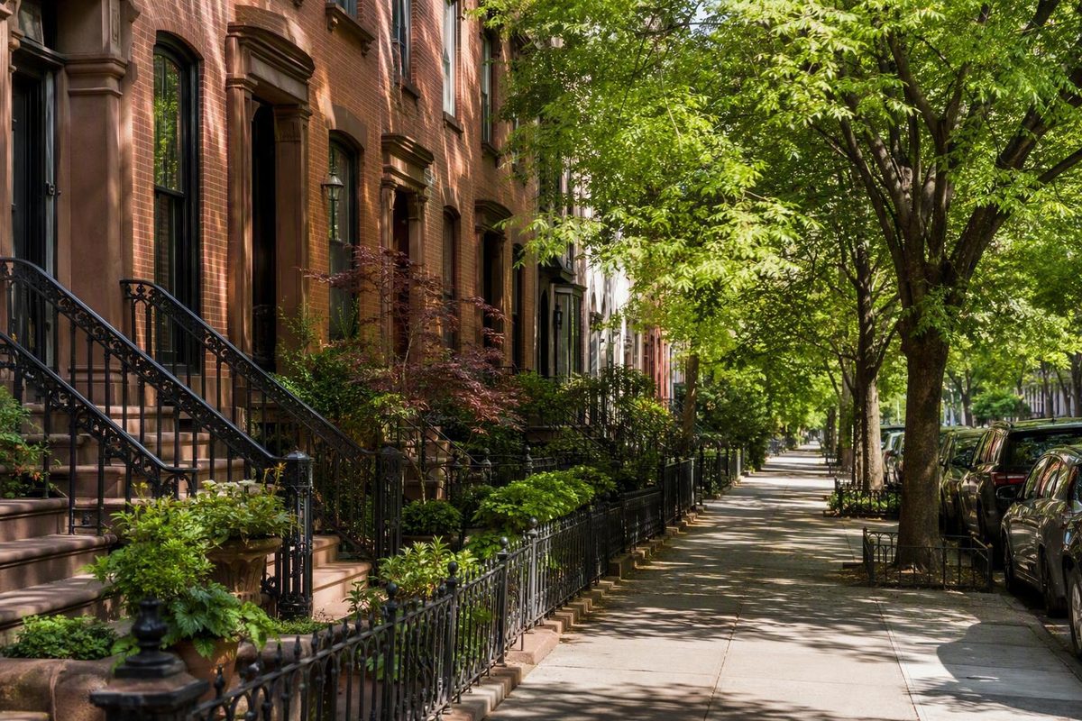
Brooklyn is one of New York City’s five boroughs, but it does not resolve into one universally accepted set of neighborhoods. Names overlap, local usage changes, and a large neighborhood may contain smaller named areas. Visitor directories may also place parks, developments, commercial corridors, and industrial districts beside conventional neighborhoods.
For visitors, the useful goal is not to memorize a definitive list or rank areas from best to worst. It is to use broad geographic regions for orientation, understand what kind of place each label represents, and build a day around a compact group of nearby interests.
How to read a Brooklyn neighborhood map
There is no single Brooklyn neighborhood map that settles every name and boundary. Published maps and directories use different inclusion rules, while neighborhood edges may be approximate, informal, overlapping, or disputed. A widely circulated Brooklyn reference map explicitly labels its boundaries as approximate rather than official or exact (see the regional Brooklyn neighborhood list and map).
That uncertainty reflects how neighborhood names work. A precise line on a third-party map should not be treated as proof that local usage is equally precise.
This guide therefore uses a limited, visitor-oriented method:
- It organizes commonly recognized places into broad geographic regions.
- It avoids drawing hard neighborhood borders in prose.
- It distinguishes neighborhoods from sub-neighborhoods, parks, developments, corridors, and historical names.
- It uses specific destinations—not neighborhood labels alone—for practical route planning.
Regional schematic—selected labels only, not a boundary map:
                              NORTH
                                ↑
                     East River / Manhattan

        NORTHWESTERN                    NORTHERN
   Brooklyn Heights, DUMBO       Greenpoint, Williamsburg
   Downtown, Fort Greene         Bushwick, Bed-Stuy

                              CENTRAL
                    Crown Heights, Flatbush
                 Prospect Park area, Kensington

                              EASTERN
                 Brownsville, Canarsie
                        East New York

        SOUTHWESTERN                    SOUTHERN
   Sunset Park, Bay Ridge        Midwood, Gravesend
   Bensonhurst, Dyker Heights    Sheepshead Bay, Coney Island

                                ↓
                  Atlantic Ocean / Jamaica Bay
Map note: This schematic shows broad relationships among selected places. It is not an official boundary document, a complete neighborhood map, or a transit map. A named place may be associated with more than one regional framework.
Published neighborhood totals differ because publishers count different things. One directory may include only major neighborhoods. Another may add sub-neighborhoods, parks, attractions, developments, commercial corridors, industrial districts, or combined browsing areas. Visit Brooklyn’s explorer, for example, includes Prospect Park, Industry City, and the Brooklyn Navy Yard alongside neighborhood names and combines some places into grouped selections (review the explorer’s place list).
Use this type key when reading any Brooklyn directory:
| Type | Meaning in this guide | Examples |
|---|---|---|
| Neighborhood | A commonly recognized present-day area name | Williamsburg, Canarsie, Bay Ridge |
| Sub-neighborhood | A smaller named area associated with a larger neighborhood or district | Mapleton in association with Borough Park |
| Historical name | A name tied to an earlier settlement, town, or geographic usage | New Lots; historical South Brooklyn |
| Park | A defined green or recreational space, not automatically a neighborhood | Prospect Park, Brooklyn Bridge Park |
| Development | A named real-estate, commercial, or mixed-use complex | Industry City |
| Industrial or institutional district | A named production, employment, cultural, or institutional area | Brooklyn Navy Yard |
| Commercial corridor | A street or business spine that may cross neighborhood boundaries | Atlantic Avenue |
| Grouped area | Distinct places combined by a publisher for convenient browsing | Gravesend/Bensonhurst/Bath Beach |
The practical question is not “Does this map prove exactly where the neighborhood ends?” It is “Does this map help me understand which places are near one another and what kind of place each label represents?”
Brooklyn neighborhoods by region: a quick orientation
The following table is a visitor-oriented overview, not an exhaustive inventory. Its regions overlap with other ways of describing Brooklyn and should not be confused with community districts, ZIP codes, police precincts, historical-town boundaries, or formal administrative divisions.
| Broad region | Common examples | Basic orientation |
|---|---|---|
| Central Brooklyn | Crown Heights, Flatbush, the Prospect Park area, Kensington | Inland areas around and beyond Prospect Park, with several large names and smaller overlapping districts |
| Eastern Brooklyn | Brownsville, Canarsie, East New York | Communities toward Brooklyn’s eastern side and the Queens boundary |
| Northern Brooklyn | Bedford-Stuyvesant, Bushwick, Greenpoint, Williamsburg | East River waterfront and inland districts north and northeast of central Brooklyn |
| Northwestern Brooklyn | Brooklyn Heights, Downtown Brooklyn, DUMBO, Fort Greene, Prospect Heights | Bridge, waterfront, civic, cultural, and brownstone areas near Downtown Brooklyn |
| Southern Brooklyn | Coney Island, Brighton Beach, Sheepshead Bay, Midwood, Flatlands, Gravesend, Marine Park, Mill Basin | Atlantic-facing, bay-facing, inland residential, and beach areas across the lower borough |
| Southwestern Brooklyn | Bay Ridge, Bensonhurst, Borough Park, Dyker Heights, Sunset Park | Harbor-facing and inland districts extending through Brooklyn’s southwest |
| Secondary name example | Mapleton | A sub-neighborhood associated with Borough Park, not a separate broad region |
These categories necessarily simplify a complicated borough. Prospect Heights appears in the northwestern group here because that placement is useful for visitor planning, although another framework might emphasize its relationship to central Brooklyn and Prospect Park. “Flatbush” can likewise refer to a present-day neighborhood, a broader part of central Brooklyn, or a historical town, depending on context.
Treat the table as a first layer. Once you choose a region, identify the places you actually want to visit and map the route between their exact addresses.
Northwestern Brooklyn: bridges, waterfronts, brownstones, and cultural anchors
That coverage does not make the region objectively better than other parts of Brooklyn; it simply provides more established visitor anchors.
Brooklyn Heights
- Setting: An East River and Upper New York Bay–facing neighborhood near the Brooklyn Bridge and Downtown Brooklyn.
- Defining visitor features: Brownstone-oriented streetscapes, waterfront approaches, and broad views from the Brooklyn Heights Promenade.
- Nearby anchors: The Brooklyn Heights Promenade and Brooklyn Bridge Park are commonly grouped with the Brooklyn Heights visitor area. Brooklyn Bridge Park remains a park rather than a neighborhood.
- Planning role: Brooklyn Heights can provide the architectural and residential side of a waterfront outing that also includes DUMBO.
DUMBO
- Setting: A compact waterfront district around the approaches to the Brooklyn and Manhattan bridges.
- Defining visitor features: Bridge views, older industrial buildings, waterfront public space, and frequently photographed streets.
- Nearby anchors: Jane’s Carousel and St. Ann’s Warehouse appear in visitor listings for DUMBO. Check current performances, admission arrangements, accessibility information, and operating hours directly.
- Planning role: DUMBO offers a concentrated set of waterfront and bridge-related reference points. Its name stands for “Down Under the Manhattan Bridge Overpass.”
Visit Brooklyn lists Brooklyn Bridge Park and the promenade with Brooklyn Heights, and Jane’s Carousel and St. Ann’s Warehouse with DUMBO (compare the destination listings). Those directory associations are useful for trip planning, but they do not establish exact neighborhood boundaries.
Brooklyn Heights and DUMBO form a logical editorial planning cluster because both relate closely to the waterfront and bridge approaches. Actual routes can still involve slopes, stairs, construction, crowding, or accessibility constraints, so map the journey from your specific start point.
Downtown Brooklyn
- Setting: A major civic, cultural, commercial, shopping, entertainment, and hotel center inland from Brooklyn Heights and DUMBO.
- Defining visitor features: Larger buildings, busy streets, public institutions, retail activity, and connections to surrounding districts.
- Nearby anchors: Visitor listings include Brooklyn Borough Hall, the Center for Brooklyn History, the New York Transit Museum, entertainment venues, shops, restaurants, and hotels.
- Planning role: Downtown Brooklyn works as a central activity area rather than a single scenic walk. It can connect plans involving Brooklyn Heights, DUMBO, Fort Greene, Boerum Hill, or nearby districts.
Fort Greene
- Setting: A neighborhood east of Downtown Brooklyn with residential streets, cultural institutions, and public space.
- Defining visitor features: Brownstone and townhouse streetscapes, arts and performance activity, and a prominent neighborhood park.
- Nearby anchors: Fort Greene Park, the Brooklyn Academy of Music—usually called BAM—and Barclays Center appear as visitor anchors associated with the area.
- Planning role: Fort Greene pairs naturally with Downtown Brooklyn when a day centers on a performance, an event, or public space rather than the East River waterfront.
Prospect Heights
- Setting: A neighborhood near Prospect Park and generally east or southeast of Fort Greene, subject to the route and boundary convention used.
- Defining visitor features: Residential streets, cultural institutions, and access to the northern Prospect Park area.
- Nearby anchors: The Brooklyn Museum and Brooklyn Botanic Garden are commonly associated with Prospect Heights in neighborhood guides (compare the Prospect Heights cultural anchors).
- Planning role: Prospect Heights is useful when a museum, garden, or nearby park entrance is the day’s primary focus.
For a compact outing, consider two basic clusters:
- Brooklyn Heights and DUMBO: waterfront scenery, bridge settings, the promenade, public space, and industrial architecture.
- Downtown Brooklyn and Fort Greene: civic activity, shopping, performance venues, public space, and event-oriented destinations.
Prospect Heights can be added when a cultural institution is a primary goal, but adding too many neighborhoods may turn a coherent day into a series of transfers. Confirm current routes, venue schedules, ticket requirements, entrances, and accessibility details before leaving.
Northern and central Brooklyn: creative districts, brownstones, parks, and residential areas
Williamsburg, Greenpoint, Bushwick, and Bedford-Stuyvesant fit the northern grouping used here. Crown Heights, Flatbush, Kensington, and the broader Prospect Park area fit the central grouping. Each is internally varied, so a short visitor description should not be mistaken for a complete neighborhood identity.
Williamsburg is repeatedly characterized in visitor publications through nightlife, cafés, galleries, markets, shopping, and creative culture. These are recurring editorial themes, not permanent definitions of every block or resident. Waterfront sections, commercial streets, residential areas, and industrial or formerly industrial districts can produce different experiences within the same broad name.
The neighborhood’s history also predates its current visitor image. Brooklyn Eagle’s neighborhood archive describes Williamsburg’s development from Dutch farmland into a nineteenth-century industrial center, followed by changes shaped by immigration and the Williamsburg Bridge, which opened in 1903 (read the archive’s Williamsburg summary). That longer view prevents contemporary nightlife and retail coverage from becoming the whole story.
Greenpoint lies along the East River north of Williamsburg. Visitor directories use waterfront spaces, food, shopping, markets, parks, and entertainment listings to orient readers there. Because individual businesses and events can move, close, or change schedules, treat those listings as planning examples rather than permanent neighborhood attributes.
Bushwick is an inland northern neighborhood associated in visitor listings with Maria Hernandez Park and the Bushwick Collective. Those are practical anchors, but they do not make the entire neighborhood one continuous public-art district. Visitors interested in a particular site should identify its exact location.
Bedford-Stuyvesant, often shortened to Bed-Stuy, is a geographically substantial northern Brooklyn neighborhood. Herbert Von King Park and Weeksville Heritage Center appear among its visitor-directory examples. As with other large neighborhoods, choosing a specific destination is more useful than treating “Bed-Stuy” as a single point.
Visit Brooklyn’s directory supplies the Greenpoint, Bushwick, and Bed-Stuy examples above, but its changing venue list should be checked against current destination information before a trip.
Moving into central Brooklyn, Crown Heights sits in relation to Bedford-Stuyvesant, Prospect Heights, Prospect Park, and Flatbush, although descriptions of its edges vary. Weeksville may be discussed as a smaller historical or local area associated with Crown Heights. For practical planning, start with a named destination or street rather than the broad neighborhood label.
Park Slope is frequently associated with brownstone architecture and Prospect Park. The important taxonomic distinction is that Park Slope is a neighborhood, while Prospect Park is a park. The park relates to several neighborhoods around its perimeter and should not be treated as belonging exclusively to Park Slope.
Across the park’s northern side, Prospect Heights is associated with cultural institutions including the Brooklyn Museum and Brooklyn Botanic Garden. The two neighborhoods can be understood as different approaches to the Prospect Park area: Park Slope is commonly framed through brownstone streets and park access, while Prospect Heights is frequently framed through nearby cultural anchors.
Prospect Park itself is not a neighborhood. “The Prospect Park area” is a convenient planning phrase for Park Slope, Prospect Heights, Prospect Lefferts Gardens, Windsor Terrace, and other nearby places. It should not erase those distinct names.
Flatbush requires particular care. The name may describe a present-day neighborhood, a broader part of central Brooklyn, or the historical town of Flatbush. Published classifications may place smaller named areas beneath or in association with it.
Ditmas Park and Prospect Park South, for example, are often treated as distinct local areas, but publishers do not always use the same hierarchy. A tourism directory may combine “Ditmas Park and Prospect Park South” for browsing, while another geographic list may nest them beneath a larger Flatbush heading. The safest approach is to name the specific area without claiming universal agreement about its status.
Kensington, broadly south or southwest of Prospect Park, receives more residential than attraction-based coverage in the supplied visitor material. That does not support assumptions about affordability, safety, family suitability, or cultural authenticity. Those questions require different evidence and depend on individual needs.
For northern and central Brooklyn, replace broad personality labels with concrete planning questions:
- Is your anchor a park, museum, heritage center, performance, market, or particular street?
- Is the attraction in the neighborhood itself or merely nearby?
- Are you looking at a large neighborhood name or a smaller district associated with it?
- Can the day revolve around one or two anchors instead of an undefined plan to explore several large areas?
Eastern Brooklyn: essential borough geography beyond the tourist circuit
Brownsville, Canarsie, and East New York are the core eastern Brooklyn examples in this guide’s regional structure. They belong in a borough-wide orientation even though the supplied visitor sources provide less descriptive depth for them than for Brooklyn Heights, DUMBO, Williamsburg, or Downtown Brooklyn.
It is not evidence that eastern neighborhoods are less important, less diverse, or objectively less worth knowing.
Brownsville is a recognized eastern Brooklyn neighborhood. It appears in borough-wide directories, but the available visitor evidence does not support manufacturing a sightseeing personality, attraction circuit, or recommended walking route for it.
Canarsie is another central name in eastern Brooklyn geography and extends toward Jamaica Bay. A responsible overview should include it without filling gaps in visitor coverage with unsupported claims about atmosphere, housing, commuting, or visitor appeal.
East New York is a large eastern Brooklyn name associated with several smaller areas. Brooklyn Eagle’s historical summary says the area was settled as New Lots and developed from farmland. That is useful as concise historical orientation, not as a complete account of the neighborhood’s formation. City Line and Cypress Hills are smaller named areas associated with East New York in the regional classification.
These relationships show why a flat alphabetical list can mislead. East New York, City Line, and Cypress Hills may all appear as place names, but that does not make them equivalent geographic units with universally agreed edges.
Editorial note: Less coverage in tourism directories does not imply lesser cultural, historical, or civic significance. It means only that the available visitor-oriented sources provide fewer well-supported details from which to build recommendations.
This guide therefore does not invent attraction lists, neighborhood personalities, fixed travel times, or walking itineraries for eastern Brooklyn. A visitor with a specific destination should begin with its exact address, verify current opening and access information, and plan the route from the actual starting point.
Southern and southwestern Brooklyn: beaches, bays, residential districts, and harbor-facing areas
Southern Brooklyn includes Atlantic-facing destinations, communities near Jamaica Bay, and extensive inland residential districts. The examples used here are Coney Island, Brighton Beach, Sheepshead Bay, Midwood, Flatlands, Gravesend, Marine Park, and Mill Basin.
The southwestern grouping includes Bay Ridge, Bensonhurst, Borough Park, Dyker Heights, and Sunset Park. These labels help with orientation, but they do not imply that every place in a group shares the same landscape or visitor role.
Coney Island is the clearest beach-and-amusement destination in the supplied visitor evidence. It combines Atlantic beachfront access with a boardwalk setting and amusement history. The Cyclone is a wooden roller coaster dating to 1927 (see the Coney Island visitor history). That historical date does not guarantee that the ride—or any other attraction—will be operating when you visit.
Coney Island requires date-specific planning. Ride operations, attraction calendars, seasonal schedules, weather, special events, and transit service can all affect a trip. Verify current details rather than assuming the same experience is available year-round.
Brighton Beach lies along the Atlantic coast near Coney Island. One commercial neighborhood guide characterizes it through Eastern European food and beachfront access (see the guide’s Brighton Beach description). That can provide a visitor cue, but it is not a complete cultural description and should not reduce the community to one cuisine or heritage label.
Sheepshead Bay is a southern Brooklyn neighborhood organized in part around a bay and waterfront setting. Brooklyn Eagle’s neighborhood archive associates its name with a fish once common in the area. The same archive summarizes Sunset Park as developing from Dutch farmland through immigration and industrial growth. These are broad historical orientations rather than complete community histories (review the neighborhood history archive).
Midwood is an inland southern neighborhood. Flatlands functions as both a modern neighborhood name and the name of one of Brooklyn’s historical towns. Gravesend likewise has modern and historical meanings. Together, these places demonstrate that southern Brooklyn is not synonymous with beaches; much of the region is inland and residential.
Marine Park and Mill Basin are separate southern Brooklyn names, even though one tourism explorer combines them into a single browsing selection. That interface choice does not make them one neighborhood. The same principle applies when directories group Gravesend, Bensonhurst, and Bath Beach.
In southwestern Brooklyn:
- Bensonhurst is a large residential neighborhood sometimes grouped with Gravesend and Bath Beach for visitor browsing.
- Borough Park is a major neighborhood name, while Mapleton is identified in a local classification as a sub-neighborhood associated with it.
- Dyker Heights belongs in the southwestern orientation, although this guide does not rely on seasonal attraction claims that would require current verification.
- Sunset Park contains residential, commercial, industrial, park, and waterfront-related geography within a broad neighborhood name.
Southern and southwestern Brooklyn can therefore be read in layers:
-
Atlantic beach destinations: especially Coney Island and Brighton Beach.
-
Inland residential districts: including Midwood, Flatlands, Gravesend, Bensonhurst, Borough Park, and Dyker Heights.
- Grouped visitor listings: useful for browsing, but not evidence that the grouped places form one neighborhood.
A beach day at Coney Island, a harbor-facing outing in Bay Ridge, and a visit to Sunset Park should not automatically become one itinerary simply because all three appear in the southern half of a borough map.
The six historical towns and the meaning of South Brooklyn
Brooklyn’s early geography is associated with six historical towns: Brooklyn, Bushwick, Flatbush, Flatlands, Gravesend, and New Utrecht. That framework helps explain why some modern neighborhood names also carry much older geographic meanings.
One Brooklyn history project traces the borough’s name to the Dutch Breukelen, later Anglicized through forms including Brookland and Brooklyn (see the Brooklyn history and map overview). The historical framework is useful for orientation, but old town geography does not align neatly with every modern neighborhood, colloquial boundary, or visitor region.
As consolidation progressed, the towns became part of the City of Brooklyn. Following an 1894 referendum, the consolidated City of Brooklyn became a borough of New York City in 1898 (compare the historical-town and consolidation overview). That political history is separate from the informal neighborhood boundaries used today.
The phrase South Brooklyn is a common source of confusion. In historical usage, South Brooklyn referred to areas south of the original town or city center of Brooklyn—not to the southernmost part of the modern borough. Depending on the period and speaker, it has been associated with places near the old city, including parts of what are now Cobble Hill, Carroll Gardens, Boerum Hill, Gowanus, and nearby districts.
That is why historical South Brooklyn can appear in the northwestern part of a modern regional map. The name preserves an older center of reference.
Keep these systems separate:
- Historical towns help explain early settlement and consolidation.
- Modern neighborhood names reflect present and evolving usage.
-
Historical South Brooklyn uses an older geographic reference point.
-
Visitor regions simplify trip planning.
- Neighborhood maps visualize informal places and may disagree at the edges.
None is a universal substitute for the others. A historical town boundary cannot automatically settle a modern neighborhood dispute, and a ZIP code does not prove that every address within it belongs to the same commonly understood neighborhood.
How to choose and combine Brooklyn neighborhoods for a visit
A ranked list of the “best” Brooklyn neighborhoods hides the most important variable: what you want to do. Waterfront scenery, architecture, museums, nightlife, green space, and beaches point toward different parts of the borough.
Use interests rather than rankings.
| If your priority is… | Start by researching… | Why this cluster is practical |
|---|---|---|
| Waterfront scenery and recognizable visitor landmarks | Brooklyn Heights and DUMBO | Promenade, bridge, park, waterfront, and industrial-building settings can be organized within one area |
| Cultural venues and central activity | Downtown Brooklyn, Fort Greene, and Prospect Heights | Civic, performance, event, museum, and garden anchors provide several ways to structure a day |
| Nightlife and creative-culture coverage | Williamsburg | Visitor publications repeatedly characterize the area through nightlife, cafés, galleries, markets, and shopping |
| Prospect Park and brownstone surroundings | Park Slope and Prospect Heights | The neighborhoods provide different approaches to the park area, architecture, and cultural institutions |
| Beach and amusement history | Coney Island | It is the clearest evidence-supported beach-and-amusement destination in Brooklyn |
| A broader residential view of the borough | One specific neighborhood in central, eastern, southern, or southwestern Brooklyn | Starting with a named destination avoids turning large residential communities into vague sightseeing labels |
These are starting points, not universal recommendations. Williamsburg’s nightlife and creative-culture identity is a recurring editorial characterization, not a promise that every street or time of day feels the same. Brooklyn Heights and DUMBO may suit a waterfront-focused visitor, while a museum or performance may point toward Prospect Heights or Fort Greene.
Choosing where to stay is also different from choosing where to spend one afternoon. New York Know’s guide to choosing a New York neighborhood for a first trip focuses on matching a base to how you move, how late you stay out, and how much walking you want to do.
New York Know’s stated planning approach is to group sights by area and build days that make sense on foot. Applied to Brooklyn, that means choosing one cluster for a half-day or full day instead of repeatedly crossing the borough. This is an editorial planning method, not a proven rule. The related guide to planning New York days without crossing the city repeatedly develops the same area-based approach.
Before departure, verify:
- current transit routes and service changes;
- station and venue accessibility for your needs;
- park, museum, performance, and attraction hours;
- ticket or reservation requirements;
- seasonal operations at beach and amusement destinations;
- construction, weather, and event conditions;
- the exact address and entrance for each anchor.
Avoid fixed claims that an entire neighborhood is a certain number of minutes from Manhattan. Travel time depends on the starting point, destination, route, waiting time, transfers, and current service.
A simple sequence works better:
- Choose one primary interest.
- Select one regional cluster.
- Identify one or two concrete anchors.
- Map the route between the actual addresses.
- Verify current transit, accessibility, venue, and seasonal conditions.
Brooklyn is not best understood through a definitive count or a ranked list. Use approximate regions to orient yourself, distinguish neighborhoods from parks and developments, and choose one interest-based cluster for a compact visit. Boundaries remain informal, while transit, venue, and seasonal details can change; confirm the practical details before you go.
Brooklyn neighborhood FAQ
How many neighborhoods are there in Brooklyn?
There is no universally accepted total. CityNeighborhoods.NYC says Brooklyn has more than 70 neighborhoods, but that is one third-party project’s count rather than an official borough-wide total (see its Brooklyn overview).
Different publishers count different things. Some include only major neighborhoods, while others add sub-neighborhoods, parks, developments, commercial districts, historical names, and combined areas. A list containing Prospect Park, Industry City, and the Brooklyn Navy Yard is using a broader place-directory method than one restricted to conventional neighborhoods.
Are Brooklyn neighborhood boundaries official?
There is no single universal boundary system governing every Brooklyn neighborhood name. Many edges are informal, approximate, overlapping, or disputed. A map may offer a useful interpretation, but precise lines do not make that interpretation definitive.
For route planning, use the destination’s exact address. For geographic understanding, compare neighborhood names and nearby anchors without assuming that every source will draw the same border.
Which Brooklyn neighborhoods are most relevant to first-time visitors?
That depends on the visitor’s interests. Brooklyn Heights and DUMBO provide a practical starting point for waterfront scenery and recognizable landmarks. Downtown Brooklyn and Fort Greene offer civic, cultural, entertainment, and event anchors. Prospect Heights and Park Slope can organize a day around cultural institutions, brownstone streets, and Prospect Park.
Williamsburg is frequently covered for nightlife and creative culture, while Coney Island is the clearest option for a beach-and-amusement outing. These are not objective rankings; the useful choice is the cluster that matches the trip.
Why is historical South Brooklyn not in the southernmost part of the borough?
The term used the original town or city of Brooklyn as its reference point. “South Brooklyn” described areas south of that earlier center, not the far-southern edge of the borough as it is understood today.
As Brooklyn expanded and neighborhood names changed, the historical term remained associated with places much farther northwest than Coney Island, Sheepshead Bay, or other modern southern neighborhoods.
Are Prospect Park, Industry City, and the Brooklyn Navy Yard neighborhoods?
They may appear beside neighborhoods in visitor directories, but more precise labels are useful. Prospect Park is a park, Industry City is a named development, and the Brooklyn Navy Yard is an industrial and institutional district.
Each can function as a destination or map reference. Including them in a neighborhood explorer is convenient for trip planning, but it does not make every listed place the same type of geographic unit.