 New York Know
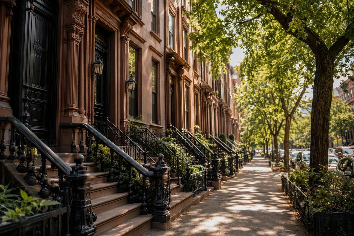
New York City becomes easier to plan when you stop treating it as one enormous collection of attractions and start seeing it as a city of areas. The first layer is the five boroughs. Within them are broad regions, conventional neighborhoods, smaller districts, historic enclaves, and commercial labels—often with flexible or overlapping borders.
That complexity is not a problem to solve before your trip. It is a practical tool. A neighborhood name helps you understand where places cluster, what can fit into the same day, and whether a potential base supports the trip you want.
This guide does not rank every part of the city or claim to provide a definitive neighborhood list. It offers a workable geographic model, representative areas in all five boroughs, and a method for turning those names into coherent walking days. That reflects New York Know’s practical approach to city planning: choose a base, group nearby sights, and spend less time crossing the city.
How NYC neighborhoods fit together
New York City has five boroughs: Manhattan, Brooklyn, Queens, the Bronx, and Staten Island. A borough is a major political and geographic division containing many neighborhoods; it is not a neighborhood itself.
The city also has 59 community districts. These provide administrative and statistical context, but they are not definitive neighborhood units, as shown by the New York City Department of City Planning’s citywide neighborhood map.
That distinction matters because common NYC place-names do not all operate at the same scale.
A useful planning hierarchy is:
- City: New York City
- Borough: Manhattan, Brooklyn, Queens, the Bronx, or Staten Island
- Broad region: Lower Manhattan, Midtown, northern Manhattan
- Neighborhood: Chinatown, Greenwich Village, Williamsburg, Astoria
- Smaller district or enclave: a named area nested within—or overlapping—a larger neighborhood or region
This is a planning aid, not a rigid classification system. “Lower Manhattan,” for example, is a broad region containing or touching several commonly recognized neighborhoods. Chinatown is generally treated as a neighborhood, while a smaller historic, cultural, or commercial district may sit within a conventional neighborhood.
A community district belongs to a different system. Community districts support local administration and the work of community boards. One community district generally contains several neighborhoods. A commonly recognized neighborhood can also be associated with more than one community district when its informal extent crosses an administrative boundary.
A community-district map therefore cannot settle every disagreement about whether a block belongs to one neighborhood or the next. It can locate an address within an administrative area, but that does not necessarily determine how residents, businesses, historians, travel guides, or property listings describe the same place.
“District” by itself is even less precise. It may refer to a community district, historic district, business district, entertainment district, or simply a convenient descriptive area. The Financial District is a familiar place-name, but the word district in its name does not make it equivalent to a community district.
For visitor planning, use the labels in this order:
- Start with the borough to establish the large-scale geography.
- Identify the broad region containing your priority destinations.
- Choose one or two neighborhoods as the focus of a day.
- Add smaller districts or enclaves only when they clarify the route.
This prevents a common mistake: treating Manhattan, Midtown, SoHo, Little Italy, and Times Square as five comparable units. They are familiar names, but they describe places at different geographic scales.
Why no one can give a definitive number of NYC neighborhoods
There is no universally authoritative number of NYC neighborhoods.
Neighborhoods are socially and historically recognized places rather than one set of officially defined citywide units. Their names and borders can overlap, change, or attract disagreement. Near an informal edge, a block may reasonably be described in relation to more than one adjacent area.
Published totals differ because directories apply different rules. One may count broad regions such as Midtown or Downtown. Another may divide those regions into smaller neighborhoods. A third may include historic enclaves, waterfront areas, commercial districts, or locally used sub-neighborhood names. Alternate spellings and nested areas create further variation.
StreetEasy, for example, presents a directory labeled 56 neighborhoods, organized across Manhattan, Brooklyn, Queens, and the Bronx. It is a useful browsing tool, but its visible scope means it should not be interpreted as the total number of neighborhoods in the entire city. The StreetEasy neighborhood directory is one publisher’s selected system, not an official census of place-names.
Other borough-by-borough lists are much longer. They may place labels such as Downtown, Midtown South, Times Square, Flushing, and Downtown Flushing alongside conventional neighborhood names. That breadth can be useful, but it also illustrates why counting entries does not settle the question. The NYCdata neighborhood list from Baruch College includes numerous labels at different scales and under different naming conventions.
Official geography provides context rather than a final answer. Community-district boundaries help locate an area within an administrative structure. Census geography supports demographic analysis. None automatically defines every informal neighborhood edge.
For a visitor, the disagreement rarely needs to become a debate. Use borders as planning aids:
- A boundary can suggest which attractions may be close enough to group.
- A neighborhood name can help you search for hotels, restaurants, parks, and museums.
- An adjacent neighborhood may offer a logical extension to a route.
- An exact street address remains more useful than a broad label when checking accommodation or transit.
If two maps disagree about an edge, inspect the blocks involved. Ask whether the destination is close to your anchor, whether the route crosses a substantial barrier, and whether the useful station is where you expect it to be. Those questions matter more than choosing the supposedly correct name for every border street.
The method used here is selective by design. The areas below are representative, visitor-relevant examples from all five boroughs—not a complete inventory, and not a ranking.
Choose an area by the trip you are actually planning
Before choosing a hotel or building daily routes, put your must-see places on a map. Do this even if your list is short. Three attractions that sound generically “central” may sit in different parts of Manhattan, while destinations with different neighborhood labels may be close enough to combine on foot.
Once the map has pins, consider four practical questions.
Where are your planned activities concentrated?
Look for the center of gravity in your itinerary. If several priorities are around Times Square, Rockefeller Center, Grand Central Terminal, and the Museum of Modern Art, Midtown may reduce repeated long journeys.
If your list leans toward the Brooklyn Bridge, Financial District, Chinatown, and downtown dining, a base or day focused farther south may make more sense. If Central Park and major museums dominate, an area beside the park could be more useful than one chosen chiefly for downtown access.
A first-time visitor does not automatically need a Midtown base. Midtown is a strong fit when its concentration of attractions matches the itinerary. That is different from declaring it universally best.
How much walking do you actually want?
A compact-looking map can conceal a demanding day. Consider how far you are comfortable walking, how often you want to stop, and whether anyone in the group has mobility, stamina, or rest requirements.
Walking tolerance also changes what “convenient” means. One traveler may value being able to walk between several sights. Another may prefer shorter periods on foot even if that requires an additional ride. An area with appealing evening options may be useful when it lets you finish near your accommodation rather than adding another journey at the end of the day.
What do you want around you in the evening?
The area that works during sightseeing hours may not be where you want to spend the evening. Decide whether you want to be near theaters and major landmarks, restaurants and bars, parks and museums, waterfront paths, or streets less focused on visitor attractions.
Descriptions of atmosphere are editorial rather than objective measurements. Use them to form questions, then inspect the exact block and nearby destinations. Conditions and street character can vary within the same neighborhood.
What access will you use repeatedly?
Do not assess a hotel by borough or neighborhood name alone. Compare its exact address with your actual destinations. A Brooklyn or Queens hotel is not automatically inconvenient, just as a Manhattan address is not automatically central to everything.
Before booking or setting out, verify:
- current subway service and planned work;
- station and route accessibility;
- door-to-door directions from the exact address;
- accommodation rates for your dates;
- attraction hours, ticket requirements, and entry conditions.
Those details are time-sensitive and are better checked close to the visit than treated as permanent neighborhood characteristics.
The central tradeoff is usually between immediate access to major sights and a more neighborhood-oriented setting. Neither is inherently better. Attraction-heavy trips often benefit from concentration. Repeat visits or slower itineraries may justify a base farther from the most famous landmarks if more time will be spent in that area.
Useful planning categories include:
- Major sightseeing: dense clusters of widely known landmarks
- Museums and parks: institutions, green space, and slower visits
- Food and nightlife: evening plans that do not require crossing the city again
- Waterfront time: promenades, parks, bridges, and river edges
- Slower neighborhood exploration: fewer reservations and more time within one area
New York Know’s area-based trip-planning philosophy is to choose where to stay, group sights geographically, and build days that work well on foot rather than beginning with a universal “best neighborhood” list.
Manhattan: major sights, dense contrasts, and many overlapping labels
Manhattan receives the greatest share of attention in many visitor guides, but its labels can still be confusing. The clearest introduction is to move from south to north.
Lower Manhattan and nearby downtown neighborhoods
Lower Manhattan is a broad region rather than one universally bounded neighborhood. At its southern end is the Financial District. Nearby or within broader definitions of downtown are Battery Park City, Tribeca, Chinatown, Little Italy, the Lower East Side, NoLita, and SoHo.
These names should not be collapsed into a single place. The Financial District and Battery area occupy Manhattan’s southern end. Chinatown and the Lower East Side lead a route north and east. SoHo, NoLita, and Little Italy form another set of adjoining or overlapping planning references.
The region contains major visitor sites including Battery Park, Wall Street, South Street Seaport, the Brooklyn Bridge, and the 9/11 Memorial. A visitor-oriented overview of Lower Manhattan also places the Financial District and several nearby neighborhoods within the broader downtown picture.
This is one of the easiest parts of the city in which to see the value of flexible labels. You can begin in the Battery area, move through the Financial District, turn toward the Seaport, and finish in Chinatown. The route crosses named areas but still forms one coherent downtown day.
For planning purposes:
- Use Financial District when Wall Street and the southern street grid are central.
- Use Battery area when the harbor edge is your anchor.
- Use Chinatown, Little Italy, or the Lower East Side when food or evening plans draw you north or east.
- Use Tribeca, SoHo, and NoLita to organize stops farther north without assuming every map gives them identical edges.
Greenwich Village, the West Village, and the East Village
“The Village” requires context. Greenwich Village, the West Village, and the East Village are related in everyday visitor language but are not interchangeable.
Greenwich Village is associated with Washington Square and New York University. Depending on the source or speaker, “Greenwich Village” may be used broadly or narrowly.
The practical response is to identify your anchor:
- Washington Square points toward Greenwich Village.
- A destination farther west should be evaluated as part of a West Village route.
- An East Village restaurant or venue should be grouped with other east-side stops rather than assumed to be beside every Village landmark.
Greenwich Village and the Lower East Side can suit food and evening plans when your chosen venues cluster there. That is itinerary guidance, not an objective measurement of nightlife quality.
Chelsea
Chelsea fits naturally into a west-side route north of the Village areas and south of much of Midtown. Its best-known visitor anchors include an art-gallery district and the High Line.
Those anchors make Chelsea useful for a day combining art and outdoor time, but the shared neighborhood label does not mean every stop is immediately adjacent. Check the locations of galleries, High Line entrances, restaurants, and performance venues before deciding the sequence.
Midtown as a practical region
Midtown is best understood as a broad, practical region with varying edges rather than a neighborhood with one universally accepted outline. Guides may divide it into Midtown East, Midtown West, the Theater District, and other smaller areas.
For visitors, the attraction cluster matters more than the disputed border. Midtown includes Times Square, the Empire State Building, Rockefeller Center, Grand Central Terminal, Broadway theaters, and the Museum of Modern Art. These anchors explain why it often works for attraction-heavy itineraries.
That concentration can be an advantage when several of those places are priorities. It can also produce a day dominated by large landmarks and busy commercial streets. Whether that feels exciting or exhausting depends on the traveler.
Do not assume every Midtown attraction belongs in one continuous walk. Instead:
- Combine Times Square with nearby Broadway plans.
- Group Rockefeller Center with surrounding Midtown attractions.
- Treat Grand Central and east-side destinations as a separate cluster when appropriate.
- Avoid repeated east-west crossings merely because every stop carries a Midtown label.
The Upper East Side and Upper West Side
Central Park separates the Upper East Side and Upper West Side. The park is therefore an intuitive geographic reference, but the two sides should not automatically be combined in one museum-heavy day.
The Upper East Side is associated with Museum Mile, the Metropolitan Museum of Art, and the Guggenheim. The Upper West Side includes Lincoln Center, the American Museum of Natural History, and Riverside Park. These documented groupings make both sides useful for visitors prioritizing museums, parks, and longer cultural visits.
Choose one side according to your anchor. A day centered on the Metropolitan Museum of Art can include part of the park and nearby east-side stops. A day centered on the American Museum of Natural History can remain on the west side and extend toward Riverside Park or Lincoln Center.
Crossing Central Park can be part of the experience, but it should be intentional rather than treated as an insignificant transfer.
Harlem and Washington Heights
Harlem and Washington Heights are important parts of northern Manhattan. Both are substantial neighborhoods rather than single attractions or cultural labels.
The useful planning question is not “What is the one thing this neighborhood represents?” but “Which specific destination brings me here, and what else nearby can form a coherent visit?”
If northern Manhattan is a priority, begin with a defined institution, historic site, event, restaurant, park, or street. Then research the current route from your base and identify nearby additions. Do not attach Harlem or Washington Heights casually to a Midtown day simply because all three are in Manhattan.
As broad interest matches rather than rankings, consider:
- Midtown for a high concentration of major attractions
- Upper East Side or Upper West Side for museums and park time
- Downtown areas for combining history, food, waterfront landmarks, and evening plans
- Northern Manhattan when a specific cultural, historic, institutional, or neighborhood destination is a genuine priority
Brooklyn and Queens: neighborhood destinations, not just Manhattan alternatives
Brooklyn and Queens are not uniform experiences, and neither should be reduced to “somewhere cheaper than Manhattan.” Each borough contains many neighborhoods, substantial distances, and multiple visitor destinations. Cost and travel time depend on the exact address.
Brooklyn
Representative Brooklyn neighborhoods include Brooklyn Heights, DUMBO, Williamsburg, Park Slope, Bedford-Stuyvesant, Bushwick, and Crown Heights. This is an orientation, not a complete borough guide.
Brooklyn Heights is near the Brooklyn Bridge and includes the Brooklyn Heights Promenade and Brooklyn Bridge Park. Its most obvious visitor-planning relationship is with DUMBO and the waterfront. These places can form a coherent cluster, although travelers should adjust the route to their walking tolerance.
DUMBO is a waterfront area whose name abbreviates “Down Under the Manhattan Bridge Overpass.” Former industrial buildings there have acquired commercial and cultural uses.
Williamsburg should not be reduced to a “hipster” label. The available visitor-oriented evidence describes a large neighborhood that includes long-time residents, a Hasidic Jewish community, and newer businesses and venues. Park Slope is associated with Prospect Park and brownstone-lined streets. These descriptions are useful starting points, but they do not support universal claims about affordability, quietness, or suitability for a particular kind of traveler. The same guide documents the DUMBO, Williamsburg, and Park Slope associations in its Brooklyn neighborhood overview.
Bedford-Stuyvesant, Bushwick, and Crown Heights are additional important examples. Each covers enough ground that its name alone is not an itinerary. Choose a restaurant, cultural venue, park, street, or event as the anchor, then determine what is genuinely nearby.
Brooklyn planning works best when you resist two assumptions: that everything in the borough is close together, and that every Brooklyn address offers the same access to Manhattan. Two hotels in the same general area may produce different routes depending on their exact locations.
Queens
Representative Queens neighborhoods include Astoria, Flushing, Jackson Heights, Jamaica, Long Island City, and Forest Hills. Because Queens is geographically extensive, borough-wide claims about atmosphere or convenience are especially unhelpful.
Long Island City includes former industrial buildings adapted for cultural uses, including MoMA PS1. Its cultural and waterfront destinations can support a focused visit, but the neighborhood name still covers more than one possible route.
Astoria is associated with Greek American culture and with immigrant communities from Bangladesh, Pakistan, and Latin America. These associations introduce part of the neighborhood’s cultural range without describing every resident, institution, or block. The same visitor guide documents the Long Island City and Astoria descriptions in its Queens neighborhood profiles.
Flushing, Jackson Heights, Jamaica, and Forest Hills provide additional reference points across Queens. They should not be compressed into a generic “Queens day.” If food is the priority, identify the businesses and streets you want to visit. If an institution, event, or park is the anchor, build the day around its exact location.
When evaluating a destination or accommodation, ask:
- Where is the useful station for my itinerary?
- Does the route require transfers?
- Are most planned activities in the same part of the city?
- What will the return route involve after evening plans?
- Does the accommodation offer good value for the actual dates?
Do not assume Brooklyn or Queens will always be cheaper than Manhattan. Likewise, “close to Manhattan” does not necessarily mean close to your particular Manhattan destinations.
The Bronx and Staten Island belong in the citywide picture
Many visitor guides give the Bronx and Staten Island less neighborhood-level coverage than Manhattan, Brooklyn, or Queens. That imbalance is not evidence that the boroughs lack distinct neighborhoods or worthwhile destinations. It means a responsible introduction should provide orientation without manufacturing rankings or broad claims about atmosphere.
Representative Bronx neighborhoods include:
- City Island
- Fordham
- Mott Haven
- Riverdale
- Soundview
Representative Staten Island neighborhoods include:
- St. George
- Stapleton
- New Dorp
- Great Kills
- Tottenville
These names appear within the broader NYCdata neighborhood list by borough, which demonstrates that the citywide neighborhood picture extends far beyond the areas most frequently profiled for visitors.
Riverdale and St. George are useful examples of recognizable neighborhood names that appear in citywide directories. Their inclusion here does not establish that they are cheap, expensive, safe, unsafe, convenient, inconvenient, or suitable for every visitor. Those judgments would require current evidence tied to a defined area and purpose.
A borough-by-borough list is a starting point, not proof that:
- every neighborhood has been included;
- every boundary is fixed;
- every place can be understood from its name;
- or the entire borough fits into one day.
If you are interested in the Bronx or Staten Island, begin with a specific destination. That may be an institution, event, historic site, park, waterfront location, restaurant, or visit with friends or family. Then research the current route, accessibility, opening information, and nearby options.
Plan a Fordham-centered visit, a St. George-centered visit, or another destination-based cluster—not an undifferentiated “Bronx day” or “Staten Island day.” The same principle applies throughout the city; larger borough labels simply make the need for precision more obvious.
Match neighborhoods to interests without turning preferences into rankings
The following comparisons match documented attractions and geographic relationships to common visitor priorities. They are not a numbered best-neighborhood list.
| Visitor priority | Areas to consider | Why they fit |
|---|---|---|
| Major attraction concentration | Midtown | Times Square, the Empire State Building, Rockefeller Center, Grand Central Terminal, Broadway, and the Museum of Modern Art form a substantial sightseeing cluster. |
| Museums and parks | Upper East Side or Upper West Side | The areas sit on opposite sides of Central Park. The east side is associated with Museum Mile, the Met, and the Guggenheim; the west side with the American Museum of Natural History, Lincoln Center, and Riverside Park. |
| Downtown history and waterfront landmarks | Financial District, Battery area, South Street Seaport | These areas connect the harbor edge, Wall Street, memorial spaces, the older downtown street pattern, and the East River waterfront. |
| Art and reused industrial spaces | Chelsea, Long Island City, DUMBO | Chelsea has galleries and the High Line; Long Island City includes MoMA PS1 and converted industrial spaces; DUMBO contains former industrial buildings with commercial and cultural uses. |
| Food and evening activity | Greenwich Village, Lower East Side | Both can support dining and evening plans when the venues you want are concentrated there. |
| Brooklyn waterfront exploration | Brooklyn Heights, DUMBO, Brooklyn Bridge Park | These adjoining areas can be organized around the promenade, park, waterfront, and Brooklyn Bridge. |
| Slower park-centered exploration | Park Slope and Prospect Park; one side of Central Park | A park can serve as the day’s anchor, with nearby streets or institutions added instead of disconnected stops. |
For major sightseeing, Midtown offers the clearest concentration. That does not mean you must sleep there. It means that several Midtown priorities can often be placed into one or two focused days.
For museums and parks, choose the side of Central Park containing your main institution. Trying to cover major museums on both sides while also exploring the park can turn a rewarding day into a race. One museum, one portion of the park, and one nearby neighborhood segment often form a more coherent plan.
For downtown history, begin around the Battery or Financial District. Then decide whether to move east toward the Seaport or north toward other downtown neighborhoods. The best extension depends on where you want to eat or finish the evening.
For art and adaptive industrial spaces, Chelsea, Long Island City, and DUMBO offer different geographic contexts. They do not belong in one day merely because they share a theme. Chelsea fits a west-side Manhattan route, Long Island City needs its own Queens logic, and DUMBO connects naturally with the Brooklyn waterfront.
For food and nightlife, Greenwich Village and the Lower East Side are options rather than guarantees. Select actual restaurants, bars, performances, or evening venues first, then use the surrounding neighborhood to complete the route.
For Brooklyn waterfront exploration, Brooklyn Heights, DUMBO, Brooklyn Bridge Park, and the Brooklyn Bridge form a clear geographic sequence. A connected map, however, does not guarantee that every traveler can or wants to walk the entire route. Consider weather, stairs, bridge crossings, waterfront detours, rest stops, and the journey back to your accommodation.
Words such as quiet, local, authentic, affordable, safe, upscale, gritty, and family-friendly are not neutral measurements. They require definitions, current evidence, and precise geography. Treat them as prompts for further investigation, not settled neighborhood facts.
Build neighborhood days instead of collecting isolated stops
A walking-first itinerary organizes each day around one compact area. Long transit moves are deliberate and limited rather than repeated every few hours.
This does not mean walking everywhere. It means using transit to reach a cluster, exploring it coherently, and using transit again when you are ready to leave. The result is easier to understand than an itinerary assembled from isolated famous places.
A Lower Manhattan sequence
Begin near the Battery and harbor edge. Move into the Financial District, using one or two priorities—such as Wall Street or the memorial area—as anchors rather than attempting to inspect every landmark.
Next, make one clear eastward turn. South Street Seaport or the East River edge provides a change of setting without requiring you to retrace the same streets repeatedly.
From the east side of downtown, work generally north toward Chinatown. Chinatown can be the finish rather than another item to check off. If time and energy remain, Little Italy or the Lower East Side can become optional extensions.
The sequence works because it moves generally north and east. It avoids bouncing from the Battery to Chinatown, back to the Financial District, and then north again. New York Know’s walking-first Lower Manhattan itinerary follows this flexible progression from the Battery area through the Financial District, toward the Seaport or river, and on to Chinatown.
Optional means optional. Little Italy and the Lower East Side may be near the finish, but proximity does not create an obligation. Adding every adjacent label can leave too little time to experience any of them.
Other useful clusters
Midtown: Choose a sub-cluster rather than treating all of Midtown as one stop. Times Square and Broadway plans can form one anchor. Rockefeller Center and surrounding sights can form another. Grand Central can support an east-side segment. Connect them only if the day remains manageable.
Central Park plus one side: Choose the Upper East Side or Upper West Side according to your museum, performance, or park priority. Cross the park if the crossing is part of the experience, not because you feel required to include both sides.
Brooklyn Heights, DUMBO, and the waterfront: Begin with the Brooklyn Heights Promenade, DUMBO, Brooklyn Bridge Park, or the bridge itself. Build the direction of travel around your chosen start and finish. Do not presume that a bridge crossing, park exploration, promenade visit, and full neighborhood walk will suit everyone in one outing.
The aim is coherence and time in place, not maximum neighborhood coverage. A good day may cover parts of two or three named areas. A poor day can touch six while leaving you with little more than station platforms and hurried photographs.
Use this repeatable template:
-
Choose one anchor. Make it the museum, landmark, park, event, meal, or street you care about most.
-
Add two or three nearby places. Confirm actual proximity instead of relying only on shared neighborhood labels.
-
Select a meal or rest area. Put the break along the route rather than creating a major detour.
-
Identify one transit entry and one exit. They need not be the same station. A one-direction route is often clearer than a loop.
-
Designate extensions as optional. Add them only if time, weather, and energy allow.
-
Verify current conditions. Check service, accessibility, tickets, opening hours, and exact directions close to the visit.
For additional examples, New York Know’s area-planning guides cover choosing a base, building compact walking routes, and reducing repeated trips across the city.
Frequently asked questions
How many neighborhoods are in New York City?
There is no single authoritative total. Counts vary because neighborhood names and borders are informal, overlapping, and changeable. Directories also use different inclusion rules: some count broad regions, while others include smaller districts, historic enclaves, commercial areas, or alternate names.
A published total should therefore be understood as the size of that source’s directory, not necessarily the number of neighborhoods in New York City.
Are NYC neighborhood boundaries official?
Neighborhood names and borders are generally not officially defined in one universally accepted citywide system. Maps may use different conventions, and adjacent neighborhoods can overlap in ordinary usage, as summarized in this reference to NYC neighborhood names and changing boundaries.
Those boundaries are useful for their stated purposes, but they do not settle every informal neighborhood edge.
Is a community district the same as a neighborhood?
No. A community district is an administrative area, while a neighborhood is a commonly recognized place whose borders may be informal.
One community district typically contains several neighborhoods. A neighborhood can also be associated with more than one community district when its informal area crosses an administrative boundary. Community districts provide useful context, but they should not be substituted automatically for neighborhood names.
Which NYC neighborhood should a first-time visitor choose?
Choose the area that best matches the geographic concentration of your plans.
Midtown can work well for a trip dominated by major Midtown attractions. Downtown may fit an itinerary focused on Lower Manhattan, Chinatown, the Village areas, or the Brooklyn Bridge. An Upper East or Upper West Side base may suit a museum-and-park trip. A Brooklyn or Queens base can work when its exact location supports the destinations you intend to visit.
Before booking, map your must-see places and compare exact addresses. Consider walking tolerance, evening plans, station access, and door-to-door routes. Then verify current subway service, accessibility, and hotel rates. There is no neighborhood that is universally best for every first visit.
Which neighborhoods can be combined in a Lower Manhattan walking day?
A coherent route can begin near the Battery, continue through the Financial District, make one eastward turn toward South Street Seaport or the East River, and finish in Chinatown.
Little Italy or the Lower East Side can be optional extensions if time and energy allow. The route works because it progresses generally north and east instead of zigzagging between unrelated stops. Choose one main anchor, add a few nearby places, schedule a meal or rest, and avoid forcing every adjacent neighborhood into the day.
Start with one workable day
You do not need to memorize every NYC neighborhood or discover one universally correct boundary map. You need a workable geographic model: begin with the five boroughs, treat neighborhood edges as flexible, identify areas tied to your priorities, and build each day around a compact cluster.
Choose one base, verify current transit from its exact address, and plan your first walking day around nearby neighborhoods rather than a citywide checklist.