 New York Know
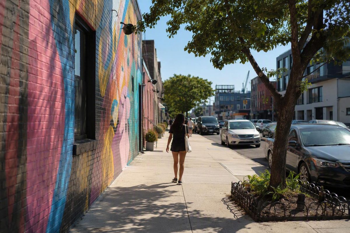
Bushwick, Brooklyn, is easy to reduce to a few colorful warehouse walls. That is also the easiest way to misunderstand it.
The murals near Jefferson Street make a strong opening: they are concentrated, visually immediate, and convenient to use as the start of a walk. But Bushwick becomes more meaningful when that mural circuit continues into commercial avenues, residential blocks, park space, churches, rowhouses, and the former industrial landscape.
The practical approach is not to collect distant recommendations. Build one connected walk instead. Start with the Bushwick Collective, continue toward Maria Hernandez Park and Knickerbocker Avenue, then choose Bushwick Avenue or another logical corridor as your finish. Add one currently verified meal, shop, gallery, performance, or evening venue—not five stops scattered across northern Brooklyn.
This is a planning framework rather than a live venue directory. Murals, businesses, events, subway service, accessibility conditions, and public access can change. Confirm operational details directly before traveling.
Where Bushwick Is—and Why Its Boundaries Are Not Simple
Bushwick is in northern Brooklyn. Broadly speaking, it sits beside Williamsburg to the northwest, Bedford–Stuyvesant to the southwest, Ridgewood across the Queens line to the northeast, and the cemetery and Highland Park area toward the southeast. These are useful orientation points, but they do not form a universally accepted outline.
New York neighborhood borders are often customary rather than official. Bushwick’s most disputed edge is in the north, around East Williamsburg and the former industrial blocks north of Flushing Avenue. A warehouse, restaurant, or arts building there may be labeled Bushwick in one guide and East Williamsburg in another. Visitor itineraries can also blur the boundary with Ridgewood, particularly when they follow Wyckoff Avenue or continue east into Queens.
Brooklyn Community District 4 provides a useful administrative reference. A commonly cited description places it within Flushing Avenue, Broadway, the Queens border, and the Cemetery of the Evergreens. A community district, however, is an administrative geography rather than a definitive statement of how every resident, business, mapmaker, or real-estate listing uses the name Bushwick. The northern industrial area is particularly likely to receive competing labels, as summarized in this overview of Bushwick’s geography and administrative boundaries.
For practical navigation, think in terms of recurring edges rather than a rigid polygon:
- Broadway is a major southwestern boundary reference, commercial street, and transit corridor.
- Flushing Avenue commonly functions as a northern reference, although some definitions extend Bushwick beyond it.
- The Brooklyn–Queens line is the firm borough boundary, even where the streetscape continues almost seamlessly into Ridgewood.
- The southeastern cemetery and parkway area frequently appears in boundary descriptions, although maps vary in the exact line they draw.
Within the neighborhood, four avenues help make the layout legible:
- Bushwick Avenue is the principal architectural and historical spine.
- Broadway carries commerce and transit along the southwestern side.
- Myrtle Avenue cuts across the neighborhood as another active commercial and transportation route.
- Knickerbocker Avenue is central to everyday shopping, food, and longstanding Latino commercial life.
These distinctions matter when planning. A venue near Bogart Street or Morgan Avenue may be described as being in Bushwick, East Williamsburg, or the disputed area between them. A destination east of the borough line is in Ridgewood, Queens, even if a walking guide presents it as an extension of a Bushwick day. The Vander Ende-Onderdonk House, for example, belongs in a Ridgewood extension rather than a list of Bushwick landmarks.
Crossing a neighborhood boundary is not a problem. Crossing it without saying so is. If you add northern industrial stops, identify them as being on the Bushwick–East Williamsburg edge where appropriate. If you continue into Queens, label that part of the route as a Ridgewood extension.
What Bushwick Is Known for Today
Bushwick is best known to many visitors for street art, especially the large murals concentrated around the Bushwick Collective. Its visitor-facing identity also includes creative workspaces, converted factories, restaurants, bars, performance venues, galleries, and vintage shopping.
Those elements are real, but they are not the whole neighborhood. Bushwick is a large residential community rather than a compact arts campus. Longstanding Latino communities—including Puerto Rican, Dominican, Mexican, Ecuadorian, and other Latin American communities—are central to its food, stores, cultural life, public spaces, and visual identity. NYC Tourism likewise presents Bushwick’s longstanding Latino population as important to its eateries and public art rather than incidental to a newer creative scene in its visitor overview of the neighborhood.
The physical contrasts explain much of Bushwick’s appeal as a walk. In the northern industrial blocks, broad walls, loading doors, garages, and low warehouses create space for large murals. Elsewhere, brick rowhouses sit beside churches, schools, small apartment buildings, auto businesses, newer developments, and former factories. A single route can move from painted metal shutters and converted industrial buildings to busy retail streets and quieter residential blocks.
Its mural concentration occupies a relatively small area near Jefferson Street. The wider neighborhood includes:
- apartment-lined residential streets;
- Spanish-language signs and Latino commercial corridors;
- churches, schools, and institutional buildings;
- historic rowhouses and freestanding homes;
- active and repurposed industrial structures;
- parks and playgrounds;
- transit corridors with everyday foot traffic;
- newer development associated with recent investment and housing pressure.
Bushwick therefore rewards selective exploration. Trying to cover every mural zone, commercial avenue, historic building, vintage store, restaurant, and nightlife venue in one day usually produces unnecessary transit or backtracking.
For a first visit, combine one or two connected areas. A compact route might pair the murals with Maria Hernandez Park and Knickerbocker Avenue. A longer version can add part of Bushwick Avenue for architecture. If shopping, dining, or nightlife is the priority, select a currently verified stop close to that route rather than treating every published recommendation as essential.
From a Town in the Woods to a Brewing and Industrial District
Bushwick’s history begins long before its Dutch name. Indigenous people lived in and used this landscape before European colonization. Historical accounts describe a 1638 transaction between Dutch colonists and Canarsie people for a much larger territory that included present-day Bushwick, Williamsburg, and Greenpoint in this local-history account.
Calling that transaction simply a land “purchase” can imply that both parties shared European concepts of permanent private ownership and the irreversible transfer of land.
The Dutch settlement covered substantially more territory than modern Bushwick. Williamsburg and Greenpoint were once part of the same Town of Bushwick rather than neighboring districts.
Even the familiar naming story contains unresolved details. Brooklyn Community Board 4 dates the official charter to 1660 and translates Boswyck as “refuge or town in the woods” in its history of Bushwick.
Other accounts use 1661 and translate Boswijck as “little town in the woods” or offer similar variations. The surviving sources therefore do not support declaring one date or English translation definitive; the alternate version appears in this neighborhood history and profile.
For generations, the section corresponding to present-day Bushwick remained largely rural while the area nearer the East River developed faster. Woodland and farms gradually gave way to mapped streets, homes, factories, foundries, and breweries during the 19th century. Elevated railways, streetcars, bridge connections, and later subway service tied the growing district more closely to employment and markets elsewhere in Brooklyn and Manhattan.
German immigration was especially important to this industrial expansion. Brewery complexes and other factories shaped both employment and the built environment.
Housing expanded around the industrial district. Bushwick’s surviving architecture includes rows and individual buildings influenced by styles such as Italianate, Neo-Grec, Romanesque Revival, and Queen Anne. Churches, schools, banks, and institutional buildings reflected periods of population growth and local prosperity.
Brewing did not disappear for a single reason. Prohibition severely disrupted the industry, while later closures were part of a wider loss of manufacturing. Factories moved or shut down, industrial employment declined, and some buildings became obsolete or were abandoned. Structures now admired as adaptable studios or atmospheric industrial backdrops were once part of an employment system.
Bushwick’s population also changed repeatedly. Italian immigrants established substantial communities, while African-American and Puerto Rican families became increasingly important during the 20th century. Dominican, Mexican, Ecuadorian, and other Latino communities subsequently contributed to the neighborhood’s commerce and culture.
These changes should not be narrated as a neat sequence in which one population disappeared and another took its place.
By the mid-to-late 20th century, Bushwick faced severe hardship. Claims involving deliberate arson or exploitative lending require attribution rather than assumption, but the broader evidence does not support treating the neighborhood’s condition as an inherent local failure.
The citywide blackout that began on July 13, 1977 became a particularly destructive episode. Looting, fires, and property damage affected shopping streets including Broadway and nearby corridors. Brooklyn Community Board 4 reports that hundreds of stores were looted and many were permanently destroyed during and after the blackout in its historical account. The blackout intensified an existing crisis; it did not create decades of industrial decline and housing abandonment overnight.
The decades that followed receive less visitor attention. During the 1980s and 1990s, residents, churches, activists, civic groups, and block associations worked on housing rehabilitation, gardens, public safety, and neighborhood stabilization. Bushwick’s recovery did not begin when destination restaurants or artists arrived. Community rebuilding was already underway.
From the early 2000s, some artists and other residents facing rising costs in Williamsburg moved southeast. Galleries, studios, restaurants, performance spaces, bars, and converted lofts became more visible as developers and businesses showed greater interest in industrial properties and comparatively lower-cost space. A commercial tour overview connects that creative migration with public investment, redevelopment, gentrification, and displacement in its Bushwick and East Williamsburg history outline.
This history changes how the neighborhood looks. A former factory is not merely an atmospheric backdrop. A mural wall may also be a workplace, property boundary, or redevelopment site. A commercial avenue can carry memories of migration, the blackout, community rebuilding, and contemporary rent pressure at the same time.
How to See the Bushwick Collective
The Bushwick Collective is an outdoor street-art project generally dated to 2012. It is not an indoor museum: there is no ticket desk, single entrance, climate-controlled gallery, or fixed permanent collection. Its murals appear on walls and shutters along public streets in and around the industrial blocks near the Jefferson Street L station. An unofficial visitor guide attributes the project’s founding to Joseph Ficalora in 2012 and identifies Troutman Street near Wyckoff Avenue as its principal concentration in its Collective guide and map.
Jefferson Street is the most commonly recommended starting point. From there, use Troutman Street as the central axis and explore nearby portions of St. Nicholas Avenue, Wyckoff Avenue, and connecting blocks. Let the visible art determine your short loops rather than attempting to reproduce an older online map exactly.
Do not plan around a single promised mural. A named artist attribution in an older guide may no longer correspond to what appears on the wall, and even a recent photograph can become outdated.
This impermanence is part of the medium rather than a planning defect. Approach the area as a changing streetscape, not a scavenger hunt for images seen online. If a particular artist or work matters to you, check the Collective’s current organizer channels immediately before traveling.
It is also important to distinguish among the different forms visible on surrounding walls:
- Collective-affiliated permission murals are works arranged for participating surfaces.
- Other commissioned murals may belong to businesses, property owners, or unrelated projects.
- Graffiti includes multiple forms and histories that should not be treated as interchangeable with large illustrative murals.
- Posters, stickers, stencils, tags, and paste-ups may be independent or unsanctioned.
- Temporary interventions can appear and disappear without being part of an organized program.
Proximity does not prove affiliation. Avoid describing every painted surface as part of the Bushwick Collective, and be cautious about identifying artists from memory or social media posts.
How long should the mural walk take? One travel writer reported spending approximately two hours on an informal visit in a 2024 personal walking account. That is an individual experience, not a standard duration or guaranteed itinerary. A quick survey can be shorter, while photography, reading about artists, waiting for clear sightlines, eating, or shopping can extend the outing.
An unofficial guide describes access from public streets as free, but that does not guarantee unchanged conditions during organized events, filming, construction, severe weather, or temporary street management. Check current organizer announcements before traveling, particularly if your visit may coincide with a public event.
Basic etiquette matters because this is a working and residential area:
- Keep sidewalks, driveways, loading zones, and building entrances clear.
- Check traffic before stepping into the street for a photograph.
- Do not enter lots, rooftops, alleys, fenced spaces, or apparently empty buildings.
- Do not touch, peel, mark, or climb on painted surfaces.
- Keep group noise reasonable.
- Ask permission before photographing an identifiable resident or worker.
- Remember that walls used as art surfaces remain part of someone’s property or workplace.
The best mural walk is attentive without becoming possessive. You are visiting public streets, not entering a visitor-only precinct.
A Walking-First Route Through the Wider Neighborhood
Because murals, access conditions, and businesses change, a modular route is more useful than brittle turn-by-turn instructions. The following sequence moves from Bushwick’s visitor-facing mural concentration toward public, commercial, and residential space. It can be shortened after any module.
No measured route or field-checked accessibility audit is established here. Before setting out, map the modules you intend to use and check walking distance, curb conditions, subway access, weather, seating needs, and the return trip against current official information.
Module 1: Jefferson Street and the mural blocks
Begin near the Jefferson Street L station. Walk toward Troutman Street, then survey nearby parts of St. Nicholas and Wyckoff Avenues. Use visible art and open public sidewalks to shape the small loops you make.
This opening shows the industrial side of Bushwick most often photographed by visitors: broad facades, roll-down doors, warehouse-scale walls, garages, and converted buildings. Look beyond the largest murals. The relationship among older industrial structures, active businesses, new uses, and street art can be as informative as any individual image.
Allow enough time to stop without blocking the sidewalk. Daylight makes navigation and viewing easier, but even then, avoid turning entrances, parked work vehicles, or residents into unwanted props.
Module 2: Continue toward Maria Hernandez Park
From the mural concentration, continue toward Maria Hernandez Park. Use a current map rather than relying on a fixed sequence of turns, particularly if construction or subway work has changed your preferred path.
The park marks a useful transition from the industrial and visitor-heavy blocks into a busier residential and commercial part of Bushwick. It can provide a natural pause and decision point, although seating, restroom availability, events, and maintenance conditions should be checked or assessed on arrival rather than assumed.
The park’s name also points toward neighborhood activism. Historical profiles identify Maria Hernandez as a local anti-drug activist who was killed and note that the park was named for her in accounts of Bushwick’s community history. That history complicates the idea that the neighborhood’s public identity began with contemporary art.
If energy or mobility is limited, the park can be the endpoint of a short visit after a nearby, verified meal. If continuing, orient the next part of the walk toward Knickerbocker Avenue.
Module 3: Follow Knickerbocker Avenue’s commercial life
Knickerbocker Avenue introduces a different Bushwick. Its importance lies not in a single attraction but in its concentration of shops, food businesses, services, and everyday foot traffic.
A 2025 neighborhood guide highlights Ecuadorian, Honduran, Mexican, and other Latin American businesses along the corridor, reinforcing its role in Bushwick’s longstanding Latino commercial life in its walking-oriented itinerary. That guide is a dated personal source, so its individual business recommendations should not be treated as proof of current operation or ownership.
Do not reduce Knickerbocker Avenue to a food crawl. Restaurants, bakeries, homeware stores, grocers, pharmacies, clothing shops, salons, and service businesses collectively show how the neighborhood functions. Nor should every storefront be treated as an attraction. People are working, shopping, commuting, and handling ordinary errands.
If you want food here, select one place after confirming its current address, hours, operating status, payment rules, and accessibility through an official channel. A focused meal leaves more time to observe the corridor than collecting small purchases from businesses chosen only because they appeared in an older article.
Module 4: Use Bushwick Avenue for architecture
A longer route can shift toward Bushwick Avenue. This is where the neighborhood’s architectural history becomes easier to read: churches, schools, institutional buildings, brick rowhouses, detached or semi-detached homes, and newer developments coexist along and near the avenue.
Walk slowly enough to notice scale and materials. Decorative brickwork, cornices, stoops, arched windows, religious architecture, and former civic or commercial buildings reflect earlier periods of construction and growth. Alterations and changes of use are also part of the story.
Bushwick Avenue can function as the historical finish to a half-day walk. There is no need to cover its full length. Choose a segment that leads logically toward a practical return route rather than walking far in one direction and retracing the entire distance.
Where Broadway and Myrtle Avenue fit
Broadway and Myrtle Avenue are essential to understanding Bushwick as a connected residential neighborhood, but they do not both need to become major sightseeing sections on a first visit.
Broadway is a long commercial and transit corridor associated with Bushwick’s growth, industrial decline, blackout damage, and later rebuilding. Myrtle Avenue is another important shopping and transportation route. Add either when it creates a useful endpoint or transit connection. Adding both merely to say you saw them can overload a half-day.
Three ways to structure the visit
Short mural-focused outing
- Arrive near Jefferson Street.
- Explore Troutman Street and adjacent mural blocks.
- Add one nearby, currently verified coffee or meal stop.
- Depart from the most convenient station after checking service.
This version suits visitors primarily interested in outdoor art or those fitting Bushwick between other plans. Map the exact loop before leaving; no universal distance or duration applies.
Half-day neighborhood walk
- Start at Jefferson Street.
- Explore the Collective area.
- Continue to Maria Hernandez Park.
- Walk part of Knickerbocker Avenue.
- Finish with one meal or a short Bushwick Avenue architecture segment.
This is the strongest first-visit format because it moves beyond the murals without attempting to cover the entire neighborhood.
Longer day with an evening finish
- Complete the half-day route at a relaxed pace.
- Add one verified vintage shop, gallery, or creative space.
- Have a planned meal.
- Attend a currently confirmed screening, performance, or nightlife event.
- Confirm the return route before the evening activity begins.
The evening component should be anchored by a specific verified venue, not by wandering indefinitely in search of nightlife.
Whichever version you choose, finish where the route naturally ends. This follows New York Know’s stated approach of grouping sights by area and building days that make sense on foot. A practical endpoint is more valuable than backtracking to every recommendation.
If you extend north toward Morgan Avenue or some Bogart Street destinations, label that section Bushwick–East Williamsburg disputed edge or East Williamsburg, depending on the location and source. If you cross into Queens, label it Ridgewood extension. The Onderdonk House, for example, belongs in that Ridgewood add-on.
Choosing Food, Shopping, Art, and Nightlife Stops
Bushwick’s venue turnover makes a timeless “best of” list unrealistic. Choose by category and geography, then verify the final selection directly.
The examples below are not confirmed-current recommendations. They are places that have appeared in dated tourism or travel coverage and illustrate the types of stops associated with Bushwick and its disputed northern edge.
Latino businesses around Knickerbocker Avenue
Knickerbocker Avenue and nearby streets are the clearest place to connect the walk with Bushwick’s longstanding Latino commercial presence. Look for a currently operating restaurant, bakery, grocer, homeware shop, or service business that fits your route and schedule.
Do not infer ownership from a menu, business name, décor, or old article. If supporting a Latino-owned or longstanding neighborhood business is important to you, verify that information through the business itself or reliable current reporting. Cultural respect requires more than attaching an identity label for promotional effect.
Vintage shopping and creative spaces near northern industrial blocks
Dated tourism coverage has listed Beacon’s Closet among the area’s shopping options. Buildings around Bogart Street have also contained galleries, studios, shops, and mixed creative uses.
These stops can pair naturally with the mural area, but the northern industrial blocks are where Bushwick and East Williamsburg labels most often overlap. Check the current address and identify the neighborhood edge accurately.
A building containing studios is not necessarily a walk-in attraction.
Restaurants and bars
Older guides have included Roberta’s, Bunna, and numerous other restaurants in Bushwick itineraries. Their appearance in tourism coverage means that they have been visitor recommendations—not that they are open on your date, accepting walk-ins, serving the same menu, or located within every source’s definition of Bushwick.
Choose one meal near the path you already intend to walk. Avoid crossing the neighborhood repeatedly for breakfast, lunch, snacks, and dinner simply because each business appeared in a different list.
Cinema, galleries, and performance spaces
Tourism sources have listed Syndicated as a restaurant-bar with a separate cinema, while other guides have mentioned galleries and creative buildings around Bogart Street. Company XIV has appeared in performing-arts listings.
These examples illustrate the hybrid cultural spaces associated with contemporary Bushwick, but schedules, tickets, public access, age policies, and accessibility are time-sensitive. Treat a screening or performance as a booked or directly verified anchor, not an assumed drop-in stop.
Drinks, production spaces, and evening venues
Kato Sake Works has appeared in travel itineraries, while tourism sources have listed venues such as 3 Dollar Bill and Xanadu. These names illustrate the range of activities associated with the broader area—production and tasting spaces, nightlife, performance, and skating—but do not establish current operation or programming.
NYC Tourism has also included Beacon’s Closet, Roberta’s, Syndicated, Kato Sake Works, and Maria Hernandez Park in a published Bushwick itinerary. Because the supplied page does not establish a current verification date for every listing, confirm each business through its official channel before relying on it.
Before choosing any named venue, check:
- operating status and current address;
- opening hours and the exact date of your visit;
- menu, screening, performance, or event schedule;
- admission charges and ticket terms;
- reservations or walk-in rules;
- age and identification requirements;
- accessibility and seating;
- restroom access;
- payment and bag policies;
- neighborhood designation near a disputed edge;
- the route to and from the nearest practical station.
If a venue cannot be confirmed through a current official source, remove it from the day rather than preserving an uncertain stop. The simplest plan remains one meal and one optional shop, gallery, screening, or performance close to the walking route.
Creative Growth, Rising Rents, and Responsible Visiting
Bushwick’s contemporary arts narrative did not begin on an empty canvas. Artists and nightlife businesses entered a landscape already shaped by industrial buildings, Latino cultural life, churches, commercial corridors, community organizations, and decades of resident-led recovery.
Some artists and lower-income residents moved into Bushwick after being priced out of Williamsburg. Former factories and warehouses offered large, adaptable spaces, while new restaurants, bars, galleries, and performance venues increased the area’s cultural visibility.
Saying that these newcomers “revitalized” Bushwick, however, erases the work residents, clergy, activists, block associations, and civic organizations were already doing after the severe decline of the 1970s. Contemporary creative growth overlapped with an existing community and an existing recovery.
Recent development has brought investment and new uses for older buildings. It has also produced concern about speculative development, rent increases, affordability, and displacement. Those outcomes can coexist. A restored building or active storefront may improve one part of the streetscape while contributing to pressure on residents or businesses nearby.
A 2024 local-history article relayed a Bloomberg analysis of StreetEasy listing data that found Bushwick’s median asking rent rose 108% from 2010 through 2023 as reported in the attributed neighborhood history. That statistic concerns advertised listings captured by StreetEasy. It does not represent every rent actually paid, every regulated apartment, or every household’s experience.
The limitation matters. Listing data can demonstrate pressure in the market visible to apartment seekers without measuring the full housing stock.
Maria Hernandez Park is one reminder that Bushwick’s public identity includes activism and community defense. Local organizations working on housing, mutual aid, environmental issues, immigrant rights, and neighborhood services provide others. These histories complicate a visitor narrative dominated by murals and nightlife.
Responsible visiting does not require guilt or performative gestures. It requires ordinary consideration:
- Spend at businesses whose operation and local connection you have verified.
- Do not claim that a business is locally rooted, longstanding, or Latino-owned without current evidence.
- Avoid staging prolonged photo shoots on stoops, loading docks, or residential entrances.
- Keep noise down on residential blocks, particularly at night.
- Respect gates, fences, rooftops, work areas, and private property.
- Ask before photographing identifiable people.
- Learn some neighborhood history before arriving.
- Include public spaces and commercial avenues rather than seeing only mural walls.
- Follow organizers’ stated expectations at community events.
The goal is not to pretend visitors have no effect. It is to move through Bushwick with awareness that creative attractions, housing struggles, local cultures, workplaces, and community institutions occupy the same streets.
Plan the Visit: Transit, Timing, Safety, and Verification
For murals, architecture, and photography, arrive during daylight. Daytime makes it easier to read the streetscape, see artwork, navigate unfamiliar blocks, and distinguish active industrial property from places that are not open to the public.
Jefferson Street on the L is the commonly cited arrival point for the Bushwick Collective. That does not mean the L will always be the most practical route from your origin or that scheduled and unscheduled service changes will not affect the trip. Check official MTA service information on the day of travel, especially on weekends and late at night.
Treat time descriptions as planning frameworks:
- A short outing can focus on the Jefferson Street mural area.
- A half-day can connect murals, Maria Hernandez Park, Knickerbocker Avenue, and possibly part of Bushwick Avenue.
- A longer day can add a verified meal, shopping stop, gallery, screening, or evening event.
Actual duration depends on the route chosen, walking pace, photography, weather, mobility needs, waiting time, and venue hours. The reported two-hour mural walk is one person’s experience, not a promise.
What to verify before leaving
Check all of the following directly:
- Subway service: planned work, delays, station access, and the return route.
- Walking route: total distance, major crossings, construction, and whether the route suits your mobility.
- Venue status: current address, hours, tickets, reservations, and age rules.
- Events: exact date, location, admission conditions, and weather policy.
- Weather: the mural experience is almost entirely outdoors.
- Accessibility: step-free transit options, curb and sidewalk conditions, venue access, seating, and route length.
- Restrooms: do not assume a small shop or restaurant provides public access.
- Mural information: current works and organizer announcements if a particular artist matters to you.
No reliable universal restroom, seating, or step-free route can be promised from the supplied information. If those needs will determine whether the walk is feasible, identify a verified venue or public facility before departure rather than improvising after arrival.
For rain, extreme heat, snow, or poor air conditions, shorten or postpone the mural component. An indoor alternative only works if its operating status, admission rules, accessibility, and schedule have been confirmed for that day.
A measured approach to safety
The available evidence does not support declaring Bushwick categorically safe or unsafe. Resident accounts conflict: some reviewers describe feeling comfortable, while others raise concerns. These are personal experiences rather than current official crime analysis, as the disagreement visible in Bushwick resident reviews demonstrates.
Use the ordinary, non-alarmist precautions appropriate to an unfamiliar part of a large city:
- Stay aware of your surroundings instead of walking while absorbed in your phone.
- Keep valuables secure and avoid displaying unnecessary equipment.
- Use well-traveled routes after dark.
- Confirm the route to your return station before leaving a venue.
- If drinking, plan the journey back in advance.
- Do not enter fenced, apparently abandoned, or private industrial property.
- Move away from a block or situation that makes you uncomfortable.
- Contact local emergency services in an emergency.
Treat evening as a separate, intentional plan. Choose a currently verified venue and know how you will arrive and leave. Do not rely on an old nightlife list or assume that wandering between industrial blocks will produce a convenient cluster of open businesses.
Bushwick is a good choice when you want street art, neighborhood history, independent cultural spaces, varied architecture, and a walk that rewards observation. Choose another area if your priority is a compact cluster of conventional landmarks, predictable indoor attractions, and minimal advance checking.
Frequently Asked Questions
Is Bushwick worth visiting for someone who is not interested in nightlife?
Yes—if street art, urban history, architecture, food, shopping, or neighborhood walking appeals to you. A daytime route can combine the Bushwick Collective, Maria Hernandez Park, Knickerbocker Avenue, and part of Bushwick Avenue without including a bar or club.
Bushwick is particularly suited to visitors who enjoy observing transitions between industrial, residential, and commercial streets. If you prefer conventional monuments or major indoor museums, another neighborhood may fit your priorities better.
Is the Bushwick Collective free, and where does the mural walk start?
An unofficial visitor guide describes access to the outdoor murals from public streets as free. There is no single museum entrance or ticket desk. Most visitor routes begin near the Jefferson Street L station and concentrate on Troutman Street and nearby parts of St. Nicholas and Wyckoff Avenues.
Murals and access conditions can change, especially around events, construction, organized painting, filming, or street work. Check current organizer information before traveling.
How much time should you spend in Bushwick?
A short, informal mural-focused outing may take around two hours, but that estimate comes from one travel writer’s experience rather than a standardized route.
A half-day is more appropriate if you want to add Maria Hernandez Park, Knickerbocker Avenue, architecture, or a meal. A longer day makes sense only when you have verified shopping, gallery, performance, or nightlife plans. Map the selected route in advance instead of assuming that a time label guarantees a particular distance or level of effort.
Is Bushwick safe for visitors?
The available evidence is not sufficient to label Bushwick definitively safe or unsafe. Resident opinions conflict, and travel-blog or review-site anecdotes are not substitutes for current official crime information.
Use ordinary city precautions: remain aware, secure valuables, stay on well-traveled routes after dark, confirm return transit, and avoid entering private or apparently abandoned property. For an evening visit, anchor the plan to a verified venue rather than wandering without a destination.
Is Bushwick the same as East Williamsburg or Ridgewood?
No. Bushwick, East Williamsburg, and Ridgewood are distinct neighborhood names, and Ridgewood is in Queens rather than Brooklyn.
Bushwick’s informal northern edge is disputed, particularly around the industrial blocks north of Flushing Avenue and near East Williamsburg. Visitor guides sometimes use the labels inconsistently. The Brooklyn–Queens line provides a firm borough distinction, but the streetscape around Bushwick and Ridgewood can feel continuous.
Label northern industrial stops carefully. Treat any destination across the Queens line—including the Vander Ende-Onderdonk House—as a Ridgewood extension rather than a Bushwick attraction.
The most rewarding Bushwick visit remains compact: begin near Jefferson Street, follow the changing mural concentration, add one connected commercial or architectural corridor, and finish with one verified food, shopping, cultural, or evening stop.
Boundaries, murals, businesses, events, and transit change, so leave room to adapt. More importantly, leave room to notice what does not appear in a mural roundup: the industrial landscape, Latino commercial life, historic architecture, public spaces, and community history that make Bushwick more than a backdrop.